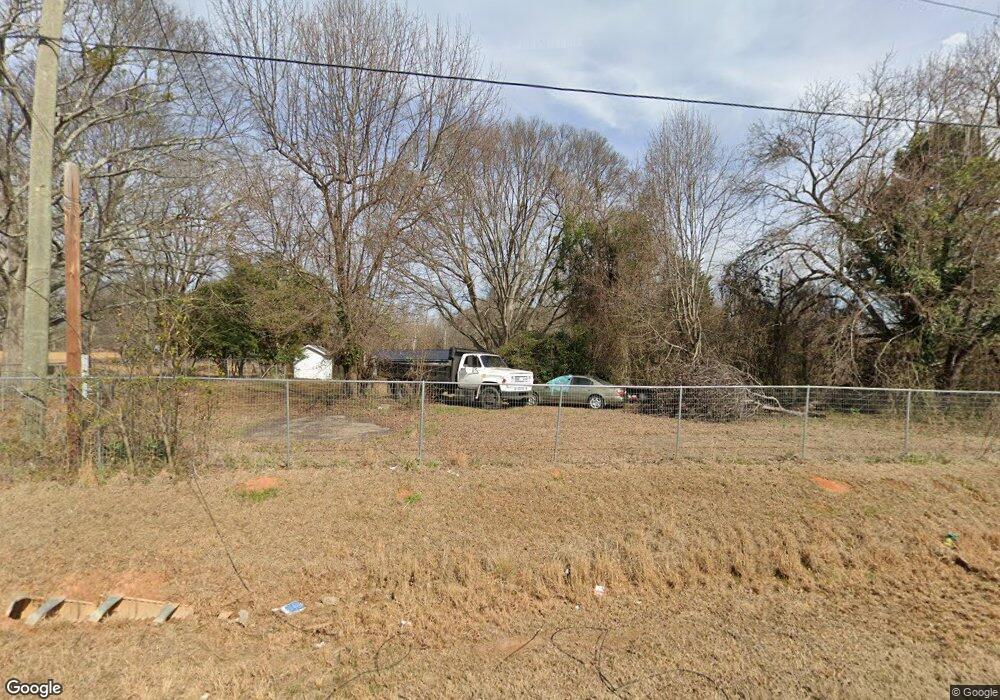
5474 Highway 29 S Colbert, GA 30628
Estimated Value: $64,951 - $410,000
--
Bed
2
Baths
--
Sq Ft
0.66
Acres
About This Home
This home is located at 5474 Highway 29 S, Colbert, GA 30628 and is currently estimated at $194,650. 5474 Highway 29 S is a home located in Madison County with nearby schools including Madison County High School.
Ownership History
Date
Name
Owned For
Owner Type
Purchase Details
Closed on
Jul 15, 2013
Sold by
Branch Banking & Trust C
Bought by
Mcintosh Gilbert Lee
Current Estimated Value
Purchase Details
Closed on
Jun 19, 2013
Sold by
Ballenger Kevin L
Bought by
Branch Banking & Trust Co
Purchase Details
Closed on
Jul 29, 2008
Sold by
Hodges William
Bought by
Ballenger Kevin
Home Financials for this Owner
Home Financials are based on the most recent Mortgage that was taken out on this home.
Original Mortgage
$67,000
Interest Rate
6.31%
Mortgage Type
New Conventional
Purchase Details
Closed on
Aug 17, 2001
Sold by
Potts Rufus
Bought by
Hodges William L and Hodges E
Purchase Details
Closed on
Aug 15, 2001
Sold by
Thomas Joe S
Bought by
Hodges William L and Hodges E
Purchase Details
Closed on
Jan 1, 1993
Bought by
Potts Rufus
Create a Home Valuation Report for This Property
The Home Valuation Report is an in-depth analysis detailing your home's value as well as a comparison with similar homes in the area
Home Values in the Area
Average Home Value in this Area
Purchase History
| Date | Buyer | Sale Price | Title Company |
|---|---|---|---|
| Mcintosh Gilbert Lee | $28,000 | -- | |
| Branch Banking & Trust Co | -- | -- | |
| Ballenger Kevin | $67,000 | -- | |
| Hodges William L | $60,000 | -- | |
| Hodges William L | -- | -- | |
| Potts Rufus | $44,500 | -- |
Source: Public Records
Mortgage History
| Date | Status | Borrower | Loan Amount |
|---|---|---|---|
| Previous Owner | Ballenger Kevin | $67,000 |
Source: Public Records
Tax History Compared to Growth
Tax History
| Year | Tax Paid | Tax Assessment Tax Assessment Total Assessment is a certain percentage of the fair market value that is determined by local assessors to be the total taxable value of land and additions on the property. | Land | Improvement |
|---|---|---|---|---|
| 2024 | $307 | $11,778 | $9,428 | $2,350 |
| 2023 | $266 | $10,207 | $7,857 | $2,350 |
| 2022 | $214 | $7,754 | $5,404 | $2,350 |
| 2021 | $237 | $7,754 | $5,404 | $2,350 |
| 2020 | $214 | $6,969 | $4,619 | $2,350 |
| 2019 | $217 | $6,969 | $4,619 | $2,350 |
| 2018 | $209 | $6,694 | $4,226 | $2,468 |
| 2017 | $184 | $6,396 | $3,928 | $2,468 |
| 2016 | $173 | $6,038 | $3,571 | $2,468 |
| 2015 | $173 | $6,038 | $3,571 | $2,468 |
| 2014 | $324 | $21,649 | $3,284 | $18,365 |
| 2013 | -- | $21,649 | $3,284 | $18,365 |
Source: Public Records
Map
Nearby Homes
- 6716 U S 29
- 465 Stone Creek Dr
- 7241 Highway 29 S
- 3965 Highway 29 S
- 1330 McCannon-morris Rd
- 1270 McCannon Morris Rd
- 210 Joe Graham Rd
- 905 Adams Duncan Rd
- 1067 Garnett Ward Rd Unit 2
- 1045 Garnett Ward Rd Unit 4
- 1097 Garnett Ward Rd Unit 1
- 1061 Garnett Ward Rd Unit 3
- 103 Three Rivers Ct
- 124 E Piedmont Park
- 703 Jack Sharp Rd
- 1329 Spratlin Mill Dr
- 0 Spratlin Mill Dr Unit 7665837
- 0 Spratlin Mill Dr Unit LOT 14-C
- 149 Candlestick Dr
- 135 Adams Duncan Rd
- 1880 U S 29
- 5473 Highway 29 S
- 5519 Highway 29 S
- 5518 Highway 29 S
- 5539 U S 29
- 5539 Highway 29 S
- 5628 Highway 29 S
- 100 Buddy Moore Rd
- 7125 U S 29
- 0 Diamond Hill Rd
- 171 Strickland Cir
- 14 Buddy Moore Rd
- 0 Strickland Cir Unit 8106817
- 0 Strickland Cir
- 0 Strickland Cir Unit CM935298
- 0 Strickland Cir Unit 959287
- 0 Strickland Cir Unit 9013535
- 0 Strickland Cir Unit 3044686
- 0 Strickland Cir Unit 8234180
- 0 Hwy 29 S Unit C 7531457
