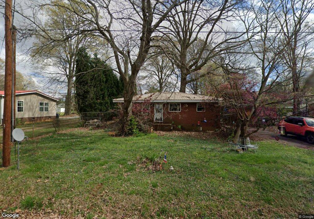
5475 Bertie Ave Salisbury, NC 28147
Estimated Value: $97,000 - $152,011
Studio
1
Bath
972
Sq Ft
$124/Sq Ft
Est. Value
About This Home
This home is located at 5475 Bertie Ave, Salisbury, NC 28147 and is currently estimated at $120,253, approximately $123 per square foot. 5475 Bertie Ave is a home located in Rowan County with nearby schools including Knollwood Elementary School, Southeast Middle School, and Jesse C Carson High School.
Ownership History
Date
Name
Owned For
Owner Type
Purchase Details
Closed on
Jul 11, 2025
Sold by
Cash And Close Charlotte Llc
Bought by
Vidal Claudia Gomez and Otero-Gomez Anthony D
Current Estimated Value
Purchase Details
Closed on
Jul 7, 2025
Sold by
Smith Glindora Motley
Bought by
Cash And Close Charlotte Llc
Purchase Details
Closed on
Jun 17, 1993
Bought by
Smith Glindora Motley
Create a Home Valuation Report for This Property
The Home Valuation Report is an in-depth analysis detailing your home's value as well as a comparison with similar homes in the area
Purchase History
| Date | Buyer | Sale Price | Title Company |
|---|---|---|---|
| Vidal Claudia Gomez | $120,000 | Tar Heel State Title | |
| Vidal Claudia Gomez | $120,000 | Tar Heel State Title | |
| Cash And Close Charlotte Llc | $100,000 | Tar Heel State Title | |
| Cash And Close Charlotte Llc | $100,000 | Tar Heel State Title | |
| Smith Glindora Motley | -- | -- |
Source: Public Records
Tax History
| Year | Tax Paid | Tax Assessment Tax Assessment Total Assessment is a certain percentage of the fair market value that is determined by local assessors to be the total taxable value of land and additions on the property. | Land | Improvement |
|---|---|---|---|---|
| 2025 | $603 | $88,993 | $20,438 | $68,555 |
| 2024 | $603 | $88,993 | $20,438 | $68,555 |
| 2023 | $603 | $88,993 | $20,438 | $68,555 |
| 2022 | $408 | $54,070 | $17,168 | $36,902 |
| 2021 | $404 | $54,070 | $17,168 | $36,902 |
| 2020 | $404 | $54,070 | $17,168 | $36,902 |
| 2019 | $404 | $54,070 | $17,168 | $36,902 |
| 2018 | $375 | $50,581 | $17,167 | $33,414 |
| 2017 | $375 | $50,581 | $17,167 | $33,414 |
| 2016 | $375 | $50,581 | $17,167 | $33,414 |
| 2015 | $379 | $50,581 | $17,167 | $33,414 |
| 2014 | $436 | $60,934 | $13,897 | $47,037 |
Source: Public Records
Map
Nearby Homes
- 355 Swink Ave
- 5650 Bertie Ave
- 735 Grace Church Rd
- 6255 Meadow Ln
- 1080 Beckham Rd
- 1060 Beckham Rd
- 620 Mount Hope Church Rd
- 0 Brookfield Cir Unit CAR4292885
- 1140 Peeler Rd
- 228 Hollybrook Ct
- 1352 Eva Ln
- 130 Lois Ln
- 1675 N Main St
- 450 Black Bear St Unit 149p
- 460 Black Bear St Unit 148p
- 410 Black Bear St Unit 153p
- 465 Black Bear St Unit 156p
- 462 Cress Loop Rd
- 555 White Hare Ln Unit 80p
- 491 White Hare Ln Unit 75
- 5525 Bertie Ave
- 5525 Bertie Ave Unit L42-45
- 5660 S Main St
- 5640 S Main St
- 5460 Bertie Ave
- 5460 Bertie Ave Unit NULL
- 5480 Bertie Ave
- 5480 Bertie Ave Unit NULL
- 5555 Bertie Ave
- 5555 Bertie Ave
- 5555 Bertie Ave
- 5670 S Main St
- 5550 Bertie Ave
- 180 Midway Dr
- 111 Eastover Dr
- 5620 S Main St
- 210 Midway Dr
- 5690 S Main St
- 335 Swink Ave
- 5635 Bertie Ave
Your Personal Tour Guide
Ask me questions while you tour the home.