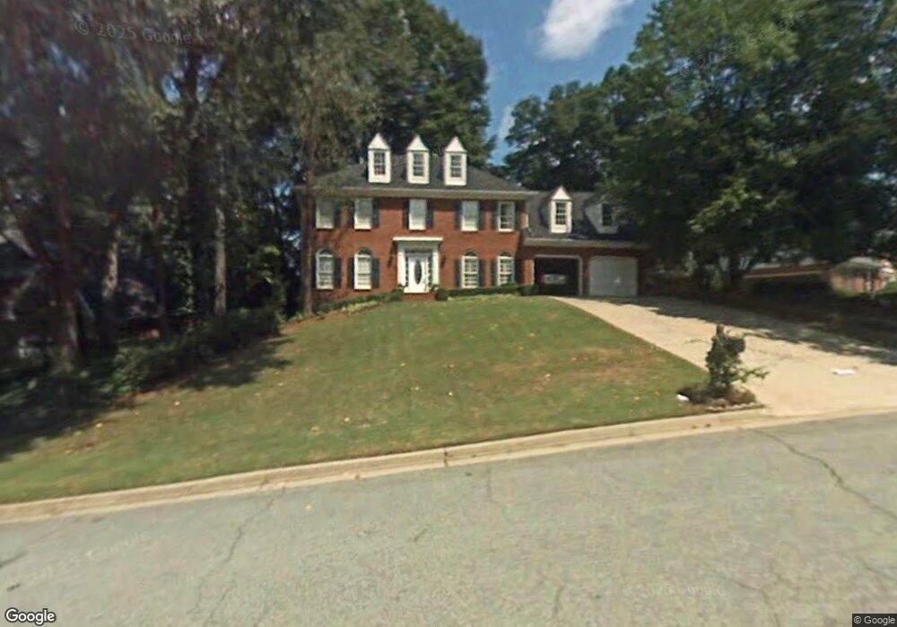
5475 Fort Fisher Way Unit 1 Norcross, GA 30092
Estimated Value: $778,143 - $881,000
4
Beds
4
Baths
2,885
Sq Ft
$286/Sq Ft
Est. Value
About This Home
This home is located at 5475 Fort Fisher Way Unit 1, Norcross, GA 30092 and is currently estimated at $825,036, approximately $285 per square foot. 5475 Fort Fisher Way Unit 1 is a home located in Gwinnett County with nearby schools including Simpson Elementary School, Pinckneyville Middle School, and Norcross High School.
Ownership History
Date
Name
Owned For
Owner Type
Purchase Details
Closed on
Jun 29, 2020
Sold by
Collier Brandon
Bought by
Gonzalez Carlos and Gonzalez Jandelyn Swanson
Current Estimated Value
Home Financials for this Owner
Home Financials are based on the most recent Mortgage that was taken out on this home.
Original Mortgage
$489,850
Outstanding Balance
$432,425
Interest Rate
3.1%
Mortgage Type
New Conventional
Estimated Equity
$392,611
Purchase Details
Closed on
Jan 11, 2016
Sold by
Collier Brandon
Bought by
Collier Brandon and Collier Crystal P
Home Financials for this Owner
Home Financials are based on the most recent Mortgage that was taken out on this home.
Original Mortgage
$348,697
Interest Rate
3.75%
Mortgage Type
FHA
Purchase Details
Closed on
Jul 6, 2015
Sold by
Cox John
Bought by
Cox John Douglas
Purchase Details
Closed on
Mar 28, 2013
Sold by
Randolfi Michael
Bought by
Cox John and Cox Ansley
Home Financials for this Owner
Home Financials are based on the most recent Mortgage that was taken out on this home.
Original Mortgage
$400,000
Interest Rate
2.78%
Mortgage Type
New Conventional
Purchase Details
Closed on
Dec 30, 2003
Sold by
Joyce Brian P and Joyce Stephanie H
Bought by
Randolfi Michael and Randolfi Christine
Home Financials for this Owner
Home Financials are based on the most recent Mortgage that was taken out on this home.
Original Mortgage
$33,265
Interest Rate
5.87%
Mortgage Type
Unknown
Purchase Details
Closed on
Jun 12, 2001
Sold by
Thurston Thurston R and Thurston Luara M
Bought by
Joyce Brian P and Joyce Stephanie H
Home Financials for this Owner
Home Financials are based on the most recent Mortgage that was taken out on this home.
Original Mortgage
$254,800
Interest Rate
7.08%
Mortgage Type
New Conventional
Purchase Details
Closed on
Nov 10, 1997
Sold by
Torhan John Thomas and Torhan Elizabeth Anne
Bought by
Thurston R Michael and Thurston Laura M
Home Financials for this Owner
Home Financials are based on the most recent Mortgage that was taken out on this home.
Original Mortgage
$192,000
Interest Rate
7%
Mortgage Type
New Conventional
Create a Home Valuation Report for This Property
The Home Valuation Report is an in-depth analysis detailing your home's value as well as a comparison with similar homes in the area
Home Values in the Area
Average Home Value in this Area
Purchase History
| Date | Buyer | Sale Price | Title Company |
|---|---|---|---|
| Gonzalez Carlos | $505,000 | -- | |
| Collier Brandon | $410,000 | -- | |
| Collier Brandon | $410,000 | -- | |
| Cox John Douglas | -- | -- | |
| Cox John | $400,000 | -- | |
| Randolfi Michael | $333,000 | -- | |
| Joyce Brian P | $318,500 | -- | |
| Thurston R Michael | $240,000 | -- |
Source: Public Records
Mortgage History
| Date | Status | Borrower | Loan Amount |
|---|---|---|---|
| Open | Gonzalez Carlos | $489,850 | |
| Previous Owner | Collier Brandon | $348,697 | |
| Previous Owner | Cox John | $400,000 | |
| Previous Owner | Randolfi Michael | $33,265 | |
| Previous Owner | Randolfi Michael | $266,400 | |
| Previous Owner | Joyce Brian P | $254,800 | |
| Previous Owner | Thurston R Michael | $192,000 |
Source: Public Records
Tax History Compared to Growth
Tax History
| Year | Tax Paid | Tax Assessment Tax Assessment Total Assessment is a certain percentage of the fair market value that is determined by local assessors to be the total taxable value of land and additions on the property. | Land | Improvement |
|---|---|---|---|---|
| 2025 | $8,559 | $281,600 | $50,160 | $231,440 |
| 2024 | $8,254 | $258,840 | $50,000 | $208,840 |
| 2023 | $8,254 | $258,840 | $50,000 | $208,840 |
| 2022 | $7,850 | $238,640 | $42,000 | $196,640 |
| 2021 | $7,091 | $195,640 | $35,520 | $160,120 |
| 2020 | $6,660 | $195,640 | $35,520 | $160,120 |
| 2019 | $6,179 | $183,440 | $30,000 | $153,440 |
| 2018 | $6,186 | $183,440 | $30,000 | $153,440 |
| 2016 | $5,128 | $162,600 | $24,000 | $138,600 |
| 2015 | $4,968 | $152,960 | $24,000 | $128,960 |
| 2014 | -- | $152,960 | $24,000 | $128,960 |
Source: Public Records
Map
Nearby Homes
- 5465 Fort Fisher Way
- 5465 Fort Fisher Way
- 4531 Outer Bank Dr
- 5545 Fitzpatrick Terrace
- 5397 Valley Mist Ct
- 5221 W Jones Bridge Rd
- 5354 Fox Hill Dr
- 5350 Wickershire Dr
- 5863 Revington Dr
- 5692 Broad River View Unit 435
- 5692 Broad River View
- 9005 Old Southwick Pass
- 510 Covington Cove
- 4916 Sudbrook Way Unit 253
- The Adams Plan at Waterside - Condos
- 4457 Watervale Way Unit 292
- 4477 Watervale Way Unit 286
- 5047 Shirley Oaks Dr Unit 313
- 4903 Sudbrook Way Unit 239
- The Olmstead II Plan at Waterside - Plaza
- 5475 Fort Fisher Way
- 5485 Fort Fisher Way
- 5455 Fort Fisher Way
- 4634 Capers Crossing W Unit 34
- 4634 Capers Crossing W Unit 2
- 5495 Fort Fisher Way
- 4624 Capers Crossing W
- 4522 Outer Bank Dr
- 5489 Folly Place Unit 1
- 5464 Fort Fisher Way Unit 1
- 5454 Fort Fisher Way
- 5484 Fort Fisher Way
- 4633 Capers Crossing W
- 5505 Fort Fisher Way
- 5488 Folly Place
- 4532 Outer Bank Dr
- 5494 Fort Fisher Way
- 4502 Outer Bank Dr Unit 1
- 4521 Outer Bank Dr
- 0 Folly Place Unit 8339506