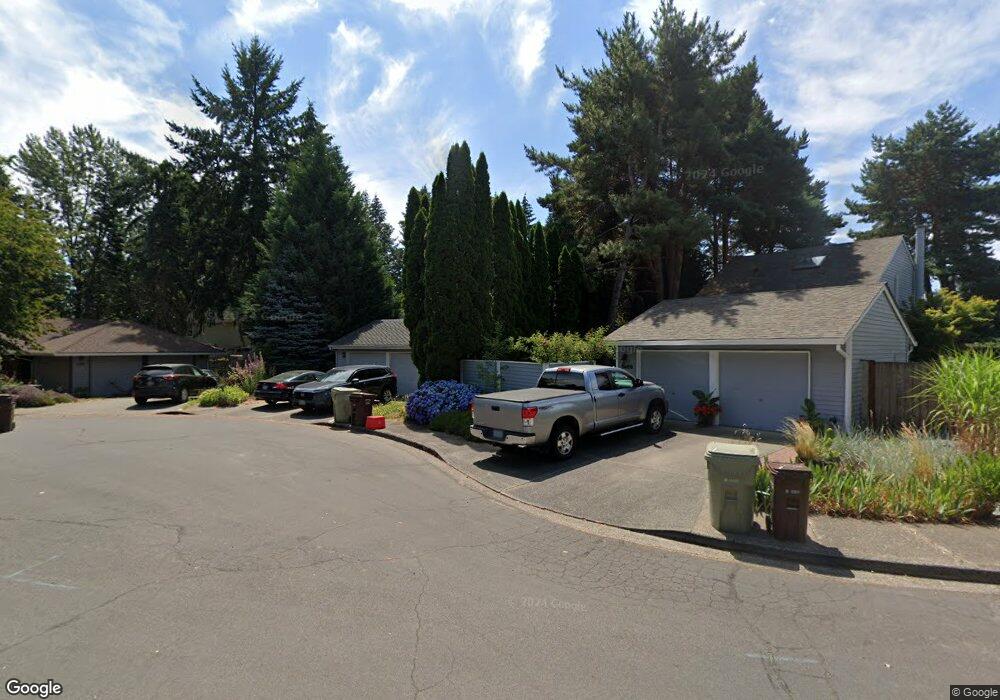
5478 NW Burning Tree Ct Portland, OR 97229
West Union NeighborhoodEstimated Value: $515,000 - $539,000
3
Beds
2
Baths
1,605
Sq Ft
$329/Sq Ft
Est. Value
About This Home
This home is located at 5478 NW Burning Tree Ct, Portland, OR 97229 and is currently estimated at $528,447, approximately $329 per square foot. 5478 NW Burning Tree Ct is a home located in Washington County with nearby schools including Lenox Elementary School, J.W. Poynter Middle School, and Liberty High School.
Ownership History
Date
Name
Owned For
Owner Type
Purchase Details
Closed on
May 22, 2019
Sold by
Sheridan Matthew Barnaby
Bought by
Sheridan Rental Llc
Current Estimated Value
Purchase Details
Closed on
Aug 25, 2009
Sold by
Sheridan Elizabeth
Bought by
Sheridan Barnaby
Purchase Details
Closed on
Jun 22, 2006
Sold by
Seeley Gregory H
Bought by
Sheridan Barnaby and Sheridan Elizabeth
Home Financials for this Owner
Home Financials are based on the most recent Mortgage that was taken out on this home.
Original Mortgage
$194,000
Outstanding Balance
$113,928
Interest Rate
6.55%
Mortgage Type
Unknown
Estimated Equity
$414,519
Purchase Details
Closed on
Jun 24, 2003
Sold by
Seeley Phillip W
Bought by
Seeley Gregory H
Home Financials for this Owner
Home Financials are based on the most recent Mortgage that was taken out on this home.
Original Mortgage
$146,700
Interest Rate
7.62%
Mortgage Type
Unknown
Create a Home Valuation Report for This Property
The Home Valuation Report is an in-depth analysis detailing your home's value as well as a comparison with similar homes in the area
Home Values in the Area
Average Home Value in this Area
Purchase History
| Date | Buyer | Sale Price | Title Company |
|---|---|---|---|
| Sheridan Rental Llc | -- | None Available | |
| Sheridan Barnaby | -- | None Available | |
| Sheridan Barnaby | $269,900 | Chicago Title Insurance Co | |
| Seeley Gregory H | $163,000 | First American |
Source: Public Records
Mortgage History
| Date | Status | Borrower | Loan Amount |
|---|---|---|---|
| Open | Sheridan Barnaby | $194,000 | |
| Previous Owner | Seeley Gregory H | $146,700 |
Source: Public Records
Tax History Compared to Growth
Tax History
| Year | Tax Paid | Tax Assessment Tax Assessment Total Assessment is a certain percentage of the fair market value that is determined by local assessors to be the total taxable value of land and additions on the property. | Land | Improvement |
|---|---|---|---|---|
| 2025 | $4,301 | $252,980 | -- | -- |
| 2024 | $4,066 | $245,620 | -- | -- |
| 2023 | $4,066 | $238,470 | $0 | $0 |
| 2022 | $3,920 | $238,470 | $0 | $0 |
| 2021 | $3,845 | $224,790 | $0 | $0 |
| 2020 | $3,760 | $218,250 | $0 | $0 |
| 2019 | $3,651 | $211,900 | $0 | $0 |
| 2018 | $3,499 | $205,730 | $0 | $0 |
| 2017 | $3,369 | $199,740 | $0 | $0 |
| 2016 | $3,282 | $193,930 | $0 | $0 |
| 2015 | $3,168 | $188,290 | $0 | $0 |
| 2014 | $3,125 | $182,810 | $0 | $0 |
Source: Public Records
Map
Nearby Homes
- 19675 NW Quail Hollow Dr
- 19670 NW Pondosa Ct
- 5344 NW Innisbrook Place
- 5320 NW Edgebrook Place
- 5375 NW Edgebrook Place
- 5170 NW Neakahnie Ave Unit 1
- 5150 NW Neakahnie Ave Unit 40
- 5180 NW Neakahnie Ave Unit 22
- 4861 NW Neskowin Place
- 5839 NW Necanicum Way
- 19070 NW Dorena St
- 20012 NW Metolius Dr
- 4825 NW Salishan Dr
- 4790 NW 188th Ave
- 18800 NW Tolovana St
- 4420 NW 187th Ave
- 4755 NW Shaniko Ct
- 4740 NW Kahneeta Dr
- 21415 NW Kenai Ct
- 4905 NW Kahneeta Ct
- 5458 NW Burning Tree Ct
- 19771 NW Quail Hollow Dr
- 19767 NW Quail Hollow Dr
- 19779 NW Quail Hollow Dr
- 19763 NW Quail Hollow Dr
- 5426 NW Burning Tree Ct
- 5488 NW Burning Tree Ct
- 19759 NW Quail Hollow Dr
- 19755 NW Quail Hollow Dr
- 5498 NW Burning Tree Ct
- 19751 NW Quail Hollow Dr
- 5412 NW Burning Tree Ct
- 5477 NW Burning Tree Ct
- 5483 NW Burning Tree Ct
- 5461 NW Burning Tree Ct
- 5445 NW Burning Tree Ct
- 5429 NW Burning Tree Ct
- 19745 NW Quail Hollow Dr
- 19739 NW Quail Hollow Dr
- 19735 NW Quail Hollow Dr