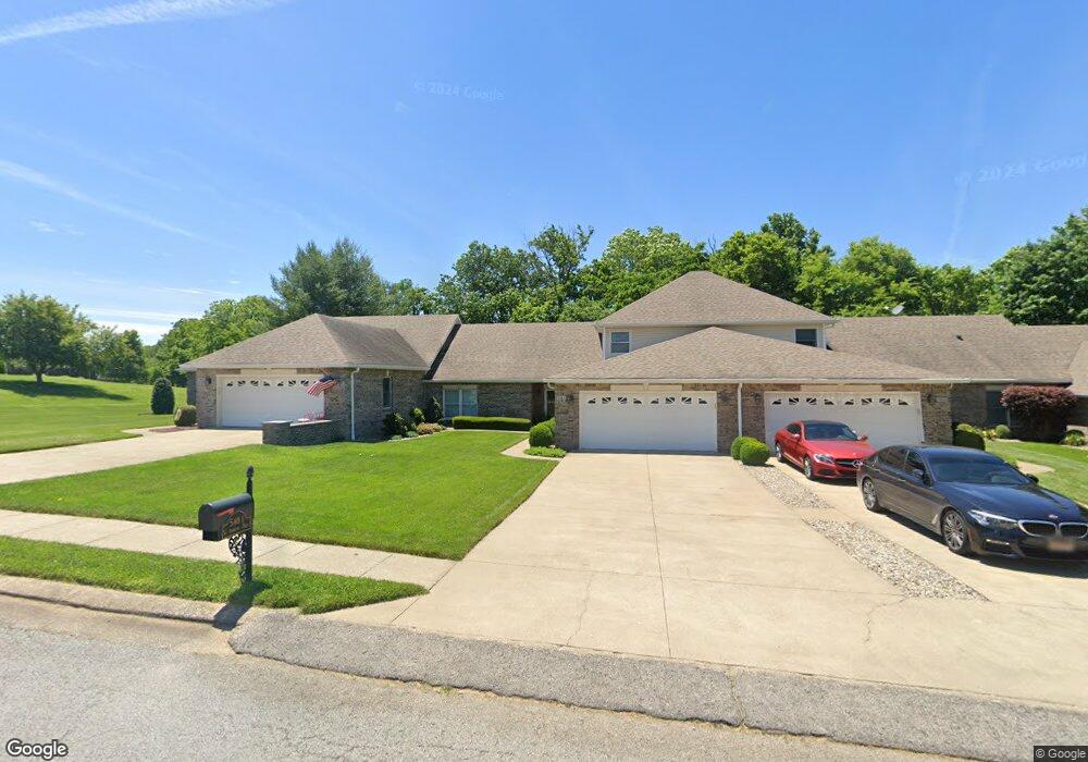
548-1 St Andrews Dr Vine Grove, KY 40175
Estimated Value: $296,443 - $353,000
3
Beds
3
Baths
1,984
Sq Ft
$167/Sq Ft
Est. Value
About This Home
This home is located at 548-1 St Andrews Dr, Vine Grove, KY 40175 and is currently estimated at $330,361, approximately $166 per square foot. 548-1 St Andrews Dr is a home with nearby schools including Vine Grove Elementary School, James T. Alton Middle School, and North Hardin High School.
Ownership History
Date
Name
Owned For
Owner Type
Purchase Details
Closed on
Sep 18, 2018
Sold by
Ousley Docky K and Spilman Paula C
Bought by
Johnson Justin R and Johnson Melissa
Current Estimated Value
Home Financials for this Owner
Home Financials are based on the most recent Mortgage that was taken out on this home.
Original Mortgage
$185,250
Outstanding Balance
$161,216
Interest Rate
4.5%
Mortgage Type
Unknown
Estimated Equity
$169,145
Purchase Details
Closed on
Aug 17, 2012
Sold by
Stinnett Edward G
Bought by
Ousley Docky K and Spilman Paula C
Home Financials for this Owner
Home Financials are based on the most recent Mortgage that was taken out on this home.
Original Mortgage
$168,150
Interest Rate
3.55%
Mortgage Type
New Conventional
Create a Home Valuation Report for This Property
The Home Valuation Report is an in-depth analysis detailing your home's value as well as a comparison with similar homes in the area
Home Values in the Area
Average Home Value in this Area
Purchase History
| Date | Buyer | Sale Price | Title Company |
|---|---|---|---|
| Johnson Justin R | $195,000 | -- | |
| Ousley Docky K | $177,000 | Mattingly Ford Title Service |
Source: Public Records
Mortgage History
| Date | Status | Borrower | Loan Amount |
|---|---|---|---|
| Open | Johnson Justin R | $185,250 | |
| Previous Owner | Ousley Docky K | $168,150 |
Source: Public Records
Tax History Compared to Growth
Tax History
| Year | Tax Paid | Tax Assessment Tax Assessment Total Assessment is a certain percentage of the fair market value that is determined by local assessors to be the total taxable value of land and additions on the property. | Land | Improvement |
|---|---|---|---|---|
| 2024 | $1,953 | $208,300 | $21,200 | $187,100 |
| 2023 | $2,258 | $208,300 | $21,200 | $187,100 |
| 2022 | $1,972 | $208,300 | $21,200 | $187,100 |
| 2021 | $2,154 | $195,000 | $21,200 | $173,800 |
| 2020 | $2,172 | $195,000 | $21,200 | $173,800 |
| 2019 | $0 | $195,000 | $0 | $0 |
| 2018 | $1,924 | $177,000 | $0 | $0 |
| 2017 | $1,916 | $177,000 | $0 | $0 |
| 2016 | $0 | $177,000 | $0 | $0 |
| 2015 | $1,546 | $177,000 | $0 | $0 |
| 2012 | -- | $152,000 | $0 | $0 |
Source: Public Records
Map
Nearby Homes
- Lot 83 Pebble Beach Ct
- Lot 82 Pebble Beach Ct
- Lot 84 Pebble Beach Ct
- 586 Pinehurst Dr
- 584 Pinehurst Dr
- 578 Pinehurst Dr
- 580 Pinehurst Dr
- 589 Pinehurst Dr
- 587 Pinehurst Dr
- 585 Pinehurst Dr
- 155 Sawgrass Ave
- 405 Turnberry Ct
- 576 Pinehurst Dr
- 575 Pinehurst Dr
- 561 Pinehurst Dr
- 557 Pinehurst Dr
- KINGSTON Plan at The Landings
- DUPONT Plan at The Landings
- ESSEX Plan at The Landings
- ABERNATHY Plan at The Landings
- 548-1 Saint Andrews Dr
- 546-2 Saint Andrews Dr
- 548-2 Saint Andrews Dr
- 548 Saint Andrews Dr Unit 1
- 546-1 Saint Andrews Dr
- 551 Saint Andrews Dr
- 549 Saint Andrews Dr
- 547-1 Saint Andrews Dr
- 547-2 Saint Andrews Dr
- 553 Saint Andrews Dr
- 545-2 Saint Andrews Dr
- 554 Saint Andrews Dr
- 545-1 Saint Andrews Dr
- 555 St Andrews
- 555 St Andrews Unit St. Andrews Dr.
- 555 Saint Andrews Dr
- 702 Augusta Dr
- 704 Augusta Dr
- 557 St Andrews
- 557 Saint Andrews Dr