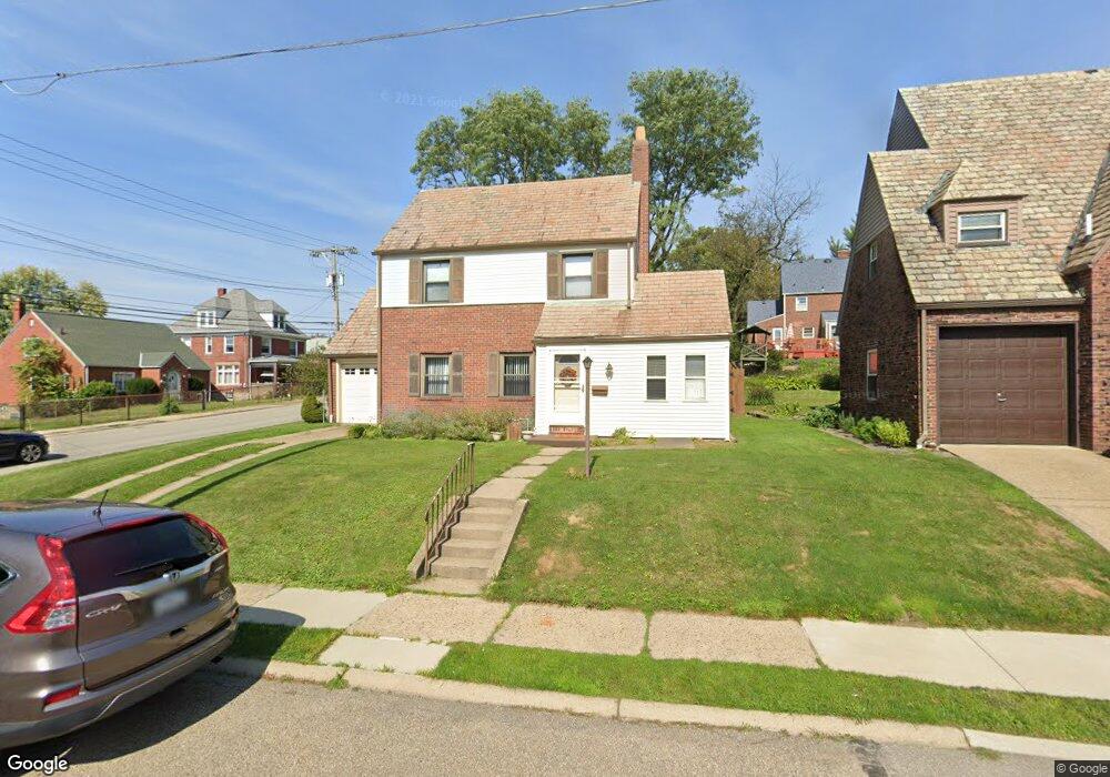
548 Charles Ave New Kensington, PA 15068
Estimated Value: $126,000 - $259,412
--
Bed
--
Bath
--
Sq Ft
4,182
Sq Ft Lot
About This Home
This home is located at 548 Charles Ave, New Kensington, PA 15068 and is currently estimated at $192,853. 548 Charles Ave is a home located in Westmoreland County with nearby schools including Mary Queen of Apostles School.
Ownership History
Date
Name
Owned For
Owner Type
Purchase Details
Closed on
Dec 28, 2000
Sold by
Wolfe Keith S and Wolfe Patti
Bought by
Hammer Keith R and Hammer Erin K
Current Estimated Value
Home Financials for this Owner
Home Financials are based on the most recent Mortgage that was taken out on this home.
Original Mortgage
$76,000
Outstanding Balance
$28,346
Interest Rate
7.69%
Mortgage Type
Purchase Money Mortgage
Estimated Equity
$164,507
Create a Home Valuation Report for This Property
The Home Valuation Report is an in-depth analysis detailing your home's value as well as a comparison with similar homes in the area
Home Values in the Area
Average Home Value in this Area
Purchase History
| Date | Buyer | Sale Price | Title Company |
|---|---|---|---|
| Hammer Keith R | $89,500 | -- |
Source: Public Records
Mortgage History
| Date | Status | Borrower | Loan Amount |
|---|---|---|---|
| Open | Hammer Keith R | $76,000 |
Source: Public Records
Tax History Compared to Growth
Tax History
| Year | Tax Paid | Tax Assessment Tax Assessment Total Assessment is a certain percentage of the fair market value that is determined by local assessors to be the total taxable value of land and additions on the property. | Land | Improvement |
|---|---|---|---|---|
| 2025 | $2,764 | $17,310 | $4,470 | $12,840 |
| 2024 | $2,738 | $17,310 | $4,470 | $12,840 |
| 2023 | $2,591 | $17,310 | $4,470 | $12,840 |
| 2022 | $2,512 | $17,310 | $4,470 | $12,840 |
| 2021 | $2,454 | $17,310 | $4,470 | $12,840 |
| 2020 | $2,402 | $17,310 | $4,470 | $12,840 |
| 2019 | $2,342 | $17,310 | $4,470 | $12,840 |
| 2018 | $2,307 | $17,310 | $4,470 | $12,840 |
| 2017 | $2,273 | $17,310 | $4,470 | $12,840 |
| 2016 | $2,273 | $17,310 | $4,470 | $12,840 |
| 2015 | $2,273 | $17,310 | $4,470 | $12,840 |
| 2014 | $2,184 | $17,310 | $4,470 | $12,840 |
Source: Public Records
Map
Nearby Homes
- 533 Freeport Rd
- 620 Ridge Ave
- 1218 Woodmont Ave
- 1308 Taylor Ave
- 1024 Knollwood Rd
- 1312 Woodmont Ave
- 327 Charles Ave
- 1400 Orchard Ave
- 1134 Leishman Ave
- 318 Ridge Ave
- 486 McCargo St
- 1506 Victoria Ave
- 1520 Woodmont Ave
- 1515 Woodmont Ave
- 201 Locust St
- 105 Locust St
- 1233 Kenneth Ave
- 1521 Victoria Ave
- 254 Ridge Ave
- 1038 Manor Rd
- 546 Charles Ave
- 529 Freeport Rd
- 800 Catalpa St
- 808 Catalpa St
- 540 Charles Ave
- 549 Charles Ave
- 812 Catalpa St
- 545 Charles Ave
- 537 Freeport Rd
- 536 Charles Ave
- 539 Charles Ave
- 714 Catalpa St
- 525 Freeport Rd
- 525 Freeport Rd
- 537 Charles Ave
- 801 Locust Street Extension
- 532 Charles Ave
- 513 Freeport Rd
- 805 Locust Street Extension
- 820 Catalpa St