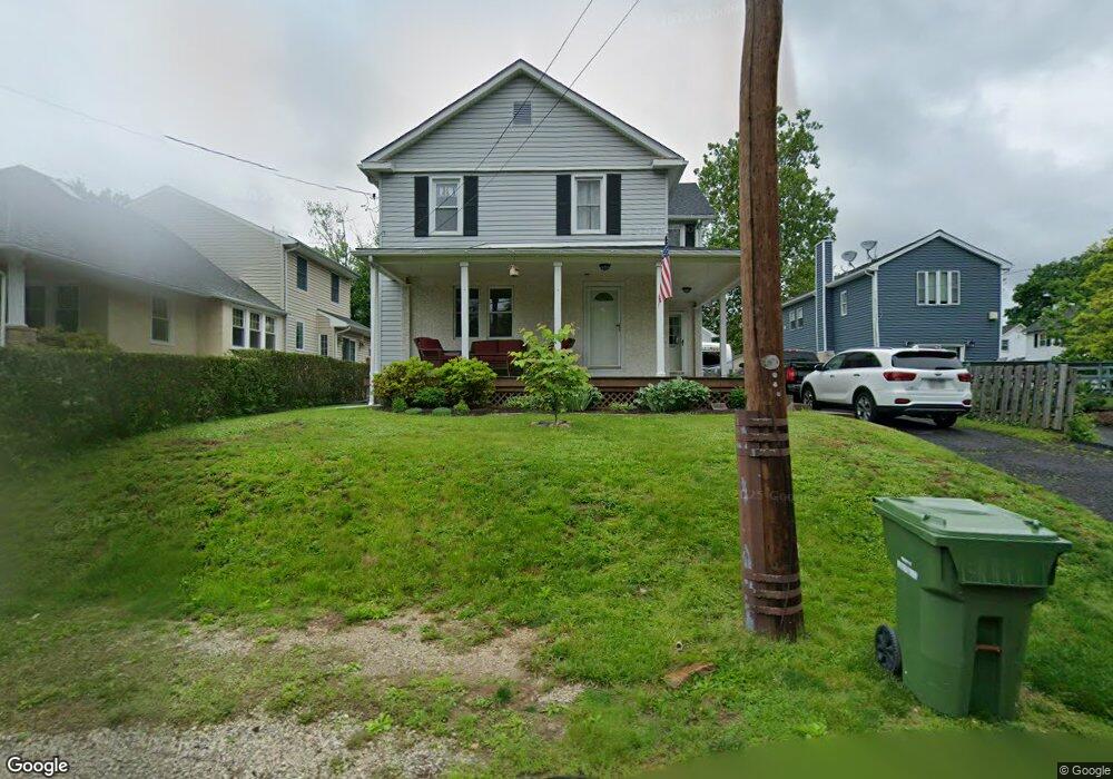
548 Meadowbrook Ave Ambler, PA 19002
Estimated Value: $461,000 - $568,000
4
Beds
2
Baths
1,668
Sq Ft
$312/Sq Ft
Est. Value
About This Home
This home is located at 548 Meadowbrook Ave, Ambler, PA 19002 and is currently estimated at $520,891, approximately $312 per square foot. 548 Meadowbrook Ave is a home located in Montgomery County with nearby schools including Fort Washington Elementary School, Sandy Run Middle School, and Upper Dublin High School.
Ownership History
Date
Name
Owned For
Owner Type
Purchase Details
Closed on
Aug 22, 2008
Sold by
Faust Margaret A and Michener William
Bought by
Faust Margaret A and Balch Matthew E
Current Estimated Value
Home Financials for this Owner
Home Financials are based on the most recent Mortgage that was taken out on this home.
Original Mortgage
$212,000
Interest Rate
6.69%
Purchase Details
Closed on
Jul 21, 1995
Sold by
Michener Eleanor Kessler
Bought by
Faust Margaret and Michener William
Create a Home Valuation Report for This Property
The Home Valuation Report is an in-depth analysis detailing your home's value as well as a comparison with similar homes in the area
Home Values in the Area
Average Home Value in this Area
Purchase History
| Date | Buyer | Sale Price | Title Company |
|---|---|---|---|
| Faust Margaret A | -- | None Available | |
| Faust Margaret | -- | -- |
Source: Public Records
Mortgage History
| Date | Status | Borrower | Loan Amount |
|---|---|---|---|
| Closed | Faust Margaret A | $212,000 |
Source: Public Records
Tax History Compared to Growth
Tax History
| Year | Tax Paid | Tax Assessment Tax Assessment Total Assessment is a certain percentage of the fair market value that is determined by local assessors to be the total taxable value of land and additions on the property. | Land | Improvement |
|---|---|---|---|---|
| 2025 | $6,512 | $133,550 | $55,750 | $77,800 |
| 2024 | $6,512 | $133,550 | $55,750 | $77,800 |
| 2023 | $6,360 | $133,550 | $55,750 | $77,800 |
| 2022 | $6,222 | $133,550 | $55,750 | $77,800 |
| 2021 | $6,067 | $133,550 | $55,750 | $77,800 |
| 2020 | $5,892 | $133,550 | $55,750 | $77,800 |
| 2019 | $5,793 | $133,550 | $55,750 | $77,800 |
| 2018 | $5,793 | $133,550 | $55,750 | $77,800 |
| 2017 | $5,582 | $133,550 | $55,750 | $77,800 |
| 2016 | $5,530 | $133,550 | $55,750 | $77,800 |
| 2015 | $5,223 | $133,550 | $55,750 | $77,800 |
| 2014 | $5,223 | $133,550 | $55,750 | $77,800 |
Source: Public Records
Map
Nearby Homes
- 64 Cavendish Dr
- 51 Cavendish Dr
- 42 Cavendish Dr
- 127 Hampstead Dr Unit 127
- 1000 Quinard Ct
- 700 Willowmere Ln
- 459 Edgewood Dr
- 1502 Seneca Run
- 1602 Seneca Run
- 900 Bellaire Ave
- 201 Cherokee Cir
- 25 N Ridge Ave Unit A
- 25 N Ridge Ave Unit B
- 2000 Chippewa Ridge
- 0 Johns Ln Unit BROOKSIDE ELITE
- 0 Johns Ln Unit EMERSON ELITE
- 774 Johns Ln
- 770 Johns Ln
- 3404 Iroquois Way
- 402 Harrison Place
- 546 Meadowbrook Ave
- 550 Meadowbrook Ave
- 538 Meadowbrook Ave
- 534 Meadowbrook Ave
- 560 Meadowbrook Ave
- 560 Meadowbrook Ave Unit A
- 543 Meadowbrook Ave
- 530 Meadowbrook Ave
- 539 Meadowbrook Ave
- 56 Cavendish Dr
- 60 Cavendish Dr Unit 60
- 58 Cavendish Dr Unit 58
- 59 Cavendish Dr
- 55 Cavendish Dr
- 62 Cavendish Dr
- 63 Cavendish Dr Unit 63
- 66 Cavendish Dr
- 543 Catherine St
- 48 Cavendish Dr
- 47 Cavendish Dr