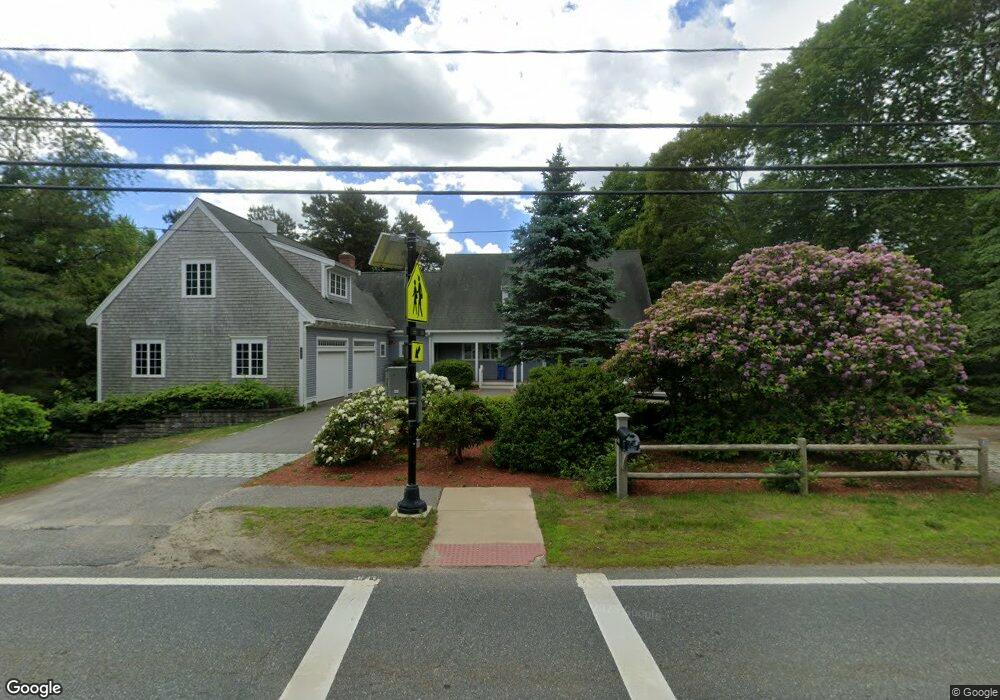
548 Route 6a East Sandwich, MA 02537
Estimated Value: $1,348,000 - $2,479,000
3
Beds
5
Baths
4,200
Sq Ft
$431/Sq Ft
Est. Value
About This Home
This home is located at 548 Route 6a, East Sandwich, MA 02537 and is currently estimated at $1,810,540, approximately $431 per square foot. 548 Route 6a is a home located in Barnstable County with nearby schools including Sandwich Middle High School and Riverview School.
Ownership History
Date
Name
Owned For
Owner Type
Purchase Details
Closed on
Nov 10, 2011
Sold by
Dockmejian Leonard B and Payne James R
Bought by
Riverview School Inc
Current Estimated Value
Home Financials for this Owner
Home Financials are based on the most recent Mortgage that was taken out on this home.
Original Mortgage
$385,000
Outstanding Balance
$262,406
Interest Rate
4.01%
Mortgage Type
Purchase Money Mortgage
Estimated Equity
$1,548,134
Create a Home Valuation Report for This Property
The Home Valuation Report is an in-depth analysis detailing your home's value as well as a comparison with similar homes in the area
Home Values in the Area
Average Home Value in this Area
Purchase History
| Date | Buyer | Sale Price | Title Company |
|---|---|---|---|
| Riverview School Inc | $770,000 | -- |
Source: Public Records
Mortgage History
| Date | Status | Borrower | Loan Amount |
|---|---|---|---|
| Open | Riverview School Inc | $385,000 |
Source: Public Records
Tax History Compared to Growth
Tax History
| Year | Tax Paid | Tax Assessment Tax Assessment Total Assessment is a certain percentage of the fair market value that is determined by local assessors to be the total taxable value of land and additions on the property. | Land | Improvement |
|---|---|---|---|---|
| 2025 | $11,826 | $1,118,800 | $225,700 | $893,100 |
| 2024 | $11,932 | $1,104,800 | $201,500 | $903,300 |
| 2023 | $11,576 | $1,006,600 | $183,200 | $823,400 |
| 2022 | $11,058 | $840,300 | $163,600 | $676,700 |
| 2021 | $10,406 | $755,700 | $157,300 | $598,400 |
| 2020 | $10,416 | $727,900 | $153,600 | $574,300 |
| 2019 | $10,223 | $713,900 | $177,000 | $536,900 |
| 2018 | $10,953 | $682,600 | $177,200 | $505,400 |
| 2017 | $9,778 | $654,900 | $183,700 | $471,200 |
| 2016 | $9,188 | $635,000 | $169,800 | $465,200 |
| 2015 | $9,104 | $614,300 | $158,400 | $455,900 |
Source: Public Records
Map
Nearby Homes
- 566 Route 6a
- 507 Massachusetts 6a Unit 9
- 0 Captain Kidd Rd
- 4 Wing Blvd
- 70 Wing Blvd E
- 5 Andersen Ave
- 11 Locust Ln
- 3 Mulberry Cir
- 665 Route 6a
- 420 Massachusetts 6a
- 37 Ploughed Neck Rd
- 36 Atkins Rd Unit D2
- 49 Atkins Rd
- 49 Atkins Rd
- 6 Harpers Hollow
- 20 Crestview Dr
- 390 Massachusetts 6a
- 4 Cowslip Path
- 21 Manor Dr
- 2 Marie Ln