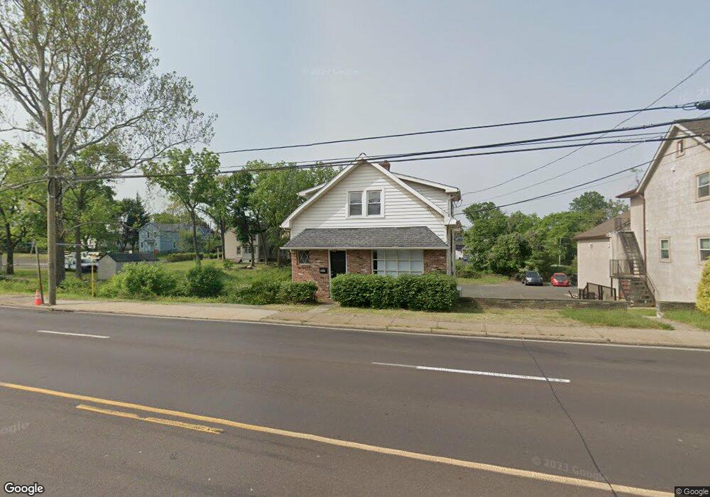
548 Street Rd Southampton, PA 18966
Estimated Value: $324,193
--
Bed
--
Bath
1,500
Sq Ft
$216/Sq Ft
Est. Value
About This Home
This home is located at 548 Street Rd, Southampton, PA 18966 and is currently estimated at $324,193, approximately $216 per square foot. 548 Street Rd is a home located in Bucks County with nearby schools including Davis Elementary School, Klinger Middle School, and William Tennent High School.
Ownership History
Date
Name
Owned For
Owner Type
Purchase Details
Closed on
Nov 21, 2019
Sold by
Musick Theodore and Musick Joan E
Bought by
548 Street Road Llc
Current Estimated Value
Home Financials for this Owner
Home Financials are based on the most recent Mortgage that was taken out on this home.
Original Mortgage
$136,500
Interest Rate
3.6%
Mortgage Type
Commercial
Purchase Details
Closed on
Oct 23, 1987
Sold by
Donovan Walter
Bought by
Musick Theodore and Musick Joan E
Create a Home Valuation Report for This Property
The Home Valuation Report is an in-depth analysis detailing your home's value as well as a comparison with similar homes in the area
Home Values in the Area
Average Home Value in this Area
Purchase History
| Date | Buyer | Sale Price | Title Company |
|---|---|---|---|
| 548 Street Road Llc | $210,000 | First Amer Abstract Of Pa | |
| Musick Theodore | $29,000 | -- |
Source: Public Records
Mortgage History
| Date | Status | Borrower | Loan Amount |
|---|---|---|---|
| Previous Owner | 548 Street Road Llc | $136,500 |
Source: Public Records
Tax History Compared to Growth
Tax History
| Year | Tax Paid | Tax Assessment Tax Assessment Total Assessment is a certain percentage of the fair market value that is determined by local assessors to be the total taxable value of land and additions on the property. | Land | Improvement |
|---|---|---|---|---|
| 2025 | $4,519 | $21,130 | $14,320 | $6,810 |
| 2024 | $4,519 | $21,130 | $14,320 | $6,810 |
| 2023 | $4,382 | $21,130 | $14,320 | $6,810 |
| 2022 | $4,290 | $21,130 | $14,320 | $6,810 |
| 2021 | $4,212 | $21,130 | $14,320 | $6,810 |
| 2020 | $5,033 | $25,600 | $14,320 | $11,280 |
| 2019 | $4,848 | $25,600 | $14,320 | $11,280 |
| 2018 | $4,736 | $25,600 | $14,320 | $11,280 |
| 2017 | $4,602 | $25,600 | $14,320 | $11,280 |
| 2016 | $4,602 | $25,600 | $14,320 | $11,280 |
| 2015 | -- | $25,600 | $14,320 | $11,280 |
| 2014 | -- | $25,600 | $14,320 | $11,280 |
Source: Public Records
Map
Nearby Homes
- 615 Belmont Ave
- 206 E Hampton Crossing
- 19 Belmont Station
- 419 Temple Rd
- 909 Carlin Dr
- 435 Temple Rd
- 415 New Rd
- 926 Carlin Dr
- 736 Plum St
- 756 Churchville Rd
- 1307 Steamboat Station Unit 1307
- 1081 Cherry Ln
- 325 Toll Dr
- 530 Andrew Dr
- 603 Steamboat Station Unit 603
- 604 Cushmore Rd
- 967 Jeffrey Dr
- 117 Maple Ave
- 559 Maple Ave
- 1238 Hiview Dr
- 548 Street Rd Unit 1
- 542 Street Rd
- 520 Street Rd
- 538 Street Rd Unit STRG 2
- 538 Street Rd Unit STRG 1
- 538 Street Rd
- 538 Street Rd Unit 700-1
- 538 Street Rd Unit 4
- 538 Street Rd Unit 101
- 538 Street Rd Unit 100
- 538 Street Rd Unit 200
- 538 Street Rd Unit 201
- 541 Street Rd
- 640 Summit Ave
- 545 Street Rd
- 539 Street Rd Unit 545
- 539 Street Rd Unit CORNER
- 539 Street Rd Unit 2ND FL
- 634 Summit Ave
- 706 Willow St