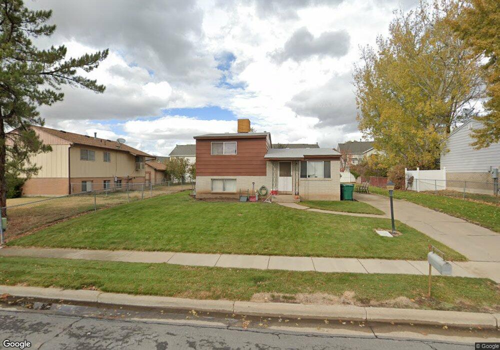
548 W 175 N Layton, UT 84041
Estimated Value: $336,000 - $374,000
3
Beds
1
Bath
800
Sq Ft
$436/Sq Ft
Est. Value
About This Home
This home is located at 548 W 175 N, Layton, UT 84041 and is currently estimated at $348,965, approximately $436 per square foot. 548 W 175 N is a home located in Davis County with nearby schools including Layton Elementary School, Fairfield Junior High School, and Layton High School.
Ownership History
Date
Name
Owned For
Owner Type
Purchase Details
Closed on
Nov 24, 2014
Sold by
Brown Steve D and Brown Earlene L
Bought by
The Steve And Earlene Brown Family Trust and Brown Earlene L
Current Estimated Value
Purchase Details
Closed on
May 12, 2000
Sold by
Evans Alvin L and Evans Dawn C
Bought by
Brown Steve D and Brown Earlene L
Create a Home Valuation Report for This Property
The Home Valuation Report is an in-depth analysis detailing your home's value as well as a comparison with similar homes in the area
Home Values in the Area
Average Home Value in this Area
Purchase History
| Date | Buyer | Sale Price | Title Company |
|---|---|---|---|
| The Steve And Earlene Brown Family Trust | -- | None Available | |
| Brown Steven D | -- | None Available | |
| Brown Steve D | -- | -- |
Source: Public Records
Tax History Compared to Growth
Tax History
| Year | Tax Paid | Tax Assessment Tax Assessment Total Assessment is a certain percentage of the fair market value that is determined by local assessors to be the total taxable value of land and additions on the property. | Land | Improvement |
|---|---|---|---|---|
| 2025 | $1,661 | $174,350 | $107,584 | $66,766 |
| 2024 | $1,618 | $171,049 | $119,689 | $51,360 |
| 2023 | $1,524 | $156,200 | $64,390 | $91,809 |
| 2022 | $1,603 | $295,000 | $134,788 | $160,212 |
| 2021 | $1,504 | $227,000 | $111,232 | $115,768 |
| 2020 | $1,353 | $196,000 | $93,301 | $102,699 |
| 2019 | $1,311 | $186,000 | $96,582 | $89,418 |
| 2018 | $1,173 | $167,000 | $84,614 | $82,386 |
| 2016 | $926 | $68,035 | $27,889 | $40,146 |
| 2015 | $893 | $62,260 | $27,889 | $34,371 |
| 2014 | $858 | $61,190 | $27,889 | $33,301 |
| 2013 | -- | $63,117 | $14,950 | $48,167 |
Source: Public Records
Map
Nearby Homes
- 485 W 100 N
- 356 W 25 N
- 6 Grover St
- 355 W Gentile St
- 750 W Gentile St
- 526 King St Unit 2
- 933 W Gentile St
- 495 Spurlock St
- 267 S Melody St
- 174 W Dawson St
- 480 Spurlock St
- 441 Church St
- 142 Green Dr
- 362 S 950 W
- 1015 W 350 S
- 1113 W Angel Hill Ct
- 1677 N 1600 W Unit 134
- 562 S 850 W
- 1096 N 300 W
- 298 Amber Ln
- 526 W 175 N
- 190 N 575 W
- 545 W 230 N
- 551 W 230 N
- 555 W 230 N
- 500 W 175 N
- 539 W 230 N
- 561 W 230 N
- 535 W 230 N
- 531 W 230 N
- 225 Cook Dr Unit 2
- 225 Cook Dr Unit 27
- 225 Cook Dr Unit 26
- 225 Cook Dr Unit 25
- 225 Cook Dr Unit 24
- 225 Cook Dr Unit 23
- 225 Cook Dr Unit 22
- 225 Cook Dr Unit 21
- 225 Cook Dr Unit 20
- 225 Cook Dr Unit 19