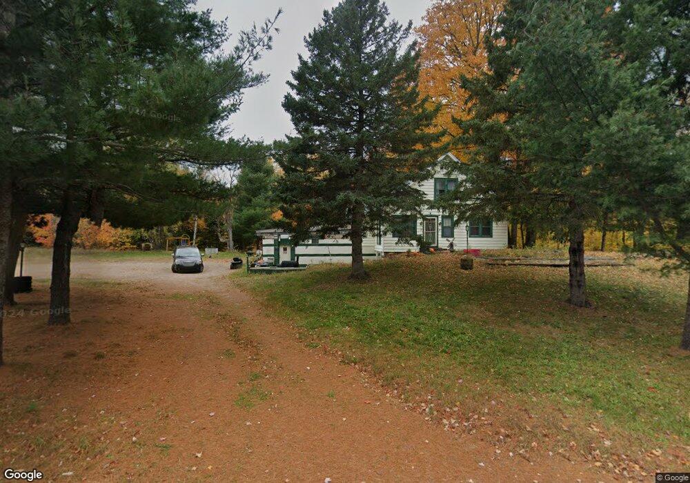
548 W Branch Rd Marquette, MI 49855
Estimated Value: $290,891 - $364,000
--
Bed
--
Bath
1,545
Sq Ft
$213/Sq Ft
Est. Value
About This Home
This home is located at 548 W Branch Rd, Marquette, MI 49855 and is currently estimated at $329,297, approximately $213 per square foot. 548 W Branch Rd is a home located in Marquette County with nearby schools including Superior Hills Elementary School, Bothwell Middle School, and Marquette Senior High School.
Ownership History
Date
Name
Owned For
Owner Type
Purchase Details
Closed on
Nov 3, 2020
Sold by
Carolyn Lindholm
Bought by
Lindholm Aaron
Current Estimated Value
Purchase Details
Closed on
Sep 14, 2020
Sold by
Lindholm Carolyn
Bought by
Lindholm Aaron
Purchase Details
Closed on
Aug 28, 2019
Sold by
Marquette County Treasurer
Bought by
Lindholm Aaron James
Home Financials for this Owner
Home Financials are based on the most recent Mortgage that was taken out on this home.
Original Mortgage
$50,000
Interest Rate
3.8%
Mortgage Type
New Conventional
Create a Home Valuation Report for This Property
The Home Valuation Report is an in-depth analysis detailing your home's value as well as a comparison with similar homes in the area
Home Values in the Area
Average Home Value in this Area
Purchase History
| Date | Buyer | Sale Price | Title Company |
|---|---|---|---|
| Lindholm Aaron | -- | Lindholm Aaron | |
| Lindholm Aaron | -- | Lindholm Aaron | |
| Lindholm Aaron James | $21,250 | -- |
Source: Public Records
Mortgage History
| Date | Status | Borrower | Loan Amount |
|---|---|---|---|
| Previous Owner | Lindholm Aaron James | $50,000 |
Source: Public Records
Tax History Compared to Growth
Tax History
| Year | Tax Paid | Tax Assessment Tax Assessment Total Assessment is a certain percentage of the fair market value that is determined by local assessors to be the total taxable value of land and additions on the property. | Land | Improvement |
|---|---|---|---|---|
| 2025 | $13 | $145,600 | $0 | $0 |
| 2024 | $13 | $122,500 | $0 | $0 |
| 2023 | $796 | $98,000 | $0 | $0 |
| 2022 | $1,721 | $72,400 | $0 | $0 |
| 2021 | $1,672 | $75,500 | $0 | $0 |
| 2020 | $1,499 | $72,400 | $0 | $0 |
| 2019 | $1,085 | $71,900 | $0 | $0 |
| 2018 | $1,057 | $72,350 | $0 | $0 |
| 2017 | $1,036 | $69,600 | $0 | $0 |
| 2016 | $1,034 | $73,550 | $0 | $0 |
| 2015 | -- | $73,550 | $0 | $0 |
| 2014 | -- | $73,550 | $0 | $0 |
| 2012 | -- | $73,550 | $0 | $0 |
Source: Public Records
Map
Nearby Homes
- 148 W Branch Rd
- Parcel D Kunde Rd
- Parcel C Kunde Rd
- Parcel B Kunde Rd
- Parcel A Kunde Rd
- 408 Green Garden Rd
- 131 Shimon Ct
- 325 Brookwood Ln
- 589 Mangum Rd
- 6432 U S 41 S
- 6382 Us Highway 41
- 119 Gordon Rd
- 145 Brewer Dr
- 121 Dandelion Ln
- 119 Chocolay Downs Golf Dr
- TBD Chocolay Downs Golf Dr
- 105 Dalton Rd
- 272 Timber Ln
- 200 Surrey Ln
- 164 Dana Ln
- 596 County Road 545
- 534 W Branch Rd
- 534 W Branch Rd
- 552 W Branch Rd
- 581 W Branch Rd
- 573 W Branch Rd
- 597 W Branch Rd
- 551 W Branch Rd
- 533 W Branch Rd
- 555 W Branch Rd
- 555 County Road 545
- 573 County Road 545
- 551 County Road 545
- 350 W Branch Rd
- 325 W Branch Rd
- 555 N Co Rd 545
- 555 Co Rd 545
- 679 W Branch Rd
- 547 W Branch Rd
- 321 W Branch Rd