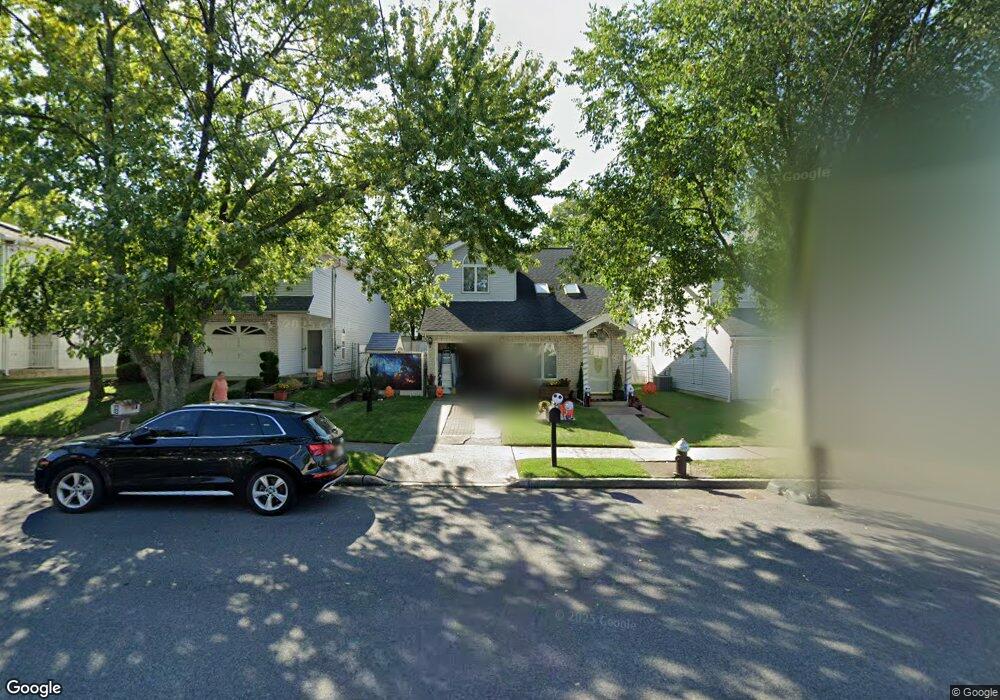
548 Winant Ave Staten Island, NY 10309
Rossville NeighborhoodEstimated Value: $936,957 - $1,150,000
3
Beds
3
Baths
3,100
Sq Ft
$342/Sq Ft
Est. Value
About This Home
This home is located at 548 Winant Ave, Staten Island, NY 10309 and is currently estimated at $1,061,239, approximately $342 per square foot. 548 Winant Ave is a home located in Richmond County with nearby schools including P.S. 56 - The Louis Desario School, Is 34 Tottenville, and Tottenville High School.
Ownership History
Date
Name
Owned For
Owner Type
Purchase Details
Closed on
Aug 11, 2000
Sold by
Rosner Scott Jay
Bought by
Mikhail Samy A and Zaky Evelen
Current Estimated Value
Home Financials for this Owner
Home Financials are based on the most recent Mortgage that was taken out on this home.
Original Mortgage
$297,000
Outstanding Balance
$106,777
Interest Rate
8.1%
Estimated Equity
$954,462
Create a Home Valuation Report for This Property
The Home Valuation Report is an in-depth analysis detailing your home's value as well as a comparison with similar homes in the area
Home Values in the Area
Average Home Value in this Area
Purchase History
| Date | Buyer | Sale Price | Title Company |
|---|---|---|---|
| Mikhail Samy A | $330,000 | -- |
Source: Public Records
Mortgage History
| Date | Status | Borrower | Loan Amount |
|---|---|---|---|
| Open | Mikhail Samy A | $297,000 |
Source: Public Records
Tax History Compared to Growth
Tax History
| Year | Tax Paid | Tax Assessment Tax Assessment Total Assessment is a certain percentage of the fair market value that is determined by local assessors to be the total taxable value of land and additions on the property. | Land | Improvement |
|---|---|---|---|---|
| 2025 | $9,440 | $59,280 | $9,484 | $49,796 |
| 2024 | $9,440 | $52,260 | $10,469 | $41,791 |
| 2023 | $9,546 | $47,002 | $10,257 | $36,745 |
| 2022 | $9,028 | $51,480 | $11,640 | $39,840 |
| 2021 | $8,978 | $50,520 | $11,640 | $38,880 |
| 2020 | $8,519 | $52,980 | $11,640 | $41,340 |
| 2019 | $8,194 | $50,100 | $11,640 | $38,460 |
| 2018 | $7,984 | $39,168 | $10,268 | $28,900 |
| 2017 | $7,682 | $37,685 | $10,657 | $27,028 |
| 2016 | $7,107 | $35,552 | $9,981 | $25,571 |
| 2015 | $6,264 | $33,540 | $9,720 | $23,820 |
| 2014 | $6,264 | $32,640 | $9,720 | $22,920 |
Source: Public Records
Map
Nearby Homes
- 149 Lucille Ave
- 494 Winant Ave
- 125 Wirt Ave
- 159 Wirt Ave
- 76 Lucille Ave
- 37 Charleston Ave
- 16 Wirt Ln
- 97 Bower Ct Unit 1
- 97 Bower Ct Unit 74
- 39 Hemlock Ct Unit 152
- 857 Bloomingdale Rd
- 22 Charleston Ave Unit 168
- 15 Lorraine Loop
- 17 Lorraine Loop
- 5 Wirt Ave
- 40 Bower Ct
- 45 Redwood Loop
- 87 Cypress Loop Unit 243
- 85 Cypress Loop
- 34 Lorraine Loop
- 552 Winant Ave
- 544 Winant Ave
- 556 Winant Ave
- 540 Winant Ave
- 141 Charleston Ave Unit 2
- 141 Charleston Ave
- 145 Charleston Ave
- 0 Westfield Ave
- 77 Westfield Ave
- 149 Charleston Ave
- 111 Charleston Ave
- 73 Westfield Ave
- 153 Charleston Ave
- 107 Charleston Ave
- 134 Charleston Ave
- 130 Charleston Ave
- 138 Charleston Ave
- 69 Westfield Ave
- 103 Charleston Ave
- 142 Charleston Ave