Estimated Value: $270,314 - $336,000
4
Beds
3
Baths
1,590
Sq Ft
$183/Sq Ft
Est. Value
About This Home
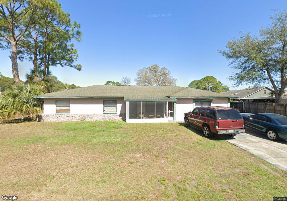
This home is located at 5480 Bridge Rd, Cocoa, FL 32927 and is currently estimated at $291,579, approximately $183 per square foot. 5480 Bridge Rd is a home located in Brevard County with nearby schools including Challenger 7 Elementary School, Space Coast Junior/Senior High School, and East Atlantic Prep of Brevard County.
Ownership History
Date
Name
Owned For
Owner Type
Purchase Details
Closed on
Oct 26, 1998
Sold by
T M S Mtg Inc
Bought by
Melendez Lucy D and Melendez Jennie D
Current Estimated Value
Home Financials for this Owner
Home Financials are based on the most recent Mortgage that was taken out on this home.
Original Mortgage
$59,950
Interest Rate
6.84%
Purchase Details
Closed on
Jul 21, 1998
Sold by
Clerk Circuit Court
Bought by
T M S Mtg Inc and Money Store
Create a Home Valuation Report for This Property
The Home Valuation Report is an in-depth analysis detailing your home's value as well as a comparison with similar homes in the area
Home Values in the Area
Average Home Value in this Area
Purchase History
| Date | Buyer | Sale Price | Title Company |
|---|---|---|---|
| Melendez Lucy D | -- | -- | |
| Melendez Lucy | $50,000 | -- | |
| T M S Mtg Inc | -- | -- |
Source: Public Records
Mortgage History
| Date | Status | Borrower | Loan Amount |
|---|---|---|---|
| Previous Owner | Melendez Lucy | $59,950 |
Source: Public Records
Tax History
| Year | Tax Paid | Tax Assessment Tax Assessment Total Assessment is a certain percentage of the fair market value that is determined by local assessors to be the total taxable value of land and additions on the property. | Land | Improvement |
|---|---|---|---|---|
| 2025 | $3,034 | $211,040 | -- | -- |
| 2024 | $2,949 | $215,060 | -- | -- |
| 2023 | $2,949 | $212,290 | $0 | $0 |
| 2022 | $2,720 | $201,320 | $0 | $0 |
| 2021 | $2,471 | $151,560 | $42,000 | $109,560 |
| 2020 | $2,284 | $135,520 | $40,000 | $95,520 |
| 2019 | $773 | $59,130 | $0 | $0 |
| 2018 | $774 | $58,030 | $0 | $0 |
| 2017 | $776 | $56,840 | $0 | $0 |
| 2016 | $782 | $55,680 | $18,000 | $37,680 |
| 2015 | $787 | $55,300 | $15,000 | $40,300 |
| 2014 | $791 | $54,870 | $11,000 | $43,870 |
Source: Public Records
Map
Nearby Homes
- 5946 Deer Ln
- 5945 Coker Ave
- 6020 Cannon Ave
- 5720 Flint Rd
- 5221 Carrick Rd
- 5950 Ackard Ave
- 5601 Banos Ave
- 5215 Holden Rd
- 5220 Holden Rd
- 6438 Hudson Rd
- 5680 Banos Ave
- 000 Port Saint John Pkwy
- 6094 Cardiff Ave
- No Access Port Saint John Pkwy
- 6481 La Brea Ave
- 5812 Homestead Ave
- 6450 Ember Ave
- 5715 Fairbridge St
- 5914 Stillwater Ave
- 0 Aruin St Unit 1222557
- 5521 Carrick Rd
- 5920 Jenkins Ave
- 5930 Jenkins Ave
- 5509 Carrick Rd
- 5479 Bridge Rd
- 5467 Bridge Rd
- 5528 Carrick Rd
- 5540 Carrick Rd
- 5940 Jenkins Ave
- 5516 Carrick Rd
- 5491 Bridge Rd
- 5445 Bridge Rd
- 5497 Carrick Rd
- 5504 Carrick Rd
- 5433 Bridge Rd
- 5950 Jenkins Ave
- 5921 Jenkins Ave
- 5933 Jenkins Ave
- 5485 Carrick Rd
- 5486 Carrick Rd
Your Personal Tour Guide
Ask me questions while you tour the home.