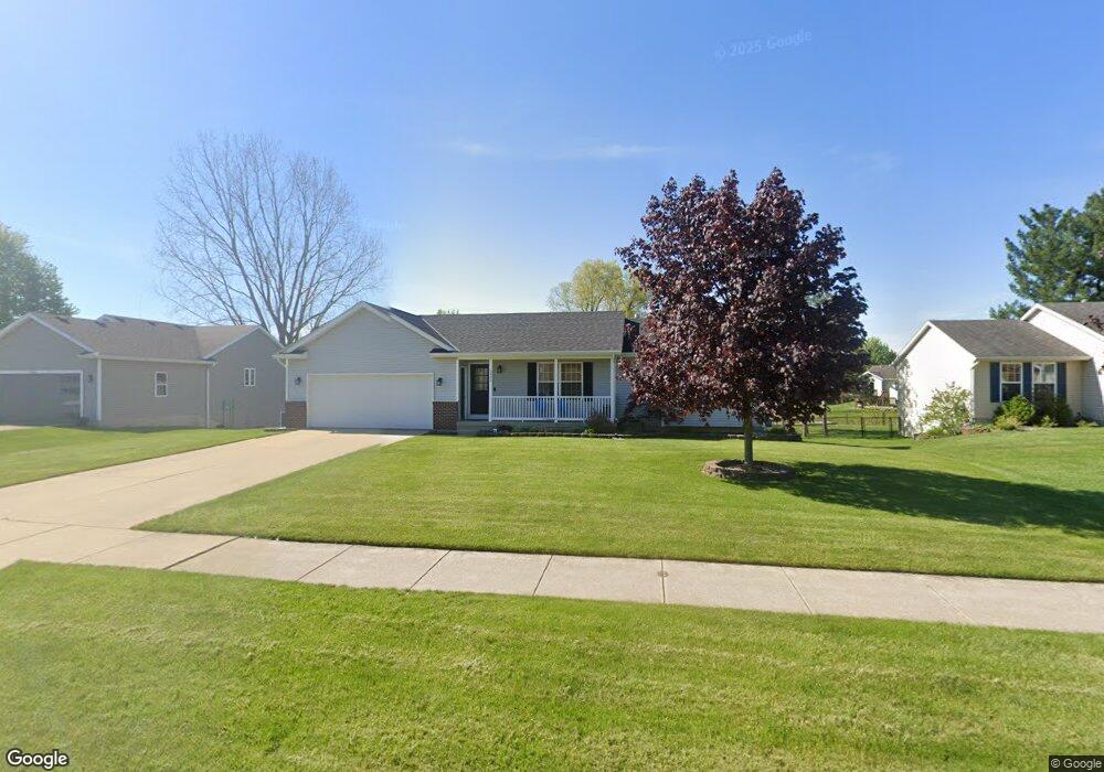
5480 Jordan St Allendale, MI 49401
Estimated Value: $314,437 - $370,000
2
Beds
2
Baths
1,080
Sq Ft
$321/Sq Ft
Est. Value
About This Home
This home is located at 5480 Jordan St, Allendale, MI 49401 and is currently estimated at $347,109, approximately $321 per square foot. 5480 Jordan St is a home located in Ottawa County with nearby schools including Evergreen Elementary School, Allendale Middle School, and Allendale High School.
Ownership History
Date
Name
Owned For
Owner Type
Purchase Details
Closed on
Aug 31, 2006
Sold by
Stites Gary Wayne and Stites Doreen
Bought by
Huf Jarrad M
Current Estimated Value
Home Financials for this Owner
Home Financials are based on the most recent Mortgage that was taken out on this home.
Original Mortgage
$128,250
Outstanding Balance
$76,683
Interest Rate
6.59%
Mortgage Type
New Conventional
Estimated Equity
$270,426
Purchase Details
Closed on
Mar 9, 2006
Sold by
Stites Gary and Stites Kay
Bought by
Wells Fargo Bank Na and First Franklin Mortgage Loan Trust 2004-
Create a Home Valuation Report for This Property
The Home Valuation Report is an in-depth analysis detailing your home's value as well as a comparison with similar homes in the area
Home Values in the Area
Average Home Value in this Area
Purchase History
| Date | Buyer | Sale Price | Title Company |
|---|---|---|---|
| Huf Jarrad M | $135,000 | Transnation Title Ins Co | |
| Wells Fargo Bank Na | $141,818 | None Available |
Source: Public Records
Mortgage History
| Date | Status | Borrower | Loan Amount |
|---|---|---|---|
| Open | Huf Jarrad M | $128,250 |
Source: Public Records
Tax History Compared to Growth
Tax History
| Year | Tax Paid | Tax Assessment Tax Assessment Total Assessment is a certain percentage of the fair market value that is determined by local assessors to be the total taxable value of land and additions on the property. | Land | Improvement |
|---|---|---|---|---|
| 2025 | $2,518 | $122,000 | $0 | $0 |
| 2024 | $2,135 | $126,100 | $0 | $0 |
| 2023 | $2,038 | $114,200 | $0 | $0 |
| 2022 | $2,276 | $105,000 | $0 | $0 |
| 2021 | $2,219 | $90,100 | $0 | $0 |
| 2020 | $2,191 | $89,400 | $0 | $0 |
| 2019 | $2,151 | $80,600 | $0 | $0 |
| 2018 | $2,020 | $75,100 | $0 | $0 |
| 2017 | $1,964 | $68,800 | $0 | $0 |
| 2016 | $1,887 | $67,800 | $0 | $0 |
| 2015 | -- | $64,200 | $0 | $0 |
| 2014 | -- | $59,700 | $0 | $0 |
Source: Public Records
Map
Nearby Homes
- 11506 56th Ave
- 5621 Estate Rd
- 10940 Gayle Ln
- 5690 Forest View St
- 10786 Melanie Dr
- 10718 Melanie Dr
- 10725 Melanie Dr
- 5779 Huber St
- 10713 Melanie Dr
- 10724 Greyhound Ave
- The Silverton Plan at Pearline Estates
- The Breckenridge Plan at Pearline Estates
- The McKinley Plan at Pearline Estates
- The Emerson Plan at Pearline Estates
- The Whitney Plan at Pearline Estates
- The Harper Plan at Pearline Estates
- The Sierra Plan at Pearline Estates
- The Poppy Plan at Pearline Estates
- The Dickenson Plan at Pearline Estates
- The Yukon Plan at Pearline Estates
- 5468 Jordan St
- 5494 Jordan St
- 5454 Jordan St
- 5510 Jordan St
- 5487 Jordan St
- 5475 Jordan St
- 10988 Lance Ave
- 5463 Jordan St
- 10972 Lance Ave
- 5505 Jordan St
- 10960 Lance Ave
- 5436 Jordan St
- 10956 Lance Ave
- 5447 Jordan St
- 11058 Lance Ave
- 10952 Lance Ave
- 5536 Jordan St
- 5433 Jordan St
- 10995 Lance Ave
- 5420 Jordan St