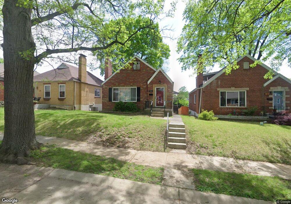
5480 Oleatha Ave Saint Louis, MO 63139
Northampton NeighborhoodEstimated Value: $214,591 - $307,000
2
Beds
1
Bath
1,050
Sq Ft
$254/Sq Ft
Est. Value
About This Home
This home is located at 5480 Oleatha Ave, Saint Louis, MO 63139 and is currently estimated at $266,648, approximately $253 per square foot. 5480 Oleatha Ave is a home located in St. Louis City with nearby schools including Buder Elementary School, Long International Middle School, and Roosevelt High School.
Ownership History
Date
Name
Owned For
Owner Type
Purchase Details
Closed on
Feb 22, 2013
Sold by
Zittel Christopher
Bought by
Embrick Melanie A
Current Estimated Value
Home Financials for this Owner
Home Financials are based on the most recent Mortgage that was taken out on this home.
Original Mortgage
$133,536
Outstanding Balance
$93,478
Interest Rate
3.44%
Mortgage Type
FHA
Estimated Equity
$173,170
Purchase Details
Closed on
Aug 10, 2012
Sold by
Hendron Patricia and Stanger Edward
Bought by
Zittel Chritopher
Create a Home Valuation Report for This Property
The Home Valuation Report is an in-depth analysis detailing your home's value as well as a comparison with similar homes in the area
Home Values in the Area
Average Home Value in this Area
Purchase History
| Date | Buyer | Sale Price | Title Company |
|---|---|---|---|
| Embrick Melanie A | -- | Ptc | |
| Zittel Chritopher | -- | Ust |
Source: Public Records
Mortgage History
| Date | Status | Borrower | Loan Amount |
|---|---|---|---|
| Open | Embrick Melanie A | $133,536 |
Source: Public Records
Tax History Compared to Growth
Tax History
| Year | Tax Paid | Tax Assessment Tax Assessment Total Assessment is a certain percentage of the fair market value that is determined by local assessors to be the total taxable value of land and additions on the property. | Land | Improvement |
|---|---|---|---|---|
| 2025 | $2,039 | $28,260 | $2,810 | $25,450 |
| 2024 | $1,940 | $24,020 | $2,810 | $21,210 |
| 2023 | $1,940 | $24,020 | $2,810 | $21,210 |
| 2022 | $1,869 | $22,270 | $2,810 | $19,460 |
| 2021 | $1,866 | $22,270 | $2,810 | $19,460 |
| 2020 | $1,761 | $21,160 | $2,810 | $18,350 |
| 2019 | $2,397 | $29,030 | $2,810 | $26,220 |
| 2018 | $2,161 | $25,330 | $2,810 | $22,520 |
| 2017 | $2,124 | $25,330 | $2,810 | $22,520 |
| 2016 | $1,912 | $22,480 | $2,810 | $19,670 |
| 2015 | $1,734 | $22,480 | $2,810 | $19,670 |
| 2014 | $1,714 | $22,480 | $2,810 | $19,670 |
| 2013 | -- | $22,230 | $2,810 | $19,420 |
Source: Public Records
Map
Nearby Homes
- 7082 Oleatha Ave
- 5425 Pernod Ave
- 3443 Sublette Ave
- 5410 Tholozan Ave
- 5329 Tholozan Ave
- 5340 Tholozan Ave
- 5504 Mardel Ave
- 5531 Arthur Ave
- 5701 Pernod Ave
- 5500 Lindenwood Ave
- 5231 Potomac St
- 5549 Lindenwood Ave
- 5630 Fyler Ave
- 5716 Pernod Ave
- 5273 Parker Ave
- 5343 Chippewa St
- 5065 Miami St
- 5050 Potomac St
- 5210 Parker Ave
- 5200 Mardel Ave
- 5476 Oleatha Ave
- 5484 Oleatha Ave
- 5472 Oleatha Ave
- 5488 Oleatha Ave
- 5468 Oleatha Ave
- 3532 Regal Place
- 5479 Pernod Ave
- 5475 Pernod Ave
- 5464 Oleatha Ave
- 5483 Pernod Ave
- 5471 Pernod Ave
- 5487 Pernod Ave
- 5481 Oleatha Ave
- 5467 Pernod Ave
- 5477 Oleatha Ave
- 5485 Oleatha Ave
- 5460 Oleatha Ave
- 5473 Oleatha Ave
- 5489 Oleatha Ave
- 3540 Regal Place