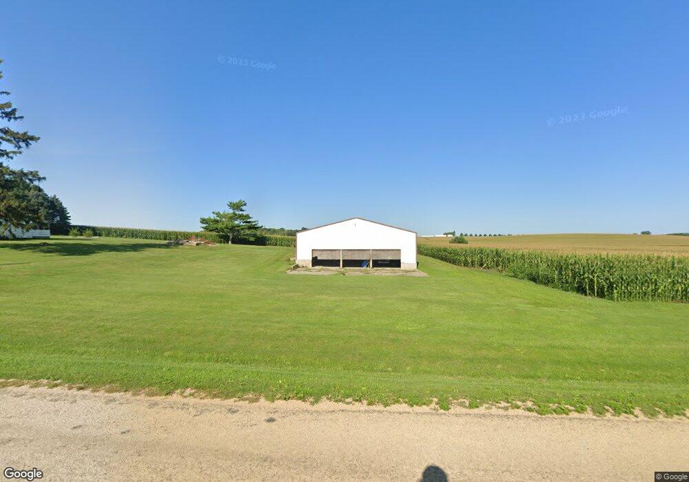
5480 S Lowden Rd Oregon, IL 61061
Estimated Value: $55,524 - $254,000
--
Bed
--
Bath
1,440
Sq Ft
$109/Sq Ft
Est. Value
About This Home
This home is located at 5480 S Lowden Rd, Oregon, IL 61061 and is currently estimated at $156,381, approximately $108 per square foot. 5480 S Lowden Rd is a home located in Ogle County with nearby schools including Oregon Elementary School, David L. Rahn Junior High School, and Oregon High School.
Ownership History
Date
Name
Owned For
Owner Type
Purchase Details
Closed on
Jul 24, 2020
Sold by
Hammer Steven R and Hammer Darlene K
Bought by
Hammer Jason R and Haugh Stephanie K
Current Estimated Value
Purchase Details
Closed on
Feb 18, 2010
Sold by
Hammer Steven R and Barth Patricia Ann
Bought by
Hammer Steven R and Hammer Darlene K
Purchase Details
Closed on
Feb 17, 2010
Sold by
Barth Patricia Ann and Barth George D
Bought by
Hammer Steven R and Hammer Darlene K
Create a Home Valuation Report for This Property
The Home Valuation Report is an in-depth analysis detailing your home's value as well as a comparison with similar homes in the area
Home Values in the Area
Average Home Value in this Area
Purchase History
| Date | Buyer | Sale Price | Title Company |
|---|---|---|---|
| Hammer Jason R | $35,000 | Chicago Title | |
| Hammer Steven R | $35,000 | None Available | |
| Hammer Steven R | -- | None Available |
Source: Public Records
Tax History Compared to Growth
Tax History
| Year | Tax Paid | Tax Assessment Tax Assessment Total Assessment is a certain percentage of the fair market value that is determined by local assessors to be the total taxable value of land and additions on the property. | Land | Improvement |
|---|---|---|---|---|
| 2024 | $1,100 | $13,054 | $7,479 | $5,575 |
| 2023 | $1,006 | $11,956 | $6,965 | $4,991 |
| 2022 | $956 | $11,067 | $6,447 | $4,620 |
| 2021 | $900 | $10,327 | $6,016 | $4,311 |
| 2020 | $692 | $7,851 | $5,749 | $2,102 |
| 2019 | $687 | $7,812 | $5,720 | $2,092 |
| 2018 | $655 | $7,476 | $5,474 | $2,002 |
| 2017 | $652 | $7,476 | $5,474 | $2,002 |
| 2016 | $624 | $7,214 | $5,282 | $1,932 |
| 2015 | $613 | $7,468 | $5,468 | $2,000 |
| 2014 | $2,022 | $24,518 | $5,468 | $19,050 |
| 2013 | $2,012 | $25,738 | $5,740 | $19,998 |
Source: Public Records
Map
Nearby Homes
- 811 Cottonwood Ct
- 806 Cottonwood Ct
- 803 Cottonwood Ct
- 519 Cottonwood Ct
- 107 Maple Ln
- 701 Woodland Dr
- 703 Kaskaskia Dr
- 705 Rock Ct
- 703 Rock Ct
- 609 Missouri Dr
- 711,713,715 Mississippi Dr
- 214 Crabapple Ct
- 906 Monongahela Dr
- 626 Rolling Ln
- 401 Saint Francis Dr
- 304 Wild Cherry Dr
- 214 Park Dr
- 327 Wild Cherry Dr
- 220 Cuyahoga Dr
- 415 Saint Francis Dr