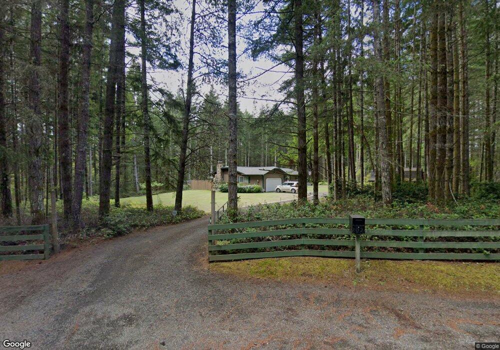
5480 SW Daisy St Port Orchard, WA 98367
Estimated Value: $545,980 - $679,000
3
Beds
2
Baths
1,324
Sq Ft
$446/Sq Ft
Est. Value
About This Home
This home is located at 5480 SW Daisy St, Port Orchard, WA 98367 and is currently estimated at $590,995, approximately $446 per square foot. 5480 SW Daisy St is a home located in Kitsap County with nearby schools including Burley Glenwood Elementary School, Cedar Heights Middle School, and South Kitsap High School.
Ownership History
Date
Name
Owned For
Owner Type
Purchase Details
Closed on
Mar 8, 2011
Sold by
Menard Dean A
Bought by
Menard Dean A and Menard Kenzie
Current Estimated Value
Home Financials for this Owner
Home Financials are based on the most recent Mortgage that was taken out on this home.
Original Mortgage
$210,509
Interest Rate
4.71%
Mortgage Type
VA
Purchase Details
Closed on
Feb 25, 2011
Sold by
Caprione Charles F and Caprione Kazuko
Bought by
Menard Dean A
Home Financials for this Owner
Home Financials are based on the most recent Mortgage that was taken out on this home.
Original Mortgage
$210,509
Interest Rate
4.71%
Mortgage Type
VA
Create a Home Valuation Report for This Property
The Home Valuation Report is an in-depth analysis detailing your home's value as well as a comparison with similar homes in the area
Home Values in the Area
Average Home Value in this Area
Purchase History
| Date | Buyer | Sale Price | Title Company |
|---|---|---|---|
| Menard Dean A | -- | Accommodation | |
| Menard Dean A | $198,280 | Stewart Title Kitsap County | |
| Menard Dean A | -- | Stewart Title Kitsap County |
Source: Public Records
Mortgage History
| Date | Status | Borrower | Loan Amount |
|---|---|---|---|
| Open | Menard Dean A | $210,509 |
Source: Public Records
Tax History Compared to Growth
Tax History
| Year | Tax Paid | Tax Assessment Tax Assessment Total Assessment is a certain percentage of the fair market value that is determined by local assessors to be the total taxable value of land and additions on the property. | Land | Improvement |
|---|---|---|---|---|
| 2026 | $3,846 | $434,100 | $114,890 | $319,210 |
| 2025 | $3,846 | $434,100 | $114,890 | $319,210 |
| 2024 | $3,730 | $434,100 | $114,890 | $319,210 |
| 2023 | $3,705 | $434,100 | $114,890 | $319,210 |
| 2022 | $3,542 | $347,240 | $91,580 | $255,660 |
| 2021 | $3,363 | $312,310 | $83,250 | $229,060 |
| 2020 | $3,200 | $288,350 | $78,710 | $209,640 |
| 2019 | $2,710 | $267,180 | $72,750 | $194,430 |
| 2018 | $2,875 | $216,850 | $62,610 | $154,240 |
| 2017 | $2,427 | $216,850 | $62,610 | $154,240 |
| 2016 | $2,377 | $194,320 | $59,630 | $134,690 |
| 2015 | $2,307 | $191,060 | $59,630 | $131,430 |
| 2014 | -- | $171,540 | $57,630 | $113,910 |
| 2013 | -- | $171,540 | $57,630 | $113,910 |
Source: Public Records
Map
Nearby Homes
- 13213 Wicks End Ln SW
- 13280 Wicks End Ln SW
- 11910 Alpine Dr SW
- 6034 Trace Dr SW
- 5884 Trace Dr SW
- 6023 Trace Dr SW
- 5864 Trace Dr SW Unit 274
- 5844 Trace Dr SW
- 5824 Trace Dr SW
- 7891 SW Conifer Ln
- 13540 Carney Lake Rd SW
- 12160 Burchard Dr SW
- 12650 Lindi Ln SW
- 12199 Burchard Dr SW
- 12520 Lindi Ln SW
- 14139 Vintage Dr SW
- 15235 Golden Hawk Place SW
- 8389 SW Harmon St
- 13102 Burchard Dr SW
- 13427 Burchard Dr SW
- 12505 Oakridge Dr SW
- 12750 Deer Crest Dr SW
- 12595 Oakridge Dr SW
- 12415 Oakridge Dr SW
- 12800 Deer Crest Dr SW
- 12625 Oakridge Dr SW
- 12725 Deer Crest Dr SW
- 5475 SW Daisy St
- 12590 Oakridge Dr SW
- 12775 Deer Crest Dr SW
- 5520 SW Daisy St
- 12375 Oakridge Dr SW
- 5415 SW Daisy St
- 12795 Mallard Dr SW
- 12860 Deer Crest Dr SW
- 5515 SW Daisy St
- 12380 Oakridge Dr SW
- 12680 Oakridge Dr SW
- 0 Mallard Dr SW
- 5640 SW Daisy St