Estimated Value: $326,467 - $354,000
4
Beds
2
Baths
1,800
Sq Ft
$191/Sq Ft
Est. Value
About This Home
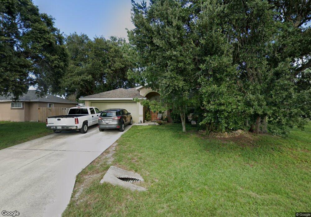
This home is located at 5485 Flint Rd, Cocoa, FL 32927 and is currently estimated at $344,117, approximately $191 per square foot. 5485 Flint Rd is a home located in Brevard County with nearby schools including Enterprise Elementary School, Space Coast Junior/Senior High School, and East Atlantic Prep of Brevard County.
Ownership History
Date
Name
Owned For
Owner Type
Purchase Details
Closed on
Sep 16, 1997
Sold by
Roden Joseph and Roden Nancy
Bought by
Dove Samuel D and Dove Kimberly A
Current Estimated Value
Home Financials for this Owner
Home Financials are based on the most recent Mortgage that was taken out on this home.
Original Mortgage
$90,994
Outstanding Balance
$14,089
Interest Rate
7.46%
Estimated Equity
$330,028
Create a Home Valuation Report for This Property
The Home Valuation Report is an in-depth analysis detailing your home's value as well as a comparison with similar homes in the area
Home Values in the Area
Average Home Value in this Area
Purchase History
| Date | Buyer | Sale Price | Title Company |
|---|---|---|---|
| Dove Samuel D | $12,000 | -- |
Source: Public Records
Mortgage History
| Date | Status | Borrower | Loan Amount |
|---|---|---|---|
| Open | Dove Samuel D | $90,994 |
Source: Public Records
Tax History
| Year | Tax Paid | Tax Assessment Tax Assessment Total Assessment is a certain percentage of the fair market value that is determined by local assessors to be the total taxable value of land and additions on the property. | Land | Improvement |
|---|---|---|---|---|
| 2025 | $1,407 | $102,390 | -- | -- |
| 2024 | $1,370 | $99,510 | -- | -- |
| 2023 | $1,370 | $96,620 | $0 | $0 |
| 2022 | $1,277 | $93,810 | $0 | $0 |
| 2021 | $1,272 | $91,080 | $0 | $0 |
| 2020 | $1,209 | $89,830 | $0 | $0 |
| 2019 | $1,144 | $87,820 | $0 | $0 |
| 2018 | $1,136 | $86,190 | $0 | $0 |
| 2017 | $1,126 | $84,420 | $0 | $0 |
| 2016 | $1,126 | $82,690 | $18,000 | $64,690 |
| 2015 | $1,136 | $82,120 | $15,000 | $67,120 |
| 2014 | $1,136 | $81,470 | $11,000 | $70,470 |
Source: Public Records
Map
Nearby Homes
- 6438 Hudson Rd
- 6450 Ember Ave
- 5220 Holden Rd
- 5460 Holden Rd
- 5215 Holden Rd
- 00 Unknown
- 5221 Carrick Rd
- 6615 Dock Ave
- 6581 Bancroft Ave
- 5715 Fairbridge St
- 6375 Cable Ave
- 5945 Coker Ave
- 5946 Deer Ln
- 6094 Cardiff Ave
- 6760 Cairo Rd
- 5720 Flint Rd
- 4975 Fay Blvd
- 0000 Grissom Pkwy
- 5095 Hogan Place
- 6815 Bryant Rd
- 5489 Flint Rd
- 6346 Fairchild Ave
- 6370 Fairchild Ave
- 5473 Flint Rd
- 5481 Flint Rd
- 5488 Flint Rd
- 5480 Flint Rd
- 5493 Flint Rd
- 6382 Fairchild Ave
- 5464 Flint Rd
- 5495 Flint Rd
- 5465 Flint Rd
- 5350 Fay Blvd
- 6345 Gillette Ave
- 5340 Fay Blvd
- 6371 Fairchild Ave
- 6365 Gillette Ave
- 6345 Fairchild Ave
- 5456 Flint Rd
- 5497 Flint Rd
Your Personal Tour Guide
Ask me questions while you tour the home.