Estimated Value: $340,000 - $363,000
3
Beds
2
Baths
1,674
Sq Ft
$208/Sq Ft
Est. Value
About This Home
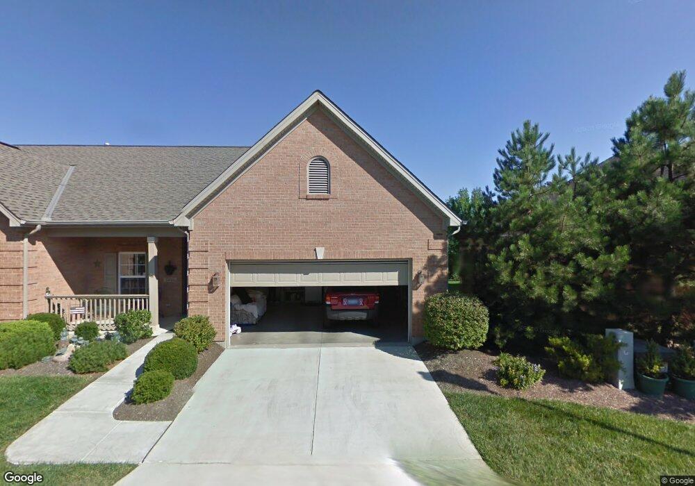
This home is located at 5486 Harbourside Dr, Mason, OH 45040 and is currently estimated at $347,389, approximately $207 per square foot. 5486 Harbourside Dr is a home located in Warren County with nearby schools including Mason Intermediate Elementary School, Mason Middle School, and William Mason High School.
Ownership History
Date
Name
Owned For
Owner Type
Purchase Details
Closed on
Jun 17, 2021
Sold by
Schott Wahnoka T and Schott Leo Anthony
Bought by
Chambers Richard Scott and The Chambers Family Living Tru
Current Estimated Value
Home Financials for this Owner
Home Financials are based on the most recent Mortgage that was taken out on this home.
Original Mortgage
$186,300
Outstanding Balance
$167,195
Interest Rate
2.9%
Mortgage Type
New Conventional
Estimated Equity
$180,194
Purchase Details
Closed on
Jun 8, 2001
Sold by
Harbour Watch Llc
Bought by
Schott Leo A and Schott Wathnoka T
Create a Home Valuation Report for This Property
The Home Valuation Report is an in-depth analysis detailing your home's value as well as a comparison with similar homes in the area
Home Values in the Area
Average Home Value in this Area
Purchase History
| Date | Buyer | Sale Price | Title Company |
|---|---|---|---|
| Chambers Richard Scott | $248,500 | None Available | |
| Schott Leo A | $186,900 | -- |
Source: Public Records
Mortgage History
| Date | Status | Borrower | Loan Amount |
|---|---|---|---|
| Open | Chambers Richard Scott | $186,300 |
Source: Public Records
Tax History
| Year | Tax Paid | Tax Assessment Tax Assessment Total Assessment is a certain percentage of the fair market value that is determined by local assessors to be the total taxable value of land and additions on the property. | Land | Improvement |
|---|---|---|---|---|
| 2025 | $4,397 | $103,370 | $21,000 | $82,370 |
| 2024 | $4,397 | $103,370 | $21,000 | $82,370 |
| 2023 | $4,143 | $81,697 | $8,610 | $73,087 |
| 2022 | $4,143 | $81,697 | $8,610 | $73,087 |
| 2021 | $3,518 | $81,697 | $8,610 | $73,087 |
| 2020 | $3,275 | $66,420 | $7,000 | $59,420 |
| 2019 | $3,033 | $66,420 | $7,000 | $59,420 |
| 2018 | $3,045 | $66,420 | $7,000 | $59,420 |
| 2017 | $2,878 | $59,021 | $6,332 | $52,689 |
| 2016 | $2,958 | $59,021 | $6,332 | $52,689 |
| 2015 | $2,966 | $59,021 | $6,332 | $52,689 |
| 2014 | $2,964 | $55,160 | $5,920 | $49,240 |
| 2013 | $2,971 | $65,240 | $7,000 | $58,240 |
Source: Public Records
Map
Nearby Homes
- 5369 N Shore Place
- 6266 Trailwood Ct
- 6304 Trailwood Ct
- 5673 Melbury Ct
- 5641 Melbury Ct
- 5576 Winding Cape Way
- 4796 White Blossom Blvd
- 6285 Greenwood Ct
- 9018 Boylston St
- 9024 Beacon St
- 6315 Greenwood Ct
- 7064 Celebration Way
- 7076 Celebration Way
- 7080 Celebration Way
- 7103 Celebration Way
- 7068 Celebration Way
- 7173 Traditions Turn
- 7123 Traditions Turn
- 7133 Traditions Turn
- 4390 S Mallard Cove
- 5486 Harbourside Dr Unit 104
- 5490 Harbourside Dr Unit 103
- 5490 Harbourside Dr Unit 103
- 5490 Harbourside Dr
- 5462 Harbourside Dr Unit 103
- 5462 Harbourside Dr Unit 16101
- 5462 Harbourside Dr
- 5496 Harbourside Dr
- 5458 Harbourside Dr Unit 102
- 5458 Harbourside Dr
- 5473 Harbourside Dr
- 5473 Harbourside Dr
- 5469 Harbourside Dr
- 5469 Harbourside Dr
- 5500 Harbourside Dr Unit 101
- 5500 Harbourside Dr Unit 101
- 5500 Harbourside Dr
- 5477 Harbourside Dr
- 5477 Harbourside Dr
- 5509 Harbourside Dr Unit 101
Your Personal Tour Guide
Ask me questions while you tour the home.