549 Brock Rd Nevada City, CA 95959
Estimated Value: $567,000 - $719,000
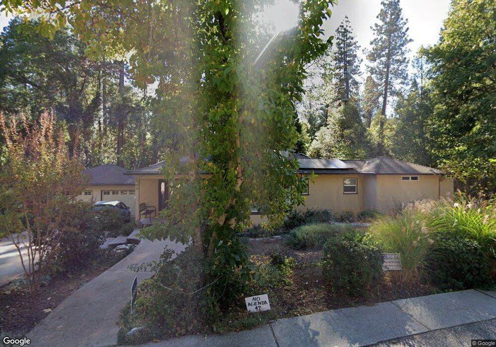
About This Home
This home is located at 549 Brock Rd, Nevada City, CA 95959 and is currently estimated at $629,147, approximately $337 per square foot. 549 Brock Rd is a home located in Nevada County with nearby schools including Deer Creek Elementary School, Seven Hills Intermediate School, and Nevada City Charter School.
Ownership History
We collect this data history from publicly available records. To have your information removed, we recommend requesting removal directly through your county’s website.
Purchase Details
Home Financials for this Owner
Home Financials are based on the most recent Mortgage that was taken out on this home.Purchase Details
Home Values in the Area
Average Home Value in this Area
Purchase History
We collect this data history from publicly available records. To have your information removed, we recommend requesting removal directly through your county’s website.
| Date | Buyer | Sale Price | Title Company |
|---|---|---|---|
| -- | Title Source Inc | ||
| -- | None Available | ||
| -- | -- |
Mortgage History
We collect this data history from publicly available records. To have your information removed, we recommend requesting removal directly through your county’s website.
| Date | Status | Borrower | Loan Amount |
|---|---|---|---|
| Closed | $214,162 |
Tax History
We collect this data history from publicly available records. To have your information removed, we recommend requesting removal directly through your county’s website.
| Year | Tax Paid | Tax Assessment Tax Assessment Total Assessment is a certain percentage of the fair market value that is determined by local assessors to be the total taxable value of land and additions on the property. | Land | Improvement |
|---|---|---|---|---|
| 2025 | $2,192 | $213,470 | $35,499 | $177,971 |
| 2024 | $2,151 | $209,285 | $34,803 | $174,482 |
| 2023 | $2,151 | $205,182 | $34,121 | $171,061 |
| 2022 | $2,108 | $201,159 | $33,452 | $167,707 |
| 2021 | $2,045 | $197,216 | $32,797 | $164,419 |
| 2020 | $2,041 | $195,195 | $32,461 | $162,734 |
| 2019 | $2,000 | $191,369 | $31,825 | $159,544 |
| 2018 | $0 | $187,617 | $31,201 | $156,416 |
| 2017 | $1,923 | $183,940 | $30,590 | $153,350 |
| 2016 | $1,853 | $180,335 | $29,991 | $150,344 |
| 2015 | $1,827 | $177,627 | $29,541 | $148,086 |
| 2014 | -- | $174,149 | $28,963 | $145,186 |
Map
- 323 Bridge Way
- 749 Gold Flat Rd
- 509 Sacramento St
- 334 Bridge Way
- 433 Sacramento St
- 315 Jordan St
- 631 Chief Kelly Dr
- 530 Lost Hill Ct
- 317 S Pine St
- 218 Drummond St
- 651 Chief Kelly Dr
- 520 Lost Hill Ct
- 214 Mill St
- 11279 Marjon Dr
- 10085 Banner Lava Cap Rd
- 523 W Broad St
- 611 W Broad St
- 101-107 New Mohawk Rd
- 203 Prospect St
- 2300 Nevada City Hwy
- 533 Brock Rd
- 501 Brock Rd
- 552 Brock Rd
- 532 Brock Rd Unit 532
- 439 Brock Rd
- 433 Brock Rd
- 4 Providence Mine Rd
- 450 Providence Mine Rd
- 2 Providence Mine Rd
- 442 Brock Rd
- 410 Brock Rd
- 401 Brock Rd
- 349 Brock Rd
- 350 Brock Rd
- 347 Brock Rd
- 348 Brock Rd
- 388 Brock Rd
- 351 Providence Mine Rd
- 352 Providence Mine Rd
- 310 Providence Mine Rd
Ask me questions while you tour the home.