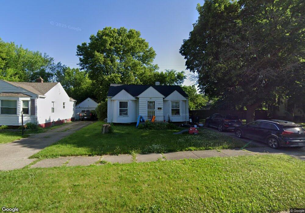
549 Burroughs Ave Flint, MI 48507
Circle Drive NeighborhoodEstimated Value: $65,533 - $86,000
3
Beds
1
Bath
1,084
Sq Ft
$70/Sq Ft
Est. Value
About This Home
This home is located at 549 Burroughs Ave, Flint, MI 48507 and is currently estimated at $75,883, approximately $70 per square foot. 549 Burroughs Ave is a home located in Genesee County with nearby schools including Freeman Elementary School, Flint Southwestern Classical Academy, and Burton Glen Charter Academy.
Ownership History
Date
Name
Owned For
Owner Type
Purchase Details
Closed on
Jun 20, 2019
Sold by
Aguilar Eric W
Bought by
Dodge Robert William and Beauchamp Amy Michelle
Current Estimated Value
Purchase Details
Closed on
Sep 27, 2000
Sold by
Baller Charles I and Ballmer Charles I
Bought by
Ballmer Charles I and Ballmer Poly
Home Financials for this Owner
Home Financials are based on the most recent Mortgage that was taken out on this home.
Original Mortgage
$82,000
Interest Rate
8.03%
Mortgage Type
Purchase Money Mortgage
Purchase Details
Closed on
Feb 19, 1999
Sold by
Sands Kathy M and Espy Carl D
Bought by
Balmer Charles I
Create a Home Valuation Report for This Property
The Home Valuation Report is an in-depth analysis detailing your home's value as well as a comparison with similar homes in the area
Home Values in the Area
Average Home Value in this Area
Purchase History
| Date | Buyer | Sale Price | Title Company |
|---|---|---|---|
| Dodge Robert William | $50,000 | None Available | |
| Ballmer Charles I | -- | Lawyers Title Insurance Corp | |
| Balmer Charles I | $68,000 | Lawyers Title |
Source: Public Records
Mortgage History
| Date | Status | Borrower | Loan Amount |
|---|---|---|---|
| Previous Owner | Ballmer Charles I | $82,000 |
Source: Public Records
Tax History
| Year | Tax Paid | Tax Assessment Tax Assessment Total Assessment is a certain percentage of the fair market value that is determined by local assessors to be the total taxable value of land and additions on the property. | Land | Improvement |
|---|---|---|---|---|
| 2025 | $1,916 | $38,900 | $0 | $0 |
| 2024 | $1,757 | $34,800 | $0 | $0 |
| 2023 | $1,703 | $32,000 | $0 | $0 |
| 2022 | $0 | $26,200 | $0 | $0 |
| 2021 | $1,735 | $25,300 | $0 | $0 |
| 2020 | $1,578 | $20,000 | $0 | $0 |
| 2019 | $840 | $14,900 | $0 | $0 |
| 2018 | $843 | $12,800 | $0 | $0 |
| 2017 | $820 | $0 | $0 | $0 |
| 2016 | $814 | $0 | $0 | $0 |
| 2015 | -- | $0 | $0 | $0 |
| 2014 | -- | $0 | $0 | $0 |
| 2012 | -- | $15,900 | $0 | $0 |
Source: Public Records
Map
Nearby Homes
- 621 Burroughs Ave
- 630 Buckingham Ave
- 4126 Circle Dr
- 720 Algonquin Ave
- 420 Burroughs Ave
- 4127 Custer Ave
- 366 E Atherton Rd
- 352 Buckingham Ave
- 3505 Comanche Ave
- 326 Burroughs Ave
- 617 McKeighan Ave
- 530 McKeighan Ave
- 3914 Red Arrow Rd
- 4424 Cheyenne Ave
- 1030 McKeighan Ave
- 4526 Milton Dr
- 3110 Menominee Ave
- 2910 Shawnee Ave
- 3056 Shaw St
- 3009 Menominee Ave
- 545 Burroughs Ave
- 605 Burroughs Ave
- 541 Burroughs Ave
- 548 Buckingham Ave
- 544 Buckingham Ave
- 609 Burroughs Ave
- 606 Buckingham Ave
- 537 Burroughs Ave
- 540 Buckingham Ave
- 536 Buckingham Ave
- 602 Burroughs Ave
- 544 Burroughs Ave
- 610 Buckingham Ave
- 606 Burroughs Ave
- 613 Burroughs Ave
- 533 Burroughs Ave
- 540 Burroughs Ave
- 548 Burroughs Ave
- 610 Burroughs Ave
- 532 Buckingham Ave
Your Personal Tour Guide
Ask me questions while you tour the home.