Estimated Value: $174,000 - $231,000
3
Beds
1
Bath
1,400
Sq Ft
$139/Sq Ft
Est. Value
About This Home
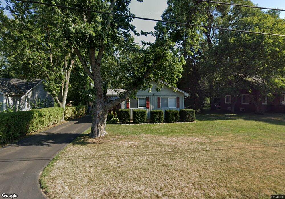
This home is located at 549 Clark St, Niles, MI 49120 and is currently estimated at $193,907, approximately $138 per square foot. 549 Clark St is a home located in Berrien County with nearby schools including James Ellis School, Howard-Ellis Elementary School, and Ring Lardner Middle School.
Ownership History
Date
Name
Owned For
Owner Type
Purchase Details
Closed on
May 17, 2007
Sold by
Hess Joseph and Hess Julie A
Bought by
Posey Danny and Posey Sarah
Current Estimated Value
Home Financials for this Owner
Home Financials are based on the most recent Mortgage that was taken out on this home.
Original Mortgage
$94,000
Outstanding Balance
$57,302
Interest Rate
6.21%
Mortgage Type
Purchase Money Mortgage
Estimated Equity
$136,605
Purchase Details
Closed on
Jan 19, 2006
Sold by
Zimmerman Phyllis J and Zimmerman Franklin B
Bought by
Wm Specialty Mortgage Llc
Purchase Details
Closed on
Aug 27, 1985
Create a Home Valuation Report for This Property
The Home Valuation Report is an in-depth analysis detailing your home's value as well as a comparison with similar homes in the area
Home Values in the Area
Average Home Value in this Area
Purchase History
| Date | Buyer | Sale Price | Title Company |
|---|---|---|---|
| Posey Danny | $117,500 | Cti | |
| Wm Specialty Mortgage Llc | $97,814 | None Available | |
| -- | $100 | -- |
Source: Public Records
Mortgage History
| Date | Status | Borrower | Loan Amount |
|---|---|---|---|
| Open | Posey Danny | $94,000 |
Source: Public Records
Tax History
| Year | Tax Paid | Tax Assessment Tax Assessment Total Assessment is a certain percentage of the fair market value that is determined by local assessors to be the total taxable value of land and additions on the property. | Land | Improvement |
|---|---|---|---|---|
| 2025 | $1,301 | $88,800 | $0 | $0 |
| 2024 | $469 | $64,300 | $0 | $0 |
| 2023 | $446 | $53,300 | $0 | $0 |
| 2022 | $425 | $46,900 | $0 | $0 |
| 2021 | $1,087 | $47,300 | $7,500 | $39,800 |
| 2020 | $1,079 | $43,100 | $0 | $0 |
| 2019 | $1,061 | $39,300 | $7,500 | $31,800 |
| 2018 | $1,005 | $39,300 | $0 | $0 |
| 2017 | $997 | $38,400 | $0 | $0 |
| 2016 | $972 | $38,700 | $0 | $0 |
| 2015 | $968 | $36,500 | $0 | $0 |
| 2014 | $371 | $34,400 | $0 | $0 |
Source: Public Records
Map
Nearby Homes
- 2002 N Old Us 31 Unit 7
- 2028 N Old Us 31 Unit 11
- 2026 N Old Us 31 Unit 2
- 2002 N Old Us 31 Unit 12S
- VL N 5th St
- 434 Bruce Ave
- 604 James St
- 31829 Heritage Place
- 440 Pucker St
- 1627 N 12th St
- 1630 Forest Trail
- 2802 Primrose Ct
- 1943 Terminal Rd
- 1422 Merrifield Ave
- 1015 N 5th St
- 1316 Eagle St
- 622 N 13th St
- 1022 Howard St
- 721 N 4th St
- V/L Pucker St
- 555 Clark St
- 543 Clark St
- 563 Clark St
- 537 Clark St
- 565 Clark St
- 30 Clark St
- 536 Monroe St
- 544 Monroe St
- 550 Monroe St
- 526 Monroe St
- 546 Clark St
- 544 Clark St
- 554 Clark St
- 521 Clark St
- 556 Monroe St
- 562 Clark St
- 2000 N Old Us 31 Unit 5S
- 2000 N Old Us 31 Unit 6S
- 2002 N Old Us 31 Unit 11S
- 2000 N Old Us 31 Unit 3S
Your Personal Tour Guide
Ask me questions while you tour the home.