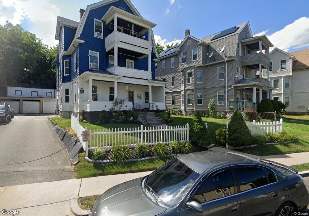
549 Maple Ave Unit 551 Hartford, CT 06114
Barry Square NeighborhoodEstimated Value: $397,842 - $491,000
6
Beds
3
Baths
3,879
Sq Ft
$113/Sq Ft
Est. Value
About This Home
This home is located at 549 Maple Ave Unit 551, Hartford, CT 06114 and is currently estimated at $437,461, approximately $112 per square foot. 549 Maple Ave Unit 551 is a home located in Hartford County with nearby schools including M. D. Fox School, Asian Studies School At Dwight/Belizzi School, and Dr. James H Naylor/Ccsu Leadership Academy.
Ownership History
Date
Name
Owned For
Owner Type
Purchase Details
Closed on
Nov 2, 2005
Sold by
Alicea Herminio and Alicea Jose
Bought by
Rosado Jose
Current Estimated Value
Home Financials for this Owner
Home Financials are based on the most recent Mortgage that was taken out on this home.
Original Mortgage
$191,900
Interest Rate
6.8%
Mortgage Type
Purchase Money Mortgage
Purchase Details
Closed on
Dec 8, 1998
Sold by
Musceodere Antonio and Muisceodere Clara
Bought by
Hermino Jose and Hermino Herminio Alicea
Create a Home Valuation Report for This Property
The Home Valuation Report is an in-depth analysis detailing your home's value as well as a comparison with similar homes in the area
Home Values in the Area
Average Home Value in this Area
Purchase History
| Date | Buyer | Sale Price | Title Company |
|---|---|---|---|
| Rosado Jose | $239,900 | -- | |
| Hermino Jose | $95,000 | -- |
Source: Public Records
Mortgage History
| Date | Status | Borrower | Loan Amount |
|---|---|---|---|
| Open | Hermino Jose | $244,107 | |
| Closed | Hermino Jose | $191,900 | |
| Closed | Hermino Jose | $47,950 | |
| Previous Owner | Hermino Jose | $115,000 |
Source: Public Records
Tax History Compared to Growth
Tax History
| Year | Tax Paid | Tax Assessment Tax Assessment Total Assessment is a certain percentage of the fair market value that is determined by local assessors to be the total taxable value of land and additions on the property. | Land | Improvement |
|---|---|---|---|---|
| 2025 | $6,543 | $94,889 | $7,644 | $87,245 |
| 2024 | $6,543 | $94,889 | $7,644 | $87,245 |
| 2023 | $6,543 | $94,889 | $7,644 | $87,245 |
| 2022 | $4,233 | $94,889 | $7,644 | $87,245 |
| 2021 | $4,233 | $56,980 | $10,150 | $46,830 |
| 2020 | $4,233 | $56,980 | $10,150 | $46,830 |
| 2019 | $4,233 | $56,980 | $10,150 | $46,830 |
| 2018 | $4,090 | $55,059 | $9,808 | $45,251 |
| 2016 | $3,814 | $51,343 | $9,341 | $42,002 |
| 2015 | $3,633 | $48,904 | $8,897 | $40,007 |
| 2014 | $3,544 | $47,708 | $8,679 | $39,029 |
Source: Public Records
Map
Nearby Homes
- 10 Warner St
- 213 Franklin Ave Unit 405
- 114 Shultas Place Unit 116
- 69 Mountford St Unit 3A
- 73 Mountford St Unit 3B
- 49 Benton St
- 152 Otis St
- 3 Pawtucket St
- 26 Barker St Unit 28
- 17 Bond St
- 15 Bond St
- 35 Clifford St
- 71 Franklin Ave
- 183 Preston St Unit 185
- 147 Preston St Unit 1
- 30 Shultas Place Unit 32
- 46 Harwich St
- 497 Wethersfield Ave
- 61 Preston St Unit 63
- 27 Allen Place
- 545 Maple Ave Unit 547
- 571 Maple Ave Unit 573
- 577 Maple Ave
- 541 Maple Ave Unit 543
- 104 Whitmore St Unit 106
- 48 Webster St Unit 50
- 537 Maple Ave Unit 539
- 583 Maple Ave Unit 585
- 40 Webster St Unit 42
- 98-100 Whitmore St
- 98 Whitmore St Unit 100
- 109 Whitmore St Unit 111
- 44 Webster St Unit 46
- 535 Maple Ave
- 587 Maple Ave Unit 589
- 94 Whitmore St Unit 96
- 36 Webster St
- 36 Webster St Unit 1N
- 590 Maple Ave Unit 2
- 590 Maple Ave Unit 1