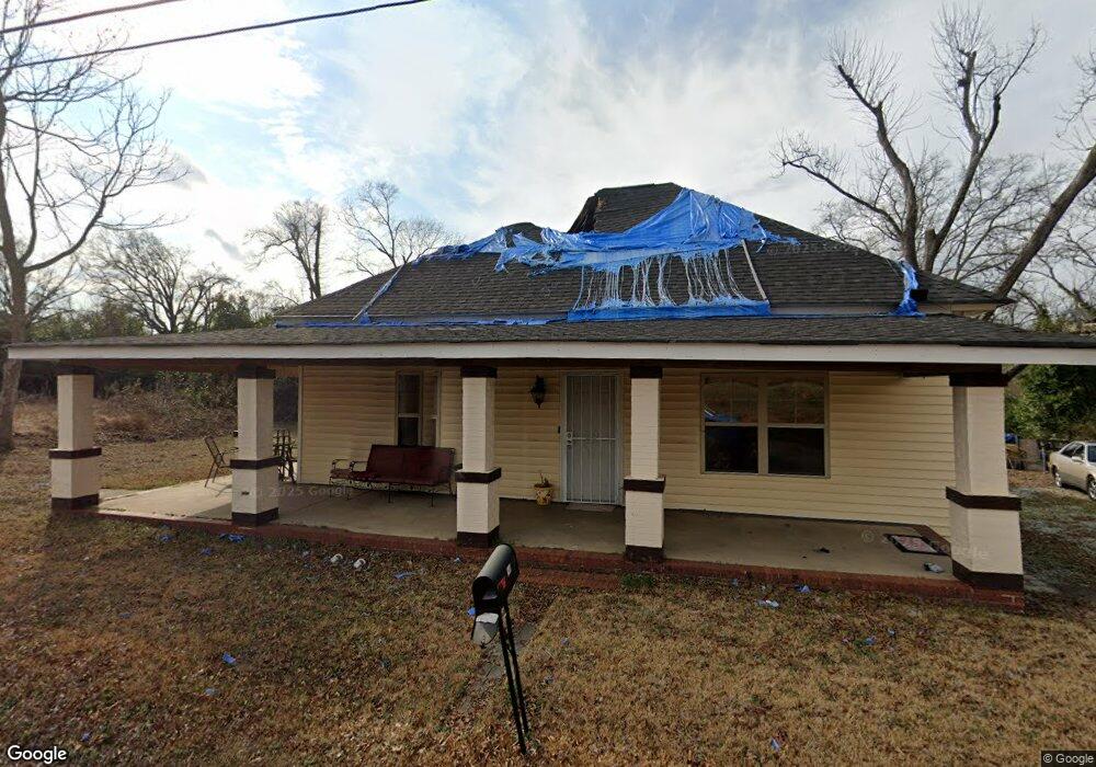
549 N 6th St Griffin, GA 30223
Spalding County NeighborhoodEstimated Value: $130,179 - $162,000
4
Beds
1
Bath
1,637
Sq Ft
$87/Sq Ft
Est. Value
About This Home
This home is located at 549 N 6th St, Griffin, GA 30223 and is currently estimated at $141,795, approximately $86 per square foot. 549 N 6th St is a home located in Spalding County with nearby schools including Moore Elementary School, Kennedy Road Middle School, and Spalding High School.
Ownership History
Date
Name
Owned For
Owner Type
Purchase Details
Closed on
Dec 29, 2020
Sold by
South Ola Properties Llc
Bought by
Garrett Diane and Garrett Hillard
Current Estimated Value
Home Financials for this Owner
Home Financials are based on the most recent Mortgage that was taken out on this home.
Original Mortgage
$98,188
Outstanding Balance
$87,633
Interest Rate
2.71%
Mortgage Type
FHA
Estimated Equity
$54,162
Purchase Details
Closed on
Dec 13, 1989
Sold by
Martin Glenn A and Edwards Wayne G
Bought by
Martin A Glenn
Purchase Details
Closed on
Mar 30, 1988
Sold by
Mangham Delores W
Bought by
Wayne Martin A and Wayne Edwards G
Purchase Details
Closed on
Mar 10, 1979
Sold by
Brown Jim Henry and Mattie Belle F
Bought by
Mangham Delores W
Purchase Details
Closed on
Mar 11, 1965
Sold by
Brown Jim Henry
Bought by
Brown Jim Henry and Mattie Belle F
Purchase Details
Closed on
Sep 22, 1951
Bought by
Brown Jim Henry
Create a Home Valuation Report for This Property
The Home Valuation Report is an in-depth analysis detailing your home's value as well as a comparison with similar homes in the area
Home Values in the Area
Average Home Value in this Area
Purchase History
| Date | Buyer | Sale Price | Title Company |
|---|---|---|---|
| Garrett Diane | $100,000 | -- | |
| Martin A Glenn | -- | -- | |
| Wayne Martin A | $14,000 | -- | |
| Mangham Delores W | $13,900 | -- | |
| Brown Jim Henry | -- | -- | |
| Brown Jim Henry | -- | -- |
Source: Public Records
Mortgage History
| Date | Status | Borrower | Loan Amount |
|---|---|---|---|
| Open | Garrett Diane | $98,188 |
Source: Public Records
Tax History Compared to Growth
Tax History
| Year | Tax Paid | Tax Assessment Tax Assessment Total Assessment is a certain percentage of the fair market value that is determined by local assessors to be the total taxable value of land and additions on the property. | Land | Improvement |
|---|---|---|---|---|
| 2024 | $57 | $13,056 | $6,800 | $6,256 |
| 2023 | $83 | $15,663 | $6,480 | $9,183 |
| 2022 | $56 | $11,867 | $4,320 | $7,547 |
| 2021 | $398 | $9,952 | $4,320 | $5,632 |
| 2020 | $398 | $9,952 | $4,320 | $5,632 |
| 2019 | $405 | $9,952 | $4,320 | $5,632 |
| 2018 | $402 | $9,508 | $4,320 | $5,188 |
| 2017 | $293 | $7,081 | $4,104 | $2,977 |
| 2016 | $386 | $9,193 | $4,332 | $4,861 |
| 2015 | $392 | $9,193 | $4,332 | $4,861 |
| 2014 | $404 | $9,193 | $4,332 | $4,861 |
Source: Public Records
Map
Nearby Homes
- 554 N 8th St
- 546 N 8th St
- 135 Alabama St
- 106 E Cherry St
- 102 E Cherry St
- 607 Lane St
- 514 Lane St
- 606 N 9th St
- 117 Thurman St
- 421 N 6th St
- 3939 Georgia Highway 3 Old Atl Rd
- 346 Adams St
- 833 A&b E Tinsley St
- 818 Haskell Ward Dr
- 418 N 9th St
- 233 E Tinsley St
- 218 E Tinsley St
- 435 W Cherry St
- 112 W Lexington Ave
- 122 W Lexington Ave