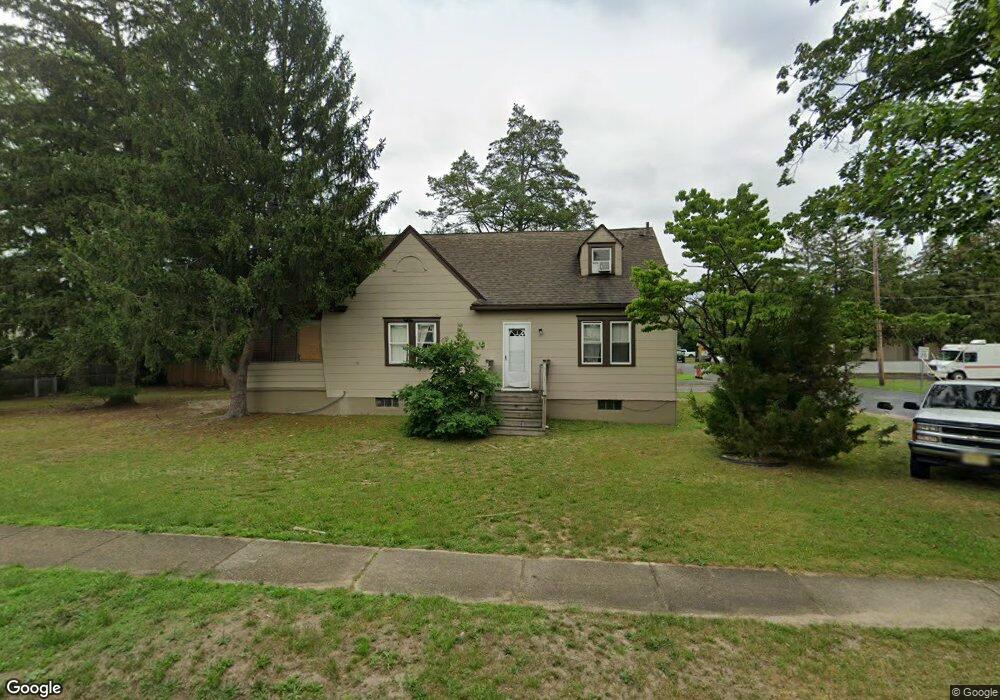
549 N West Ave Vineland, NJ 08360
Estimated Value: $198,378 - $288,000
--
Bed
--
Bath
1,186
Sq Ft
$213/Sq Ft
Est. Value
About This Home
This home is located at 549 N West Ave, Vineland, NJ 08360 and is currently estimated at $252,595, approximately $212 per square foot. 549 N West Ave is a home located in Cumberland County with nearby schools including Max Leuchter Elementary School, T.W. Wallace Middle School, and Vineland Senior High School.
Ownership History
Date
Name
Owned For
Owner Type
Purchase Details
Closed on
Oct 30, 1998
Sold by
Demaio Joseph A
Bought by
Larosa Frank and Larosa Linda
Current Estimated Value
Home Financials for this Owner
Home Financials are based on the most recent Mortgage that was taken out on this home.
Original Mortgage
$109,250
Outstanding Balance
$23,972
Interest Rate
6.65%
Estimated Equity
$228,623
Purchase Details
Closed on
Feb 12, 1993
Bought by
Behrens Paul D
Create a Home Valuation Report for This Property
The Home Valuation Report is an in-depth analysis detailing your home's value as well as a comparison with similar homes in the area
Home Values in the Area
Average Home Value in this Area
Purchase History
| Date | Buyer | Sale Price | Title Company |
|---|---|---|---|
| Larosa Frank | $115,000 | -- | |
| Behrens Paul D | $72,000 | -- |
Source: Public Records
Mortgage History
| Date | Status | Borrower | Loan Amount |
|---|---|---|---|
| Open | Larosa Frank | $109,250 |
Source: Public Records
Tax History Compared to Growth
Tax History
| Year | Tax Paid | Tax Assessment Tax Assessment Total Assessment is a certain percentage of the fair market value that is determined by local assessors to be the total taxable value of land and additions on the property. | Land | Improvement |
|---|---|---|---|---|
| 2025 | $3,471 | $109,000 | $30,000 | $79,000 |
| 2024 | $3,471 | $109,000 | $30,000 | $79,000 |
| 2023 | $3,448 | $109,000 | $30,000 | $79,000 |
| 2022 | $3,345 | $109,000 | $30,000 | $79,000 |
| 2021 | $3,284 | $109,000 | $30,000 | $79,000 |
| 2020 | $3,589 | $122,600 | $30,000 | $92,600 |
| 2019 | $3,539 | $122,600 | $30,000 | $92,600 |
| 2018 | $3,446 | $122,600 | $30,000 | $92,600 |
| 2017 | $3,273 | $122,600 | $30,000 | $92,600 |
| 2016 | $3,158 | $122,600 | $30,000 | $92,600 |
| 2015 | $3,042 | $122,600 | $30,000 | $92,600 |
| 2014 | $2,876 | $122,600 | $30,000 | $92,600 |
Source: Public Records
Map
Nearby Homes
- 550 Northwest Ave
- 108 W Park Ave
- 663 Wayne Ave
- 400 N 7th St
- 636 E Pear St
- 1489 N Delsea Dr
- 0 W Landis Ave
- 1252 W Oak Rd
- 218 W Montrose St
- 329 W Grape St
- 404 Montrose St
- 1267 Northeast Blvd
- 1298 W Cornell St
- 511 E Grape St
- 818 E Pear St
- 1429 W Oak Rd
- 409 N East Ave
- 1500 Venus Dr
- 411 N East Ave
- 1143 N East Ave
- 551 N West Ave
- 104 Fenimore St
- 103 Mount Vernon St
- 545 N West Ave
- 105 Mount Vernon St
- 103 Fenimore St
- 540 N West Ave
- 108 Fenimore St
- 555 N West Ave
- 109 Mount Vernon St
- 538 N West Ave
- 539 N West Ave
- 111 Fenimore St
- 546 N West Ave
- 104 Mount Vernon St
- 559 N West Ave
- 112 Fenimore St
- 534 N West Ave
- 104 Bortle Ave
- 115 Mount Vernon St