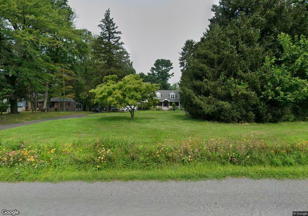
549 Port Indian Rd West Norriton, PA 19403
West Norriton Township NeighborhoodEstimated Value: $343,000 - $534,000
3
Beds
1
Bath
1,806
Sq Ft
$247/Sq Ft
Est. Value
About This Home
This home is located at 549 Port Indian Rd, West Norriton, PA 19403 and is currently estimated at $445,421, approximately $246 per square foot. 549 Port Indian Rd is a home located in Montgomery County with nearby schools including Charles Blockson Middle School, Paul V Fly Elementary School, and East Norriton Middle School.
Ownership History
Date
Name
Owned For
Owner Type
Purchase Details
Closed on
Aug 16, 2021
Sold by
Carassai Christy A and Spitko Martin Fowler
Bought by
Carassai Christy A and Arena Thomas R
Current Estimated Value
Home Financials for this Owner
Home Financials are based on the most recent Mortgage that was taken out on this home.
Original Mortgage
$125,000
Outstanding Balance
$113,319
Interest Rate
2.7%
Mortgage Type
New Conventional
Estimated Equity
$332,102
Purchase Details
Closed on
Aug 30, 2017
Sold by
Keebler Christopher
Bought by
Carassai Christy A and Spitko Ii Martin Fowler
Home Financials for this Owner
Home Financials are based on the most recent Mortgage that was taken out on this home.
Original Mortgage
$216,218
Interest Rate
4.4%
Mortgage Type
FHA
Purchase Details
Closed on
Sep 29, 1993
Bought by
Keebler Christopher
Create a Home Valuation Report for This Property
The Home Valuation Report is an in-depth analysis detailing your home's value as well as a comparison with similar homes in the area
Home Values in the Area
Average Home Value in this Area
Purchase History
| Date | Buyer | Sale Price | Title Company |
|---|---|---|---|
| Carassai Christy A | $158,928 | None Available | |
| Carassai Christy A | $310,000 | None Available | |
| Keebler Christopher | $95,000 | -- |
Source: Public Records
Mortgage History
| Date | Status | Borrower | Loan Amount |
|---|---|---|---|
| Open | Carassai Christy A | $125,000 | |
| Previous Owner | Carassai Christy A | $216,218 |
Source: Public Records
Tax History Compared to Growth
Tax History
| Year | Tax Paid | Tax Assessment Tax Assessment Total Assessment is a certain percentage of the fair market value that is determined by local assessors to be the total taxable value of land and additions on the property. | Land | Improvement |
|---|---|---|---|---|
| 2025 | $6,932 | $141,900 | $63,890 | $78,010 |
| 2024 | $6,932 | $141,900 | $63,890 | $78,010 |
| 2023 | $6,854 | $141,900 | $63,890 | $78,010 |
| 2022 | $6,810 | $141,900 | $63,890 | $78,010 |
| 2021 | $6,769 | $141,900 | $63,890 | $78,010 |
| 2020 | $6,567 | $141,900 | $63,890 | $78,010 |
| 2019 | $6,420 | $141,900 | $63,890 | $78,010 |
| 2018 | $5,239 | $141,900 | $63,890 | $78,010 |
| 2017 | $6,061 | $141,900 | $63,890 | $78,010 |
| 2016 | $6,006 | $141,900 | $63,890 | $78,010 |
| 2015 | $5,564 | $141,900 | $63,890 | $78,010 |
| 2014 | $5,564 | $141,900 | $63,890 | $78,010 |
Source: Public Records
Map
Nearby Homes
- 2044 Mill Rd
- 0 Roosevelt Blvd
- 2017 Yorktown S
- 526 Bassett Ln
- 2012 Yorktown S
- 1914 Yorktown S
- 1905 Yorktown N
- 1924 Juniata Rd
- 365 Norris Hall Ln
- 143 Riversedge Dr Unit CONDO 143
- 37 Burnside Ave
- 307 Brandon Rd
- 402 Brandon Rd
- 167 Woodstream Dr Unit CONDO 167
- 176 Riversedge Dr
- 533 Brandon Rd
- 121 Woodstream Dr Unit CONDO 121
- 1503 Reagan Ct
- 2504 Grant Ct
- 123 Glenwood Ave
- 545 Port Indian Rd
- 557 Port Indian Rd
- 541 Port Indian Rd
- 537 Port Indian Rd
- 533 Port Indian Rd
- 234 Egypt Rd
- 525 Port Indian Rd
- 224 Egypt Rd
- 236 Egypt Rd
- 230 Egypt Rd
- 298 Egypt Rd
- 226 Egypt Rd Unit 7
- 519 Port Indian Rd
- 220 Egypt Rd
- 292 Egypt Rd
- 296 Egypt Rd
- 294 Egypt Rd
- 513 Port Indian Rd
- 210 Egypt Rd
- 206 Egypt Rd