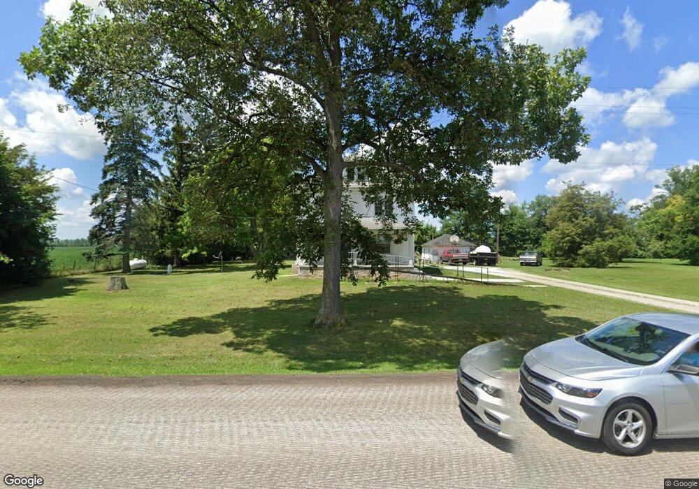
5490 State Route 547 Bellevue, OH 44811
Estimated Value: $194,109 - $296,000
4
Beds
2
Baths
1,920
Sq Ft
$121/Sq Ft
Est. Value
About This Home
This home is located at 5490 State Route 547, Bellevue, OH 44811 and is currently estimated at $232,027, approximately $120 per square foot. 5490 State Route 547 is a home located in Huron County with nearby schools including Bellevue Elementary School, Bellevue Middle School, and Bellevue High School.
Ownership History
Date
Name
Owned For
Owner Type
Purchase Details
Closed on
Sep 26, 2000
Bought by
Claus Berdella and Claus Roger A
Current Estimated Value
Purchase Details
Closed on
Jul 19, 1983
Bought by
Steinmetz Berdella
Create a Home Valuation Report for This Property
The Home Valuation Report is an in-depth analysis detailing your home's value as well as a comparison with similar homes in the area
Home Values in the Area
Average Home Value in this Area
Purchase History
| Date | Buyer | Sale Price | Title Company |
|---|---|---|---|
| Claus Berdella | -- | -- | |
| Steinmetz Berdella | $42,800 | -- |
Source: Public Records
Tax History Compared to Growth
Tax History
| Year | Tax Paid | Tax Assessment Tax Assessment Total Assessment is a certain percentage of the fair market value that is determined by local assessors to be the total taxable value of land and additions on the property. | Land | Improvement |
|---|---|---|---|---|
| 2024 | $1,705 | $50,130 | $12,840 | $37,290 |
| 2023 | $1,705 | $39,750 | $9,580 | $30,170 |
| 2022 | $1,393 | $39,750 | $9,580 | $30,170 |
| 2021 | $1,405 | $39,750 | $9,580 | $30,170 |
| 2020 | $1,477 | $39,910 | $9,350 | $30,560 |
| 2019 | $1,454 | $39,910 | $9,350 | $30,560 |
| 2018 | $1,435 | $39,910 | $9,350 | $30,560 |
| 2017 | $1,147 | $34,820 | $9,180 | $25,640 |
| 2016 | $1,116 | $34,820 | $9,180 | $25,640 |
| 2015 | $1,137 | $34,840 | $9,190 | $25,650 |
| 2014 | $1,002 | $30,810 | $9,210 | $21,600 |
| 2013 | $998 | $30,810 | $9,210 | $21,600 |
Source: Public Records
Map
Nearby Homes
- 3851 Everingin Rd
- 3050 E Main St
- 7740 Washington St
- 140 Hobson St
- 817 E Main St
- 501 E Center St
- 111 Park Ave
- 140 Harkness St
- 206 Southwest St
- 720 Kilbourne St
- 736 Kilbourne St
- 129 Hamilton St
- 155 Ashford Ave
- 154 Ashford Ave
- 881 Flat Rock Rd
- 818 Bellaire Dr
- 196 Ridge St N
- 803 Del Moy Ave
- 126 Greenwood Heights
- 98 West St
- 2695 Section Line Road 30
- 2695 Section Line Road 30
- 2779 Section Line Road 30
- 2728 Section Line Road 30
- 2596 Section Line Road 30
- 2596 Section Line 30 Rd
- 2870 Section Line Road 30
- 5332 State Route 547
- 5725 State Route 547
- 2428 Section Line Road 30
- 2429 Section Line Road 30
- 2048 Section Line Road 30
- 3141 Section Line Road 30
- 2257 Section Line Road 30
- 2236 Section Line Road 30