Estimated Value: $381,000 - $440,000
3
Beds
2
Baths
2,450
Sq Ft
$167/Sq Ft
Est. Value
About This Home
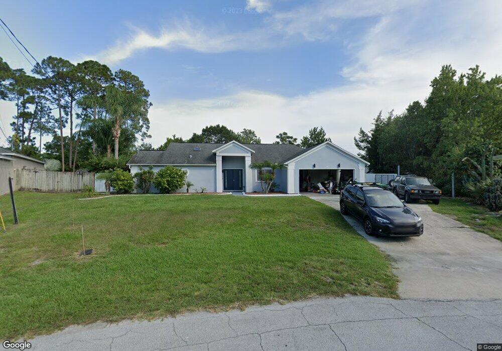
This home is located at 5493 Flint Rd, Cocoa, FL 32927 and is currently estimated at $408,471, approximately $166 per square foot. 5493 Flint Rd is a home located in Brevard County with nearby schools including Enterprise Elementary School, Space Coast Junior/Senior High School, and East Atlantic Prep of Brevard County.
Ownership History
Date
Name
Owned For
Owner Type
Purchase Details
Closed on
Apr 5, 2017
Sold by
Wilson Berengere Christele and Sacra Berengere Christele
Bought by
Wilson Berengere Christele and Mata Angel Gerardo
Current Estimated Value
Purchase Details
Closed on
Aug 28, 2012
Sold by
Sacra Scott Anthony
Bought by
Wilson Christele and Sacra Berengere Christele
Purchase Details
Closed on
Apr 10, 2003
Sold by
Contino John L and Contino Pauline B
Bought by
Sacra Scott A and Wilson Berengere C
Home Financials for this Owner
Home Financials are based on the most recent Mortgage that was taken out on this home.
Original Mortgage
$96,000
Interest Rate
5.74%
Purchase Details
Closed on
Oct 27, 1997
Sold by
Kenny Patrick J and Kenny Ethel M
Bought by
Contino John L and Contino Pauline B
Home Financials for this Owner
Home Financials are based on the most recent Mortgage that was taken out on this home.
Original Mortgage
$77,600
Interest Rate
7.55%
Create a Home Valuation Report for This Property
The Home Valuation Report is an in-depth analysis detailing your home's value as well as a comparison with similar homes in the area
Home Values in the Area
Average Home Value in this Area
Purchase History
| Date | Buyer | Sale Price | Title Company |
|---|---|---|---|
| Wilson Berengere Christele | -- | Attorney | |
| Wilson Christele | -- | None Available | |
| Sacra Scott A | $120,000 | -- | |
| Contino John L | $97,000 | -- |
Source: Public Records
Mortgage History
| Date | Status | Borrower | Loan Amount |
|---|---|---|---|
| Previous Owner | Sacra Scott A | $96,000 | |
| Previous Owner | Contino John L | $77,600 |
Source: Public Records
Tax History
| Year | Tax Paid | Tax Assessment Tax Assessment Total Assessment is a certain percentage of the fair market value that is determined by local assessors to be the total taxable value of land and additions on the property. | Land | Improvement |
|---|---|---|---|---|
| 2025 | $2,988 | $220,920 | -- | -- |
| 2024 | $1,726 | $214,700 | -- | -- |
| 2023 | $1,726 | $124,310 | $0 | $0 |
| 2022 | $1,611 | $120,690 | $0 | $0 |
| 2021 | $1,622 | $117,180 | $0 | $0 |
| 2020 | $1,548 | $114,470 | $0 | $0 |
| 2019 | $1,487 | $111,900 | $0 | $0 |
| 2018 | $1,482 | $109,820 | $0 | $0 |
| 2017 | $974 | $73,870 | $0 | $0 |
| 2016 | $984 | $72,360 | $18,000 | $54,360 |
| 2015 | $994 | $71,860 | $15,000 | $56,860 |
| 2014 | $998 | $71,290 | $11,000 | $60,290 |
Source: Public Records
Map
Nearby Homes
- 6438 Hudson Rd
- 5460 Holden Rd
- 6450 Ember Ave
- 5220 Holden Rd
- 5215 Holden Rd
- 5221 Carrick Rd
- 00 Unknown
- 6615 Dock Ave
- 6581 Bancroft Ave
- 5715 Fairbridge St
- 5945 Coker Ave
- 5946 Deer Ln
- 6375 Cable Ave
- 6094 Cardiff Ave
- 5720 Flint Rd
- 4975 Fay Blvd
- 6760 Cairo Rd
- 0000 Grissom Pkwy
- 5095 Hogan Place
- 6815 Bryant Rd