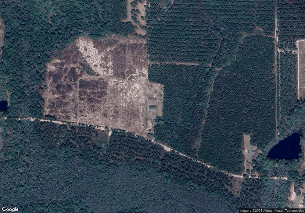
5497 Strickland Rd Waycross, GA 31503
Estimated Value: $138,000 - $194,000
3
Beds
1
Bath
1,576
Sq Ft
$103/Sq Ft
Est. Value
About This Home
This home is located at 5497 Strickland Rd, Waycross, GA 31503 and is currently estimated at $162,525, approximately $103 per square foot. 5497 Strickland Rd is a home located in Ware County with nearby schools including Memorial Drive Elementary School, Waycross Middle School, and Ware County High School.
Ownership History
Date
Name
Owned For
Owner Type
Purchase Details
Closed on
Sep 3, 2024
Sold by
Burquez Joann Strickland
Bought by
Lairsey Christopher Kevin and Lairsey Teresa A
Current Estimated Value
Home Financials for this Owner
Home Financials are based on the most recent Mortgage that was taken out on this home.
Original Mortgage
$112,000
Outstanding Balance
$74,032
Interest Rate
6.47%
Mortgage Type
New Conventional
Estimated Equity
$88,493
Purchase Details
Closed on
May 19, 2016
Sold by
Strickland Myrtle G
Bought by
May Dorothy S
Purchase Details
Closed on
Mar 30, 2006
Sold by
Strickland Myrtle G
Bought by
May Dorothy S
Create a Home Valuation Report for This Property
The Home Valuation Report is an in-depth analysis detailing your home's value as well as a comparison with similar homes in the area
Home Values in the Area
Average Home Value in this Area
Purchase History
| Date | Buyer | Sale Price | Title Company |
|---|---|---|---|
| Lairsey Christopher Kevin | $140,000 | -- | |
| Lairsey Christopher Kevin | $140,000 | -- | |
| Lairsey Christopher Kevin | $140,000 | -- | |
| May Dorothy S | -- | -- | |
| Burquez Joann Strickland | -- | -- | |
| May Dorothy S | -- | -- |
Source: Public Records
Mortgage History
| Date | Status | Borrower | Loan Amount |
|---|---|---|---|
| Open | Lairsey Christopher Kevin | $112,000 | |
| Closed | Lairsey Christopher Kevin | $112,000 |
Source: Public Records
Tax History Compared to Growth
Tax History
| Year | Tax Paid | Tax Assessment Tax Assessment Total Assessment is a certain percentage of the fair market value that is determined by local assessors to be the total taxable value of land and additions on the property. | Land | Improvement |
|---|---|---|---|---|
| 2024 | $708 | $53,346 | $38,111 | $15,235 |
| 2023 | $714 | $56,209 | $36,687 | $19,522 |
| 2022 | $662 | $56,209 | $36,687 | $19,522 |
| 2021 | $500 | $46,954 | $31,548 | $15,406 |
| 2020 | $520 | $46,236 | $31,548 | $14,688 |
| 2019 | $555 | $45,648 | $31,548 | $14,100 |
| 2018 | $584 | $45,060 | $31,548 | $13,512 |
| 2017 | $462 | $45,060 | $31,548 | $13,512 |
| 2016 | $462 | $91,948 | $80,208 | $11,740 |
| 2015 | $443 | $55,838 | $44,098 | $11,740 |
| 2014 | $419 | $55,838 | $44,098 | $11,740 |
| 2013 | -- | $55,838 | $0 | $0 |
Source: Public Records
Map
Nearby Homes
- 5588 Brunswick Hwy
- 8.84 Strickland Rd
- 563 Bennett Rd
- 300 Josephine Park Rd
- 950 Apple Dr
- 4807 Doe Rd
- 0 Miles Still Rd
- 4086 Memorial Dr
- 56 Fj Melton Ln
- 7532 Central Ave
- 115 Travis Trail
- 157 Hwy
- 12169 Central Ave
- 12091 Central Ave
- 6498 Central Ave
- 120 Scarlett Dr
- 4408 Brunswick Hwy
- 815 Aycock Rd
- 4337 Whitehall Church Rd
- 4337 White Hall Church Rd
- 5301 Strickland Rd
- 5374 Strickland Rd
- 5470 Sams Rd
- 5450 Sams Rd
- 5306 Strickland Rd
- 5295 Strickland Rd
- 5293 Old Strickland Rd
- 5614 Strickland Rd
- 5632 Strickland Rd
- 5650 Strickland Rd
- 5665 Laura Walker Rd
- 5670 Strickland Rd
- 5698 Strickland Rd
- 5210 Strickland Rd
- 5203 Strickland Rd
- 5183 Strickland Rd
- 5186 Strickland Rd
- 5141 Strickland Rd
- 5653 Laura Walker Rd
