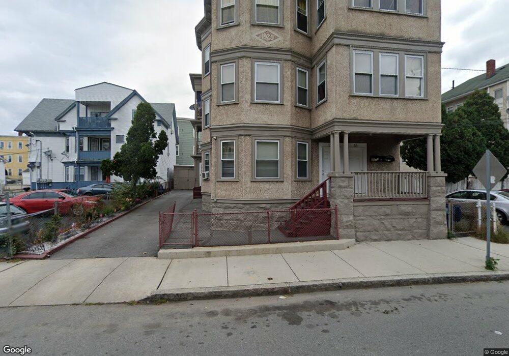
55-57 Erving Ave Lawrence, MA 01841
Arlington NeighborhoodEstimated Value: $598,000 - $855,000
9
Beds
3
Baths
4,638
Sq Ft
$163/Sq Ft
Est. Value
About This Home
This home is located at 55-57 Erving Ave, Lawrence, MA 01841 and is currently estimated at $756,333, approximately $163 per square foot. 55-57 Erving Ave is a home located in Essex County with nearby schools including School For Exceptional Studies, Lawrence Family Development Charter School, and Community Day Charter Public School - Gateway.
Ownership History
Date
Name
Owned For
Owner Type
Purchase Details
Closed on
Mar 9, 1999
Sold by
Pizzano Joseph M
Bought by
Lopez Socorro
Current Estimated Value
Home Financials for this Owner
Home Financials are based on the most recent Mortgage that was taken out on this home.
Original Mortgage
$112,900
Interest Rate
6.76%
Mortgage Type
Purchase Money Mortgage
Create a Home Valuation Report for This Property
The Home Valuation Report is an in-depth analysis detailing your home's value as well as a comparison with similar homes in the area
Home Values in the Area
Average Home Value in this Area
Purchase History
| Date | Buyer | Sale Price | Title Company |
|---|---|---|---|
| Lopez Socorro | $107,000 | -- |
Source: Public Records
Mortgage History
| Date | Status | Borrower | Loan Amount |
|---|---|---|---|
| Open | Lopez Socorro | $181,000 | |
| Closed | Lopez Socorro | $144,967 | |
| Closed | Lopez Socorro | $112,900 |
Source: Public Records
Tax History
| Year | Tax Paid | Tax Assessment Tax Assessment Total Assessment is a certain percentage of the fair market value that is determined by local assessors to be the total taxable value of land and additions on the property. | Land | Improvement |
|---|---|---|---|---|
| 2025 | $5,930 | $673,900 | $111,100 | $562,800 |
| 2024 | $5,717 | $618,000 | $116,700 | $501,300 |
| 2023 | $6,044 | $594,900 | $112,700 | $482,200 |
| 2022 | $5,702 | $498,400 | $106,300 | $392,100 |
| 2021 | $5,423 | $442,000 | $106,300 | $335,700 |
| 2020 | $5,020 | $403,900 | $88,500 | $315,400 |
| 2019 | $4,809 | $351,500 | $65,800 | $285,700 |
| 2018 | $4,701 | $328,300 | $59,600 | $268,700 |
| 2017 | $4,395 | $286,500 | $56,500 | $230,000 |
| 2016 | $4,101 | $264,400 | $44,100 | $220,300 |
| 2015 | $3,933 | $260,100 | $44,100 | $216,000 |
Source: Public Records
Map
Nearby Homes
- 131A Lawrence St Unit 40
- 192 Union St
- 5 Kendrick St
- 91 Summer St Unit 2
- 89 Newbury St Unit 89B
- 7-9 Bennington St
- 80-82 Haverhill St
- 71-75 Common St
- 11 Lawrence St Unit 606
- 129-131 Lexington St
- 46 Amesbury St Unit 2B
- 434-438 Hampshire St
- 27 Willow St Unit A
- 162 E Haverhill St
- 10 Holly St
- 324-326 Broadway
- 202 Broadway Unit 3-2
- 202 Broadway Unit 3-3
- 109 Ferry St
- 25-27 Bicknell Ave
- 55-57 Erving Ave Unit 3
- 55 Erving Ave Unit 57
- 14-16 Currier St
- 14 Currier St Unit 16
- 41 Erving Ave Unit 43
- 10-12 Currier St
- 68 Currier St
- 6-8 Currier St
- 10 Currier St Unit 12
- 24 Currier St
- 67 Erving Ave Unit 69
- 16-18 Wilmot St
- 11 Trinity St
- 20 Wilmot St Unit 22
- 12 Wilmot St Unit 14
- 73 Erving Ave
- 24-26 Wilmot St Unit 3
- 24-26 Wilmot St
- 24-26 Wilmot St Unit 2
- 24-26 Wilmot St Unit 1
Your Personal Tour Guide
Ask me questions while you tour the home.