S
Seller's Agent in 2026
Stephan Morrissey
The Virtual Realty Group
Estimated Value: $813,000 - $956,000
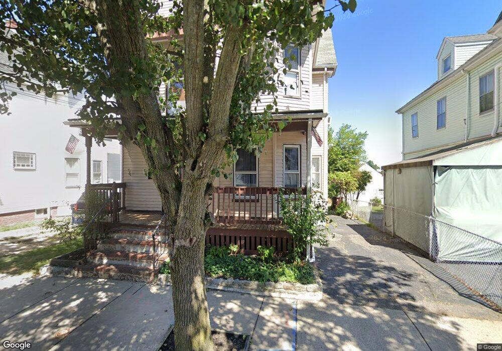
NEW PRICE! Everett legal 3 unit multifamily! Well maintained and updated home with two, 2 bedroom units and third floor 1 bedroom unit. Nice, quiet side street with rear garden and deck. Coin operated laundry in basement for the tenants. Systems in good condition and brand new roof just installed! Long term tenants on first floor and upper two units will be available as second floor unit is owner occupant at this time . The second floor 2 bedroom and a top floor layout easily permits combining top two units into a larger 4 bedroom if a larger unit is needed. Ready for next owner occupant or investor. Come and see for yourself!
We collect this data history from publicly available records. To have your information removed, we recommend requesting removal directly through your county’s website.
| Date | Buyer | Sale Price | Title Company |
|---|---|---|---|
| Leisey Scott P | $435,000 | -- | |
| Kotuckova Ft | -- | -- |
We collect this data history from publicly available records. To have your information removed, we recommend requesting removal directly through your county’s website.
| Date | Status | Borrower | Loan Amount |
|---|---|---|---|
| Open | Leisey Scott P | $326,250 | |
| Closed | Kotuckova Ft | $90,000 |
| Date | Event | Price | List to Sale | Price per Sq Ft |
|---|---|---|---|---|
| 05/22/2026 05/22/26 | Pending | -- | -- | -- |
| 05/14/2026 05/14/26 | Price Changed | $824,900 | -1.2% | $372 / Sq Ft |
| 05/06/2026 05/06/26 | Price Changed | $834,900 | -1.8% | $376 / Sq Ft |
| 04/26/2026 04/26/26 | For Sale | $849,900 | -- | $383 / Sq Ft |
| Year | Tax Paid | Tax Assessment Tax Assessment Total Assessment is a certain percentage of the fair market value that is determined by local assessors to be the total taxable value of land and additions on the property. | Land | Improvement |
|---|---|---|---|---|
| 2025 | $7,934 | $696,600 | $226,200 | $470,400 |
| 2024 | $7,363 | $642,500 | $206,100 | $436,400 |
| 2023 | $7,265 | $616,700 | $197,100 | $419,600 |
| 2022 | $5,845 | $564,200 | $174,700 | $389,500 |
| 2021 | $5,391 | $546,200 | $168,400 | $377,800 |
| 2020 | $5,545 | $521,100 | $168,400 | $352,700 |
| 2019 | $5,842 | $471,900 | $160,400 | $311,500 |
| 2018 | $5,574 | $404,500 | $139,800 | $264,700 |
| 2017 | $5,321 | $368,500 | $125,400 | $243,100 |
| 2016 | $4,793 | $331,700 | $112,000 | $219,700 |
| 2015 | $4,493 | $307,500 | $101,000 | $206,500 |
S
Seller's Agent in 2026
Stephan Morrissey
The Virtual Realty Group
Ask me questions while you tour the home.
