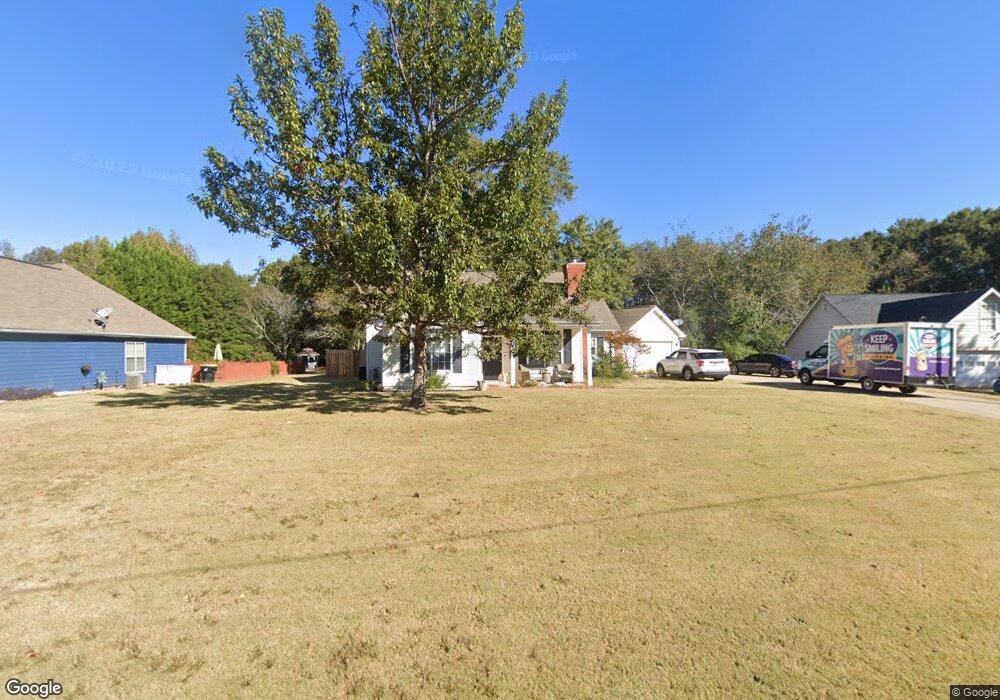
55 Ashton Ct Covington, GA 30016
Estimated Value: $235,622 - $264,000
3
Beds
2
Baths
1,398
Sq Ft
$178/Sq Ft
Est. Value
About This Home
This home is located at 55 Ashton Ct, Covington, GA 30016 and is currently estimated at $248,906, approximately $178 per square foot. 55 Ashton Ct is a home located in Newton County with nearby schools including Oak Hill Elementary School, Veterans Memorial Middle School, and Alcovy High School.
Ownership History
Date
Name
Owned For
Owner Type
Purchase Details
Closed on
Nov 8, 2021
Sold by
Corbin James
Bought by
Ralston Corbin S
Current Estimated Value
Purchase Details
Closed on
Aug 18, 1995
Sold by
Tommy Martin Bldrs
Bought by
Corbin James N
Create a Home Valuation Report for This Property
The Home Valuation Report is an in-depth analysis detailing your home's value as well as a comparison with similar homes in the area
Home Values in the Area
Average Home Value in this Area
Purchase History
| Date | Buyer | Sale Price | Title Company |
|---|---|---|---|
| Ralston Corbin S | -- | -- | |
| Corbin James N | $89,500 | -- |
Source: Public Records
Mortgage History
| Date | Status | Borrower | Loan Amount |
|---|---|---|---|
| Closed | Corbin James N | $0 |
Source: Public Records
Tax History
| Year | Tax Paid | Tax Assessment Tax Assessment Total Assessment is a certain percentage of the fair market value that is determined by local assessors to be the total taxable value of land and additions on the property. | Land | Improvement |
|---|---|---|---|---|
| 2025 | $2,295 | $95,960 | $16,000 | $79,960 |
| 2024 | $2,197 | $89,040 | $16,000 | $73,040 |
| 2023 | $2,206 | $79,840 | $8,800 | $71,040 |
| 2022 | $1,941 | $70,080 | $8,800 | $61,280 |
| 2021 | $1,625 | $56,160 | $8,800 | $47,360 |
| 2020 | $1,744 | $54,720 | $8,800 | $45,920 |
| 2019 | $1,751 | $54,160 | $8,800 | $45,360 |
| 2018 | $749 | $46,440 | $6,800 | $39,640 |
| 2017 | $1,298 | $40,640 | $6,800 | $33,840 |
| 2016 | $1,052 | $33,480 | $4,000 | $29,480 |
| 2015 | $1,023 | $32,640 | $4,000 | $28,640 |
| 2014 | $783 | $25,680 | $0 | $0 |
Source: Public Records
Map
Nearby Homes
- 170 Gibson Way
- 1925 Oak Hill Rd
- 130 Berkshire Dr
- 185 Wilson Rd
- 14908 Brown Bridge Rd
- 2215 Oak Hill Rd
- 220 Trotters Walk
- 425 Berkshire Dr
- 70 Fields Creek Way
- 110 Chapel Heights Way
- 20 W Forest Dr
- 35 Fourwood Dr
- 14290 Brown Bridge Rd
- 125 Cardinal Ct Unit 1
- 5737 Highway 20 S
- 0 Goldfinch Dr
- 0 Goldfinch Dr Unit 7564125
- 5240 Highway 20 S
- 125 Goldfinch Dr
- 130 Goldfinch Dr
- 65 Ashton Ct Unit 2
- 45 Ashton Ct Unit 2
- 35 Ashton Ct
- 260 Ashton Dr
- 40 Ashton Ct
- 40 Ashton Ct Unit 66
- 75 Ashton Ct Unit 2
- 250 Ashton Dr
- 25 Ashton Ct
- 60 Ashton Ct
- 60 Ashton Ct Unit 64
- 30 Ashton Ct
- 270 Ashton Dr
- 240 Ashton Dr
- 50 Ashton Ct Unit /65
- 50 Ashton Ct Unit 2
- 230 Ashton Dr
- 15 Ashton Ct
- 20 Ashton Ct
- 280 Ashton Dr
Your Personal Tour Guide
Ask me questions while you tour the home.