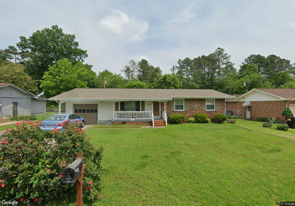
55 Belmeade Dr Unit LOT 7 Rossville, GA 30741
Lakeview NeighborhoodEstimated Value: $265,772 - $292,000
--
Bed
2
Baths
1,524
Sq Ft
$183/Sq Ft
Est. Value
About This Home
This home is located at 55 Belmeade Dr Unit LOT 7, Rossville, GA 30741 and is currently estimated at $278,693, approximately $182 per square foot. 55 Belmeade Dr Unit LOT 7 is a home located in Catoosa County with nearby schools including West Side Elementary School, Lakeview Middle School, and Lakeview-Fort Oglethorpe High School.
Ownership History
Date
Name
Owned For
Owner Type
Purchase Details
Closed on
Apr 22, 2020
Sold by
Huff Alma Ann
Bought by
Huff Alma Ann and Huff Dwight Franklin
Current Estimated Value
Purchase Details
Closed on
Nov 4, 2011
Sold by
Carroll Freddy R
Bought by
Huff Alma A
Home Financials for this Owner
Home Financials are based on the most recent Mortgage that was taken out on this home.
Original Mortgage
$117,932
Interest Rate
4.12%
Mortgage Type
FHA
Purchase Details
Closed on
Aug 17, 2004
Bought by
Carroll Freddy R
Create a Home Valuation Report for This Property
The Home Valuation Report is an in-depth analysis detailing your home's value as well as a comparison with similar homes in the area
Home Values in the Area
Average Home Value in this Area
Purchase History
| Date | Buyer | Sale Price | Title Company |
|---|---|---|---|
| Huff Alma Ann | -- | -- | |
| Huff Alma A | $121,000 | -- | |
| Carroll Freddy R | $95,000 | -- |
Source: Public Records
Mortgage History
| Date | Status | Borrower | Loan Amount |
|---|---|---|---|
| Previous Owner | Huff Alma A | $117,932 |
Source: Public Records
Tax History Compared to Growth
Tax History
| Year | Tax Paid | Tax Assessment Tax Assessment Total Assessment is a certain percentage of the fair market value that is determined by local assessors to be the total taxable value of land and additions on the property. | Land | Improvement |
|---|---|---|---|---|
| 2024 | $1,781 | $83,500 | $10,000 | $73,500 |
| 2023 | $1,482 | $66,190 | $9,070 | $57,120 |
| 2022 | $1,153 | $51,490 | $9,070 | $42,420 |
| 2021 | $1,077 | $51,490 | $9,070 | $42,420 |
| 2020 | $1,055 | $45,572 | $8,708 | $36,864 |
| 2019 | $1,066 | $45,572 | $8,708 | $36,864 |
| 2018 | $1,126 | $45,572 | $8,708 | $36,864 |
| 2017 | $1,123 | $45,458 | $8,708 | $36,750 |
| 2016 | $1,112 | $42,786 | $8,708 | $34,078 |
| 2015 | -- | $42,786 | $8,708 | $34,078 |
| 2014 | -- | $42,786 | $8,708 | $34,078 |
| 2013 | -- | $42,786 | $8,707 | $34,078 |
Source: Public Records
Map
Nearby Homes
- 88 Milford Dr
- 77 Peachstone Ln
- 38 Tanforan Dr
- 27 Green St
- 66 Loach Dr
- 2105 McBrien Rd
- 5318 Greenbriar Rd
- 1906 Prigmore Rd
- 19 Winchester Dr
- 41 Greens Lake Rd
- 2 Bell Ave
- 1906 McBrien Rd
- 4321 Lazard St
- 5289 Spriggs St
- 231 Winchester Dr
- 308 Winchester Dr
- 1623 Prigmore Rd
- 5601 E State Line Rd
- 210 Honeyberry Ln
- 228 Steele Rd