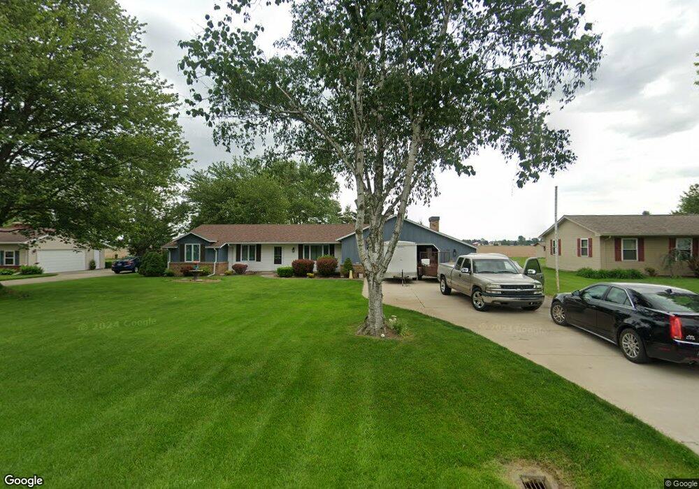
55 Bethany Dr Fremont, OH 43420
Estimated Value: $245,395 - $282,000
3
Beds
2
Baths
1,686
Sq Ft
$160/Sq Ft
Est. Value
About This Home
This home is located at 55 Bethany Dr, Fremont, OH 43420 and is currently estimated at $270,599, approximately $160 per square foot. 55 Bethany Dr is a home located in Sandusky County with nearby schools including Fremont Ross High School, Bishop Hoffman Catholic School - This is St Joe's School now, and St. Joseph School.
Ownership History
Date
Name
Owned For
Owner Type
Purchase Details
Closed on
Nov 16, 2020
Sold by
Claddagn Properties Llc
Bought by
Wheeler Pamela R
Current Estimated Value
Purchase Details
Closed on
Mar 5, 2020
Sold by
Foster Michelle A and Herring Amy S
Bought by
Claddugh Properties Llc
Purchase Details
Closed on
Jun 29, 2018
Sold by
Estate Of Patrick C Herring
Bought by
Foster Michelle A and Herring Amy S
Purchase Details
Closed on
Sep 21, 2017
Sold by
Estate Of Linda M Herring
Bought by
Herning Patrick C
Create a Home Valuation Report for This Property
The Home Valuation Report is an in-depth analysis detailing your home's value as well as a comparison with similar homes in the area
Home Values in the Area
Average Home Value in this Area
Purchase History
| Date | Buyer | Sale Price | Title Company |
|---|---|---|---|
| Wheeler Pamela R | $176,900 | None Available | |
| Claddugh Properties Llc | $85,000 | None Available | |
| Foster Michelle A | -- | None Available | |
| Herning Patrick C | -- | None Available |
Source: Public Records
Tax History Compared to Growth
Tax History
| Year | Tax Paid | Tax Assessment Tax Assessment Total Assessment is a certain percentage of the fair market value that is determined by local assessors to be the total taxable value of land and additions on the property. | Land | Improvement |
|---|---|---|---|---|
| 2024 | $2,807 | $74,590 | $11,620 | $62,970 |
| 2023 | $2,807 | $59,330 | $9,380 | $49,950 |
| 2022 | $2,354 | $59,330 | $9,380 | $49,950 |
| 2021 | $2,428 | $59,330 | $9,380 | $49,950 |
| 2020 | $1,776 | $41,760 | $9,380 | $32,380 |
| 2019 | $1,733 | $41,760 | $9,380 | $32,380 |
| 2018 | $1,689 | $41,760 | $9,380 | $32,380 |
| 2017 | $1,643 | $39,450 | $9,380 | $30,070 |
| 2016 | $1,445 | $39,450 | $9,380 | $30,070 |
| 2015 | $1,421 | $39,450 | $9,380 | $30,070 |
| 2014 | $1,754 | $46,280 | $9,350 | $36,930 |
| 2013 | $1,716 | $46,280 | $9,350 | $36,930 |
Source: Public Records
Map
Nearby Homes
- 2087 County Road 216
- 711 Bloom Rd
- 1730 Port Clinton Rd Unit 41
- 1730 Port Clinton Rd
- 1730 Port Clinton Rd Unit 33
- 0 Sean Dr
- Outlot A Sean Dr
- 2939 County Road 206
- 263 Saint Paul Dr
- 612 2nd St
- 251 Saint Paul Dr
- 0 County Road 210
- 315 Ethan Dr
- 335 Cottage St
- 533 Sandusky Ave Unit 535
- 318 Ethan Dr
- 199 Saint Thomas Dr
- 433 Sandusky Ave
- 230 N Pennsylvania Ave
- 2100 Ohio 53