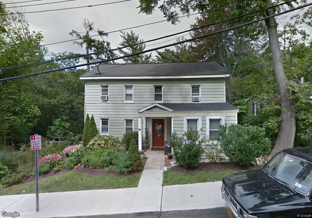
55 Brookside Ave Mount Kisco, NY 10549
Estimated Value: $687,000 - $837,000
--
Bed
--
Bath
--
Sq Ft
0.32
Acres
About This Home
This home is located at 55 Brookside Ave, Mount Kisco, NY 10549 and is currently estimated at $770,687. 55 Brookside Ave is a home located in Westchester County with nearby schools including Mount Kisco Elementary School, Fox Lane Middle School, and Fox Lane High School.
Ownership History
Date
Name
Owned For
Owner Type
Purchase Details
Closed on
Jun 1, 2021
Sold by
31 41 Main Street Llc
Bought by
Resnick Allen and Allen Resnick Revocable Living
Current Estimated Value
Purchase Details
Closed on
May 25, 2006
Sold by
Martabano Kenneth and Martabano Alfred V
Bought by
Peralta Juan M
Purchase Details
Closed on
Aug 23, 2002
Sold by
Marchiano Harry F
Bought by
Martabano Kenneth and Martabano Alfred
Home Financials for this Owner
Home Financials are based on the most recent Mortgage that was taken out on this home.
Original Mortgage
$275,000
Interest Rate
6.34%
Mortgage Type
Unknown
Purchase Details
Closed on
Nov 25, 1997
Sold by
Marchiano Harry F
Bought by
Banks Lloyd F and Banks Jane
Create a Home Valuation Report for This Property
The Home Valuation Report is an in-depth analysis detailing your home's value as well as a comparison with similar homes in the area
Home Values in the Area
Average Home Value in this Area
Purchase History
| Date | Buyer | Sale Price | Title Company |
|---|---|---|---|
| Resnick Allen | -- | Regal Title Agency | |
| Peralta Juan M | $500,000 | First American Title Ins Co | |
| Martabano Kenneth | $275,000 | -- | |
| Banks Lloyd F | $225,000 | First American Title Ins Co |
Source: Public Records
Mortgage History
| Date | Status | Borrower | Loan Amount |
|---|---|---|---|
| Previous Owner | Martabano Kenneth | $275,000 |
Source: Public Records
Tax History Compared to Growth
Tax History
| Year | Tax Paid | Tax Assessment Tax Assessment Total Assessment is a certain percentage of the fair market value that is determined by local assessors to be the total taxable value of land and additions on the property. | Land | Improvement |
|---|---|---|---|---|
| 2024 | $7,173 | $53,400 | $13,800 | $39,600 |
| 2023 | $7,003 | $53,400 | $13,800 | $39,600 |
| 2022 | $7,475 | $53,400 | $13,800 | $39,600 |
| 2021 | $7,282 | $53,400 | $13,800 | $39,600 |
| 2020 | $7,190 | $53,400 | $13,800 | $39,600 |
| 2019 | $10,171 | $53,400 | $13,800 | $39,600 |
| 2018 | $1,802 | $53,400 | $13,800 | $39,600 |
| 2017 | $1,760 | $53,400 | $13,800 | $39,600 |
| 2016 | $5,761 | $53,400 | $13,800 | $39,600 |
| 2015 | -- | $53,400 | $13,800 | $39,600 |
| 2014 | -- | $53,400 | $13,800 | $39,600 |
| 2013 | -- | $53,400 | $13,800 | $39,600 |
Source: Public Records
Map
Nearby Homes
- 29 Carpenter Ave Unit 4A
- 47 Carpenter Ave Unit A
- 67 Carpenter Ave Unit B
- 3306 Victoria Dr
- 50 Barker St Unit 535
- 25 Barker St Unit 512
- 903 Kensington Way
- 17 Mountain Ave
- 35 Stewart Place Unit 204A
- 25 Stewart Place Unit 514
- 120 Mclain St
- 199 Grove St
- 200 Diplomat Dr Unit 8B
- 100 Diplomat Dr Unit 7A
- 100 Diplomat Dr Unit 4B
- 100 Diplomat Dr Unit 3J
- 323 E Main St
- 28 Mclain St
- 24 Penwood Rd
- 100 Woodcrest Ln Unit 123
- 57 Brookside Ave
- 1 N Bedford Rd
- 56 Brookside Ave
- 44 Brookside Ave
- 4 Grove St
- 12 Grove St
- 71 Brookside Ave
- 14 Grove St
- 2 Grove St
- 28 Grove St
- 3 Grove St Unit 56
- 19 Grove St
- 32 Grove St
- 23 Grove St
- 25 Grove St
- 29 Carpenter Ave Unit 3A
- 29 Carpenter Ave Unit 6A
- 29 Carpenter Ave Unit 5A
- 29 Carpenter Ave Unit B2
- 29 Carpenter Ave Unit A5