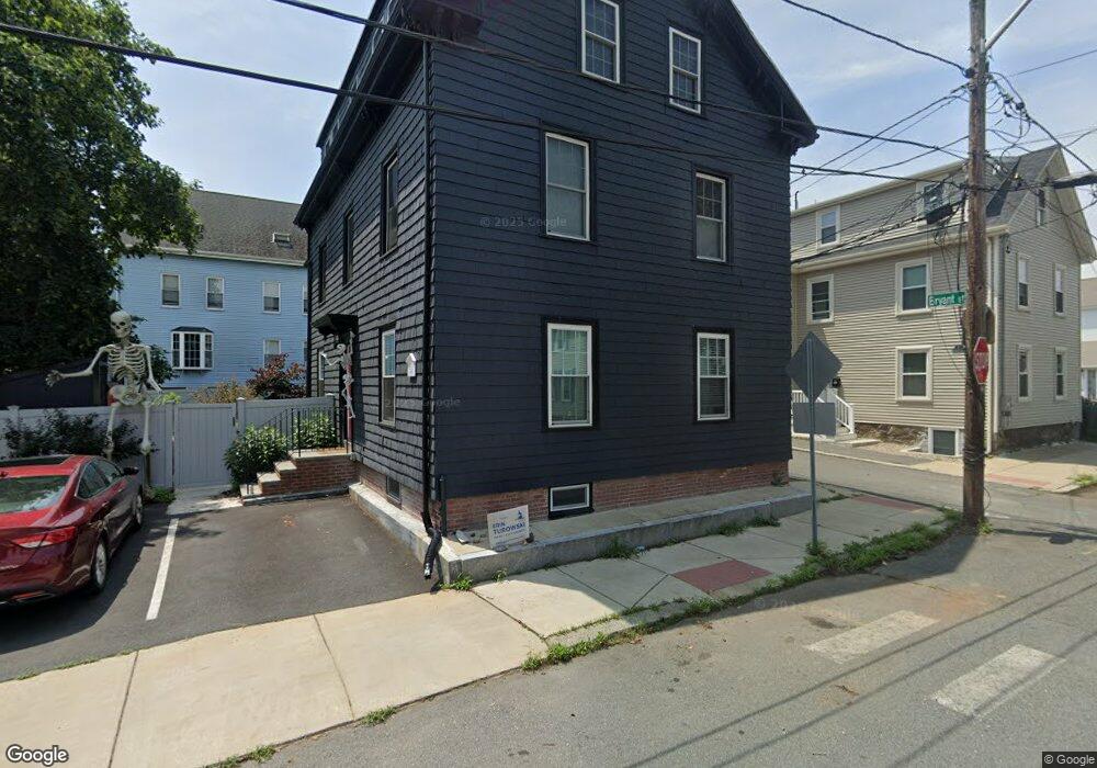
55 Buffum St Salem, MA 01970
North Salem NeighborhoodEstimated Value: $490,000 - $1,028,000
6
Beds
3
Baths
2,619
Sq Ft
$302/Sq Ft
Est. Value
About This Home
This home is located at 55 Buffum St, Salem, MA 01970 and is currently estimated at $790,817, approximately $301 per square foot. 55 Buffum St is a home located in Essex County with nearby schools including Bates Elementary School, Saltonstall School, and Carlton Elementary School.
Ownership History
Date
Name
Owned For
Owner Type
Purchase Details
Closed on
Nov 20, 2019
Sold by
Naumkeag Rt and Copelas
Bought by
Mitchell Jamie and Roy-Mitchell Jessica
Current Estimated Value
Home Financials for this Owner
Home Financials are based on the most recent Mortgage that was taken out on this home.
Original Mortgage
$405,000
Outstanding Balance
$352,442
Interest Rate
3.5%
Mortgage Type
New Conventional
Estimated Equity
$438,375
Purchase Details
Closed on
Jan 5, 2011
Sold by
Copelas Peter
Bought by
Naumkeag Rt and Copelas
Create a Home Valuation Report for This Property
The Home Valuation Report is an in-depth analysis detailing your home's value as well as a comparison with similar homes in the area
Home Values in the Area
Average Home Value in this Area
Purchase History
| Date | Buyer | Sale Price | Title Company |
|---|---|---|---|
| Mitchell Jamie | $540,000 | -- | |
| Mitchell Jamie | $540,000 | -- | |
| Naumkeag Rt | -- | -- |
Source: Public Records
Mortgage History
| Date | Status | Borrower | Loan Amount |
|---|---|---|---|
| Open | Mitchell Jamie | $405,000 | |
| Closed | Mitchell Jamie | $405,000 | |
| Previous Owner | Naumkeag Rt | $150,000 | |
| Previous Owner | Naumkeag Rt | $85,000 |
Source: Public Records
Tax History
| Year | Tax Paid | Tax Assessment Tax Assessment Total Assessment is a certain percentage of the fair market value that is determined by local assessors to be the total taxable value of land and additions on the property. | Land | Improvement |
|---|---|---|---|---|
| 2025 | $8,490 | $748,700 | $203,200 | $545,500 |
| 2024 | $8,148 | $701,200 | $193,100 | $508,100 |
| 2023 | $7,894 | $631,000 | $178,300 | $452,700 |
| 2022 | $7,653 | $577,600 | $172,300 | $405,300 |
| 2021 | $7,315 | $530,100 | $160,400 | $369,700 |
| 2020 | $5,865 | $405,900 | $151,500 | $254,400 |
| 2019 | $5,807 | $384,600 | $143,800 | $240,800 |
| 2018 | $5,420 | $352,400 | $136,700 | $215,700 |
| 2017 | $5,050 | $318,400 | $115,300 | $203,100 |
| 2016 | $4,905 | $313,000 | $109,900 | $203,100 |
| 2015 | $4,779 | $291,200 | $101,000 | $190,200 |
Source: Public Records
Map
Nearby Homes
- 40 Buffum St Unit 2
- 40 Buffum St Unit 1
- 21 Manning St
- 16 Oakland St
- 44 Orne St Unit 44
- 112 North St
- 3 S Mason St
- 9 Highland St
- 41 Dearborn St
- 16 Franklin St Unit 2403
- 16 Franklin St Unit 1303
- 86 Flint St
- 16 River St
- 23 River St
- 30 Driscoll St
- 17 North St Unit 2
- 35 Flint St Unit 209
- 35 Flint St Unit 106
- 128 Boston St Unit 4
- 289 Essex St Unit 211
- 55 Buffum St Unit 3
- 55 Buffum St Unit 2
- 55 Buffum St
- 55 Buffum St Unit 1
- 57 Buffum St
- 57 Buffum St Unit 1
- 57 Buffum St Unit 3
- 57 Buffum St Unit 2
- 11 Bryant St Unit 13
- 53 Buffum St
- 13 Bryant St
- 60 Buffum St
- 58 Buffum St
- 61 Buffum St
- 62 Buffum St
- 51 Buffum St
- 4 Bryant St
- 50-1 Barr St
- 56 Buffum St
- 50 Barr St Unit 2
Your Personal Tour Guide
Ask me questions while you tour the home.