Estimated Value: $215,644 - $247,000
3
Beds
1
Bath
1,196
Sq Ft
$194/Sq Ft
Est. Value
About This Home
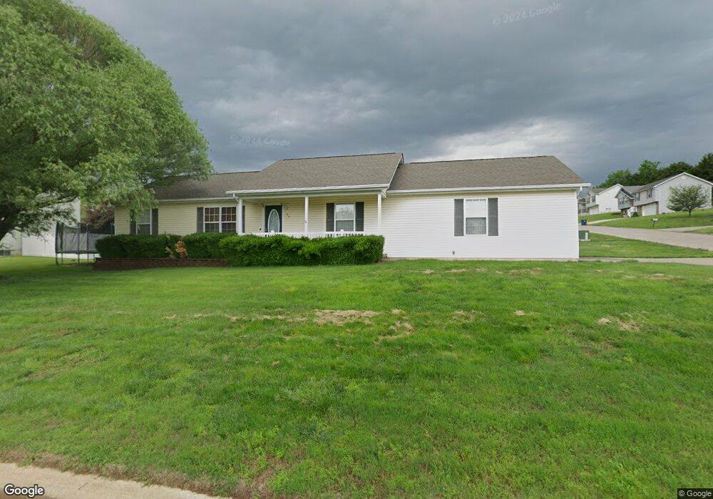
This home is located at 55 C C Camp Rd, Union, MO 63084 and is currently estimated at $231,881, approximately $193 per square foot. 55 C C Camp Rd is a home located in Franklin County with nearby schools including Union High School and Immaculate Conception School.
Ownership History
Date
Name
Owned For
Owner Type
Purchase Details
Closed on
Apr 23, 2012
Sold by
Schmuke David R
Bought by
Schmuke David R and Schmuke Jeanni N
Current Estimated Value
Home Financials for this Owner
Home Financials are based on the most recent Mortgage that was taken out on this home.
Original Mortgage
$134,750
Outstanding Balance
$93,617
Interest Rate
4.11%
Mortgage Type
New Conventional
Estimated Equity
$138,264
Purchase Details
Closed on
Feb 22, 2006
Sold by
Kee Enterprises Llc
Bought by
Fifth & Oak Enterprises Inc
Create a Home Valuation Report for This Property
The Home Valuation Report is an in-depth analysis detailing your home's value as well as a comparison with similar homes in the area
Home Values in the Area
Average Home Value in this Area
Purchase History
| Date | Buyer | Sale Price | Title Company |
|---|---|---|---|
| Schmuke David R | -- | None Available | |
| Fifth & Oak Enterprises Inc | -- | None Available |
Source: Public Records
Mortgage History
| Date | Status | Borrower | Loan Amount |
|---|---|---|---|
| Open | Schmuke David R | $134,750 |
Source: Public Records
Tax History
| Year | Tax Paid | Tax Assessment Tax Assessment Total Assessment is a certain percentage of the fair market value that is determined by local assessors to be the total taxable value of land and additions on the property. | Land | Improvement |
|---|---|---|---|---|
| 2025 | $1,866 | $31,293 | $0 | $0 |
| 2024 | $1,866 | $28,671 | $0 | $0 |
| 2023 | $1,728 | $28,671 | $0 | $0 |
| 2022 | $1,858 | $30,767 | $0 | $0 |
| 2021 | $1,861 | $30,767 | $0 | $0 |
| 2020 | $1,713 | $27,860 | $0 | $0 |
| 2019 | $1,709 | $27,860 | $0 | $0 |
| 2018 | $1,493 | $25,547 | $0 | $0 |
| 2017 | $1,497 | $25,547 | $0 | $0 |
| 2016 | $1,415 | $23,608 | $0 | $0 |
| 2015 | $1,392 | $23,608 | $0 | $0 |
| 2014 | $1,458 | $24,700 | $0 | $0 |
Source: Public Records
Map
Nearby Homes
- 435 Eve Estates Dr
- 406 Emma Ln
- 1008 N Washington Ave
- 910 N Church St
- 1157 Rock Rd
- 207 E Park Ave
- 0 Highway V
- 0 Heard Ct
- 000 Mo-V
- 3732 Highway A
- 21 Forest Ln
- 413 W State St
- 1552 Clearview Rd
- 613 W State St
- 5950 Highway V
- 1122 Old County Farm Rd
- N Highway 47 E State Highway 47
- 614 E State St
- 54 Hickory Cir
- 914 W State St
Your Personal Tour Guide
Ask me questions while you tour the home.