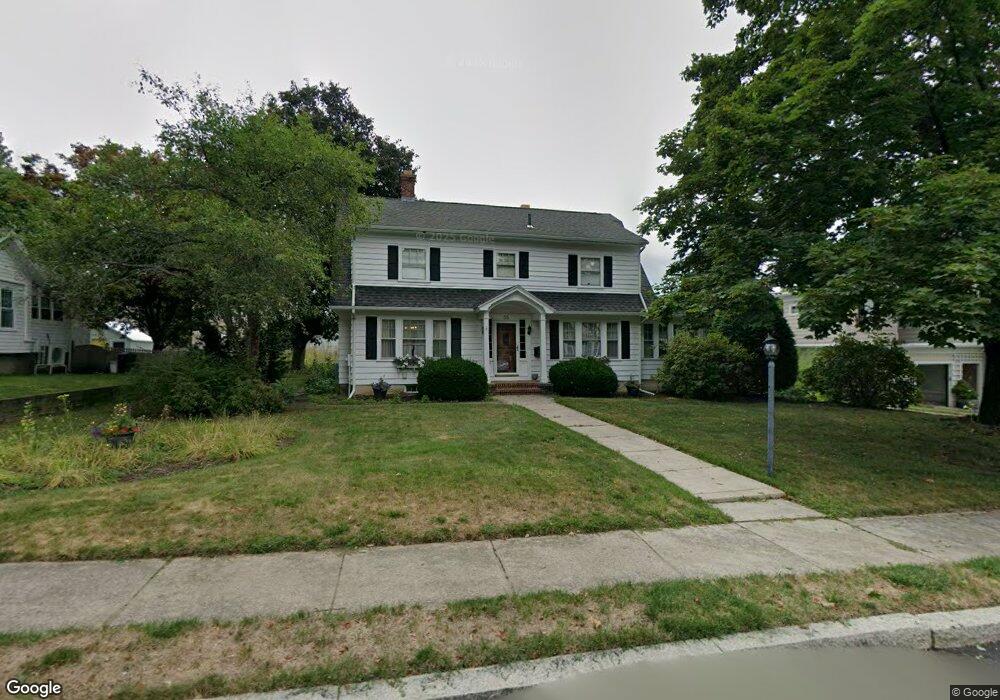
55 Colburn St North Attleboro, MA 02760
North Attleboro NeighborhoodEstimated Value: $608,000 - $649,282
4
Beds
2
Baths
2,409
Sq Ft
$261/Sq Ft
Est. Value
About This Home
This home is located at 55 Colburn St, North Attleboro, MA 02760 and is currently estimated at $628,321, approximately $260 per square foot. 55 Colburn St is a home located in Bristol County with nearby schools including North Attleboro High School, Cadence Academy Preschool - North Attleborough, and Bishop Feehan High School.
Ownership History
Date
Name
Owned For
Owner Type
Purchase Details
Closed on
Nov 5, 1999
Sold by
Bliss Donald R and Bliss Donald L
Bought by
Luongo Ross M and Clemmey Melissa
Current Estimated Value
Create a Home Valuation Report for This Property
The Home Valuation Report is an in-depth analysis detailing your home's value as well as a comparison with similar homes in the area
Home Values in the Area
Average Home Value in this Area
Purchase History
| Date | Buyer | Sale Price | Title Company |
|---|---|---|---|
| Luongo Ross M | $215,000 | -- |
Source: Public Records
Mortgage History
| Date | Status | Borrower | Loan Amount |
|---|---|---|---|
| Open | Luongo Ross M | $217,800 | |
| Closed | Luongo Ross M | $242,400 | |
| Closed | Luongo Ross M | $192,000 |
Source: Public Records
Tax History Compared to Growth
Tax History
| Year | Tax Paid | Tax Assessment Tax Assessment Total Assessment is a certain percentage of the fair market value that is determined by local assessors to be the total taxable value of land and additions on the property. | Land | Improvement |
|---|---|---|---|---|
| 2025 | $6,042 | $512,500 | $147,900 | $364,600 |
| 2024 | $6,015 | $521,200 | $147,900 | $373,300 |
| 2023 | $5,877 | $459,500 | $154,300 | $305,200 |
| 2022 | $5,525 | $396,600 | $147,900 | $248,700 |
| 2021 | $5,856 | $410,400 | $147,900 | $262,500 |
| 2020 | $5,782 | $402,900 | $147,900 | $255,000 |
| 2019 | $5,545 | $389,400 | $134,400 | $255,000 |
| 2018 | $0 | $374,300 | $134,400 | $239,900 |
| 2017 | $4,948 | $374,300 | $134,400 | $239,900 |
| 2016 | $4,866 | $368,100 | $155,800 | $212,300 |
| 2015 | $4,757 | $362,000 | $162,200 | $199,800 |
| 2014 | $4,547 | $343,400 | $142,400 | $201,000 |
Source: Public Records
Map
Nearby Homes
- 80 Broadway Unit 9
- 50 Metcalf Rd
- 130 E Washington St Unit 57
- 130 E Washington St Unit 71
- 130 E Washington St Unit 36
- 130 E Washington St Unit 9
- 137 Sumner St
- 160 Crescent Ave
- 300 E Washington St Unit 54R
- 93 Bank St
- 40 Roosevelt Ave
- 16 Richards Ave Unit 106
- 12 Roosevelt Ave
- 0 Anawan Rd
- 16 Johnson St
- 30 Sperry Ln Unit Lot 15
- 46 Westside Ave
- 27 Taylor St
- 19 Church St Unit C9
- 121 E Washington St Unit 8