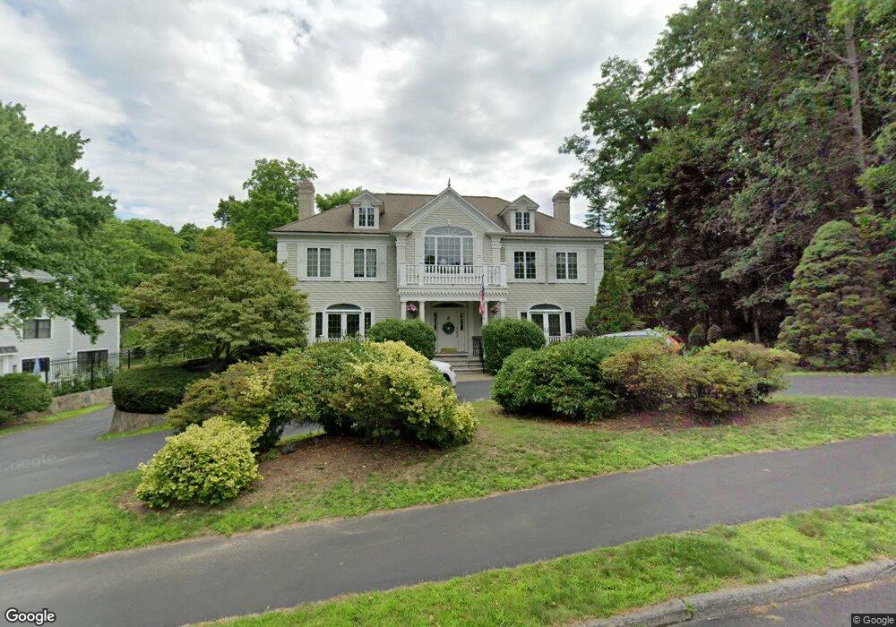
55 Cranmore Rd Wellesley Hills, MA 02481
Estimated Value: $3,596,300 - $4,481,000
6
Beds
6
Baths
5,218
Sq Ft
$799/Sq Ft
Est. Value
About This Home
This home is located at 55 Cranmore Rd, Wellesley Hills, MA 02481 and is currently estimated at $4,169,767, approximately $799 per square foot. 55 Cranmore Rd is a home located in Norfolk County with nearby schools including Katharine Lee Bates Elementary School, Wellesley Middle School, and Wellesley Sr High School.
Ownership History
Date
Name
Owned For
Owner Type
Purchase Details
Closed on
Jan 31, 2007
Sold by
Hoff Andrea W and Hoff Frederick D
Bought by
Fadule Jill H
Current Estimated Value
Purchase Details
Closed on
May 16, 1991
Sold by
A Epifano Inc
Bought by
Martin Deforest E and Martin Dolores P
Create a Home Valuation Report for This Property
The Home Valuation Report is an in-depth analysis detailing your home's value as well as a comparison with similar homes in the area
Home Values in the Area
Average Home Value in this Area
Purchase History
| Date | Buyer | Sale Price | Title Company |
|---|---|---|---|
| Fadule Jill H | $2,450,000 | -- | |
| Martin Deforest E | $300,000 | -- |
Source: Public Records
Mortgage History
| Date | Status | Borrower | Loan Amount |
|---|---|---|---|
| Previous Owner | Martin Deforest E | $767,000 | |
| Previous Owner | Martin Deforest E | $385,000 |
Source: Public Records
Tax History Compared to Growth
Tax History
| Year | Tax Paid | Tax Assessment Tax Assessment Total Assessment is a certain percentage of the fair market value that is determined by local assessors to be the total taxable value of land and additions on the property. | Land | Improvement |
|---|---|---|---|---|
| 2025 | $30,871 | $3,003,000 | $1,274,000 | $1,729,000 |
| 2024 | $30,647 | $2,944,000 | $1,274,000 | $1,670,000 |
| 2023 | $26,747 | $2,336,000 | $1,112,000 | $1,224,000 |
| 2022 | $25,381 | $2,173,000 | $881,000 | $1,292,000 |
| 2021 | $25,533 | $2,173,000 | $881,000 | $1,292,000 |
| 2020 | $25,143 | $2,175,000 | $881,000 | $1,294,000 |
| 2019 | $25,165 | $2,175,000 | $881,000 | $1,294,000 |
| 2018 | $26,876 | $2,249,000 | $884,000 | $1,365,000 |
| 2017 | $26,516 | $2,249,000 | $884,000 | $1,365,000 |
| 2016 | $26,901 | $2,274,000 | $869,000 | $1,405,000 |
| 2015 | $26,287 | $2,274,000 | $869,000 | $1,405,000 |
Source: Public Records
Map
Nearby Homes
- 49 Cranmore Rd
- 65 Royalston Rd
- 89 Monadnock Rd
- 89 Monadnock Rd Unit 1
- 54 Cranmore Rd
- 60 Cranmore Rd
- 48 Cranmore Rd
- 41 Cranmore Rd
- 85 Monadnock Rd
- 47 Royalston Rd
- 69 Royalston Rd
- 52 Royalston Rd
- 60 Royalston Rd
- 90 Monadnock Rd
- 43 Royalston Rd
- 81 Monadnock Rd
- 68 Royalston Rd
- 35 Cranmore Rd
- 36 Cranmore Rd
- 50 Royalston Rd