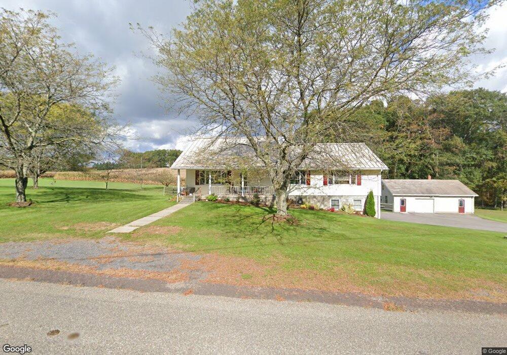
55 Derrs Rd Bloomsburg, PA 17815
Estimated Value: $360,218 - $450,000
--
Bed
--
Bath
1,920
Sq Ft
$208/Sq Ft
Est. Value
About This Home
This home is located at 55 Derrs Rd, Bloomsburg, PA 17815 and is currently estimated at $399,055, approximately $207 per square foot. 55 Derrs Rd is a home located in Columbia County with nearby schools including Millville Area Elementary School and Millville Area Junior/Senior High School.
Ownership History
Date
Name
Owned For
Owner Type
Purchase Details
Closed on
Apr 5, 2019
Sold by
Kunkel Wade A
Bought by
Shelley Thomas E and Shelley Emily M
Current Estimated Value
Home Financials for this Owner
Home Financials are based on the most recent Mortgage that was taken out on this home.
Original Mortgage
$247,000
Outstanding Balance
$217,157
Interest Rate
4.3%
Mortgage Type
New Conventional
Estimated Equity
$181,898
Purchase Details
Closed on
Jul 11, 2015
Sold by
Derr Gerald P and Derr Diane M
Bought by
Kunkel Wade A
Home Financials for this Owner
Home Financials are based on the most recent Mortgage that was taken out on this home.
Original Mortgage
$202,350
Interest Rate
4.25%
Mortgage Type
Adjustable Rate Mortgage/ARM
Purchase Details
Closed on
Feb 9, 2001
Bought by
Derr Gerald P and Derr Diane M
Create a Home Valuation Report for This Property
The Home Valuation Report is an in-depth analysis detailing your home's value as well as a comparison with similar homes in the area
Home Values in the Area
Average Home Value in this Area
Purchase History
| Date | Buyer | Sale Price | Title Company |
|---|---|---|---|
| Shelley Thomas E | $260,000 | None Available | |
| Kunkel Wade A | $213,000 | Attorney | |
| Derr Gerald P | -- | -- |
Source: Public Records
Mortgage History
| Date | Status | Borrower | Loan Amount |
|---|---|---|---|
| Open | Shelley Thomas E | $247,000 | |
| Previous Owner | Kunkel Wade A | $202,350 |
Source: Public Records
Tax History Compared to Growth
Tax History
| Year | Tax Paid | Tax Assessment Tax Assessment Total Assessment is a certain percentage of the fair market value that is determined by local assessors to be the total taxable value of land and additions on the property. | Land | Improvement |
|---|---|---|---|---|
| 2025 | $4,321 | $54,946 | $0 | $0 |
| 2024 | $4,165 | $54,946 | $6,775 | $48,171 |
| 2023 | $3,791 | $54,946 | $6,775 | $48,171 |
| 2022 | $3,665 | $54,946 | $6,775 | $48,171 |
| 2021 | $3,561 | $54,946 | $6,775 | $48,171 |
| 2020 | $3,436 | $54,946 | $6,775 | $48,171 |
| 2019 | $3,436 | $54,946 | $6,775 | $48,171 |
| 2018 | $3,422 | $54,946 | $6,775 | $48,171 |
| 2017 | $3,367 | $54,946 | $6,775 | $48,171 |
| 2016 | -- | $54,946 | $6,775 | $48,171 |
| 2015 | -- | $54,946 | $6,775 | $48,171 |
| 2014 | -- | $54,946 | $6,775 | $48,171 |
Source: Public Records
Map
Nearby Homes
- 459-463 Danville Rd
- 494 Buckhorn Rd
- 93 Woodside Rd
- 451 Eyersgrove Rd
- 126 Orchard Dr
- 516 Washingtonville Rd
- 25 Rhoades Hill Rd
- 4 Eyersgrove Rd
- 58 Blee Hill Rd
- 29 Robbins Rd
- 2305 State Route 42
- 0 Preserve Ln
- LOT 33 Preserve Ln
- LOT 32 Preserve Ln
- 49 Preserve Ln
- 99 Pony Trail Dr
- 14 Fairfield Ln
- 2622 Johnson Rd
- 5 Williamsburg Blvd
- 7 Williamsburg Blvd
- 64 Derrs Rd
- 147 Columbia Hill Rd
- 78 Derrs Rd
- 85 Derrs Rd
- 91 Derrs Rd
- 171 Columbia Hill Rd
- 45 Nichols Rd
- 105 Derrs Rd
- 100 Derrs Rd
- 192 Columbia Hill Rd
- 967 Columbia Hill Rd
- 102 Derrs Rd
- 442 Hollow Rd
- 875 Buckhorn Rd
- 101 Robinson Rd
- 100 Columbia Hill Rd
- 231 Shultz Rd
- 132 Robinson Rd
- 215 Rishel Rd
- 677 Buckhorn Rd