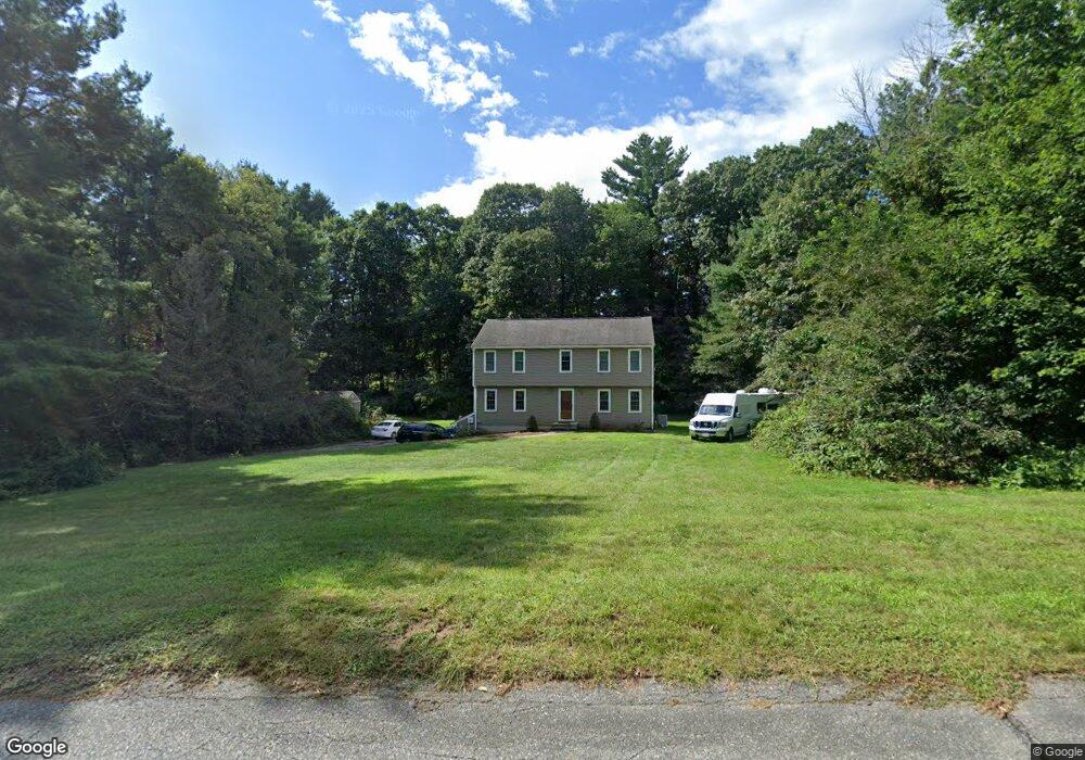
55 Desert Brook Rd Wrentham, MA 02093
Estimated Value: $685,000 - $837,000
4
Beds
3
Baths
2,014
Sq Ft
$364/Sq Ft
Est. Value
About This Home
This home is located at 55 Desert Brook Rd, Wrentham, MA 02093 and is currently estimated at $732,987, approximately $363 per square foot. 55 Desert Brook Rd is a home located in Norfolk County with nearby schools including Delaney Elementary School and Charles E Roderick.
Ownership History
Date
Name
Owned For
Owner Type
Purchase Details
Closed on
Jun 30, 2004
Sold by
Linnehan Daniel and Linnehan Stephanie
Bought by
Blitchington Peter J and Blitchington Sharon L
Current Estimated Value
Home Financials for this Owner
Home Financials are based on the most recent Mortgage that was taken out on this home.
Original Mortgage
$364,000
Outstanding Balance
$182,800
Interest Rate
6.3%
Mortgage Type
Purchase Money Mortgage
Estimated Equity
$550,187
Purchase Details
Closed on
Jun 16, 2003
Sold by
Bank Of America Na and Peterson Jeanne M
Bought by
Linnehan Stephanie and Linnehan Daniel
Home Financials for this Owner
Home Financials are based on the most recent Mortgage that was taken out on this home.
Original Mortgage
$264,800
Interest Rate
5.77%
Mortgage Type
Purchase Money Mortgage
Purchase Details
Closed on
Nov 24, 1993
Sold by
Riddell Peter and Riddell Joelle
Bought by
Wall Kevin M and Wall Sherrie L
Home Financials for this Owner
Home Financials are based on the most recent Mortgage that was taken out on this home.
Original Mortgage
$105,000
Interest Rate
6.72%
Mortgage Type
Purchase Money Mortgage
Purchase Details
Closed on
May 18, 1993
Sold by
Carter Rt
Bought by
Ridell Peter
Home Financials for this Owner
Home Financials are based on the most recent Mortgage that was taken out on this home.
Original Mortgage
$159,750
Interest Rate
7.47%
Mortgage Type
Purchase Money Mortgage
Purchase Details
Closed on
Feb 22, 1991
Sold by
Carter Stephen M
Bought by
Carter Ft
Create a Home Valuation Report for This Property
The Home Valuation Report is an in-depth analysis detailing your home's value as well as a comparison with similar homes in the area
Purchase History
| Date | Buyer | Sale Price | Title Company |
|---|---|---|---|
| Blitchington Peter J | $455,000 | -- | |
| Linnehan Stephanie | $331,000 | -- | |
| Wall Kevin M | $180,000 | -- | |
| Ridell Peter | $177,500 | -- | |
| Carter Ft | $71,500 | -- |
Source: Public Records
Mortgage History
| Date | Status | Borrower | Loan Amount |
|---|---|---|---|
| Open | Blitchington Peter J | $364,000 | |
| Closed | Blitchington Peter J | $91,000 | |
| Previous Owner | Linnehan Stephanie | $264,800 | |
| Previous Owner | Carter Ft | $23,000 | |
| Previous Owner | Carter Ft | $105,000 | |
| Previous Owner | Carter Ft | $159,750 |
Source: Public Records
Tax History
| Year | Tax Paid | Tax Assessment Tax Assessment Total Assessment is a certain percentage of the fair market value that is determined by local assessors to be the total taxable value of land and additions on the property. | Land | Improvement |
|---|---|---|---|---|
| 2025 | $6,901 | $595,400 | $302,200 | $293,200 |
| 2024 | $6,746 | $562,200 | $302,200 | $260,000 |
| 2023 | $6,407 | $507,700 | $274,600 | $233,100 |
| 2022 | $6,194 | $453,100 | $256,100 | $197,000 |
| 2021 | $5,700 | $405,100 | $223,500 | $181,600 |
| 2020 | $5,643 | $396,000 | $198,700 | $197,300 |
| 2019 | $5,467 | $387,200 | $198,700 | $188,500 |
| 2018 | $5,783 | $406,100 | $199,000 | $207,100 |
| 2017 | $5,425 | $380,700 | $195,100 | $185,600 |
| 2016 | $5,338 | $373,800 | $189,500 | $184,300 |
| 2015 | $4,705 | $314,100 | $151,800 | $162,300 |
| 2014 | $4,657 | $304,200 | $146,000 | $158,200 |
Source: Public Records
Map
Nearby Homes
- 10 Earle Stewart Ln Unit Lot 5
- 12 Earle Stewart Ln
- 2 Earle Stewart Ln
- 3 Earle Stewart Ln
- 135 Creek St Unit 2
- 440 Chestnut St
- 613 West St
- 500 Franklin St
- 1222 South St
- 10 Nature View Dr
- 15 Nature View Dr
- 165 Wampum St
- 6 Woodchester Rd
- 15 Tilting Rock Rd
- 440 South St
- 23 Horseshoe Dr
- 18 Northern Spy Rd
- 0 Fall Ln
- 20 Field Cir
- 19 Chestnut St Lot 2
- 65 Desert Brook Rd
- 45 Desert Brook Rd
- 60 Desert Brook Rd
- 140 Bennett St
- 70 Desert Brook Rd
- 50 Desert Brook Rd
- 75 Desert Brook Rd
- 150 Bennett St
- 40 Desert Brook Rd
- 130 Bennett St
- 80 Desert Brook Rd
- 30 Desert Brook Rd
- 0 Wilkinson Way Unit 71896961
- 105 Desert Brook Rd
- 120 Bennett St
- 000 Great St
- 30 LOT Amber Dr
- Lot 2 Rockett Ln
- 24 LOT Amber Dr
- 500 Thurston Washington Route 1
Your Personal Tour Guide
Ask me questions while you tour the home.