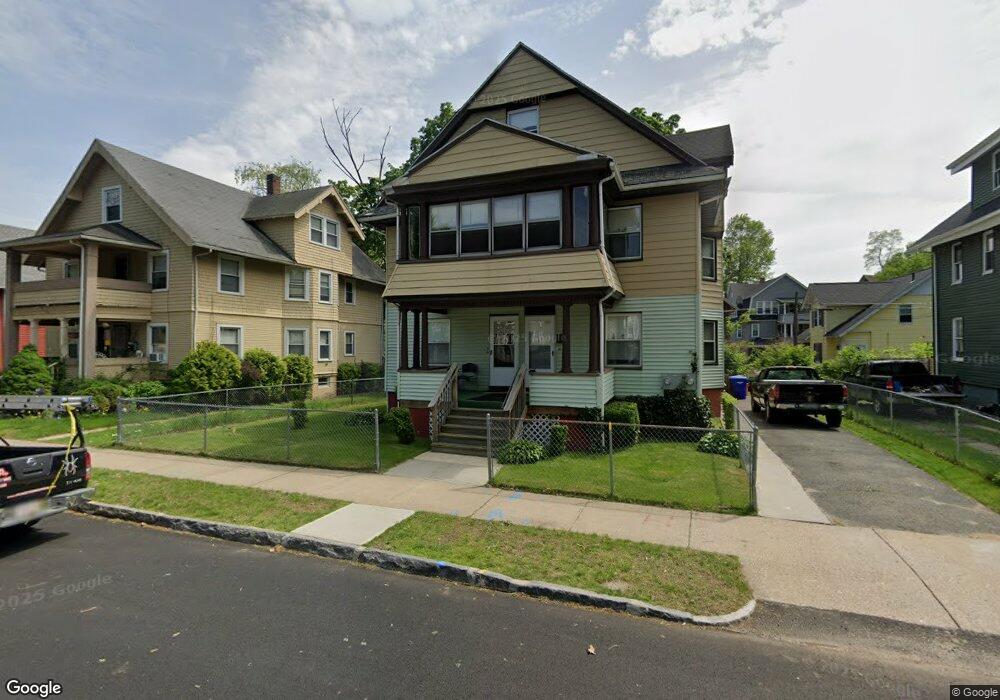
55 Dexter St Unit 57 Springfield, MA 01105
Maple-High Six Corners NeighborhoodEstimated Value: $311,830 - $382,000
6
Beds
2
Baths
3,208
Sq Ft
$109/Sq Ft
Est. Value
About This Home
This home is located at 55 Dexter St Unit 57, Springfield, MA 01105 and is currently estimated at $348,208, approximately $108 per square foot. 55 Dexter St Unit 57 is a home located in Hampden County with nearby schools including Milton Bradley School, South End Middle School, and High School Of Commerce.
Ownership History
Date
Name
Owned For
Owner Type
Purchase Details
Closed on
May 13, 2011
Sold by
Baidy Earl D and Baidy Yvonne
Bought by
Springfield City Of
Current Estimated Value
Purchase Details
Closed on
Feb 10, 2011
Sold by
Baidy Earl D and Baidy Yvonne
Bought by
Springfield City Of
Purchase Details
Closed on
Feb 25, 1972
Bought by
Baidy Earl D and Baidy Yvonne
Create a Home Valuation Report for This Property
The Home Valuation Report is an in-depth analysis detailing your home's value as well as a comparison with similar homes in the area
Home Values in the Area
Average Home Value in this Area
Purchase History
| Date | Buyer | Sale Price | Title Company |
|---|---|---|---|
| Springfield City Of | -- | -- | |
| Springfield City Of | $1,535 | -- | |
| Baidy Earl D | $18,500 | -- |
Source: Public Records
Tax History Compared to Growth
Tax History
| Year | Tax Paid | Tax Assessment Tax Assessment Total Assessment is a certain percentage of the fair market value that is determined by local assessors to be the total taxable value of land and additions on the property. | Land | Improvement |
|---|---|---|---|---|
| 2025 | $4,265 | $272,000 | $24,700 | $247,300 |
| 2024 | $4,278 | $266,400 | $23,100 | $243,300 |
| 2023 | $3,742 | $219,500 | $22,000 | $197,500 |
| 2022 | $3,457 | $183,700 | $20,000 | $163,700 |
| 2021 | $3,374 | $178,500 | $18,200 | $160,300 |
| 2020 | $3,176 | $162,600 | $18,200 | $144,400 |
| 2019 | $2,368 | $120,300 | $18,200 | $102,100 |
| 2018 | $2,271 | $114,700 | $18,200 | $96,500 |
| 2017 | $2,271 | $115,500 | $14,600 | $100,900 |
| 2016 | $1,956 | $99,500 | $14,600 | $84,900 |
| 2015 | $1,898 | $96,500 | $14,600 | $81,900 |
Source: Public Records
Map
Nearby Homes
- 18 Greenacre Square
- 19 Pine Street Ct
- 0 Central St
- 3 Noel St
- 308 Maple St
- 3 Ashley St
- 122 Bellevue Ave
- 128 Mill St
- 120 Mill St
- 3 Hillside Place
- 68 Ashley St
- 95 Dickinson St
- 0 Allen St (Ss)
- 29 Warriner Ave
- 78-80 Shamrock St
- 32 Wendell Place
- 65-67 Shamrock St
- 7-9 Glendell Terrace
- 371-373 Oakland St
- 320 Oakland St
- 63 Dexter St
- 51 Dexter St
- 61 Dexter St
- 18 Newman St
- 14 Newman St
- 43 Dexter St Unit 45
- 69 Dexter St
- 54 Dexter St Unit 56
- 15 Dorne St Unit 17
- 15-17 Dorne St
- 60 Dexter St Unit 62
- 60-62 Dexter St
- 60-62 Dexter St Unit 62
- 50 Dexter St
- 68 Dexter St Unit 68
- 66 Dexter St Unit 68
- 35 Dexter St Unit 37
- 35 Dexter St Unit 1
- 35-37 Dexter St
- 23 Newman St