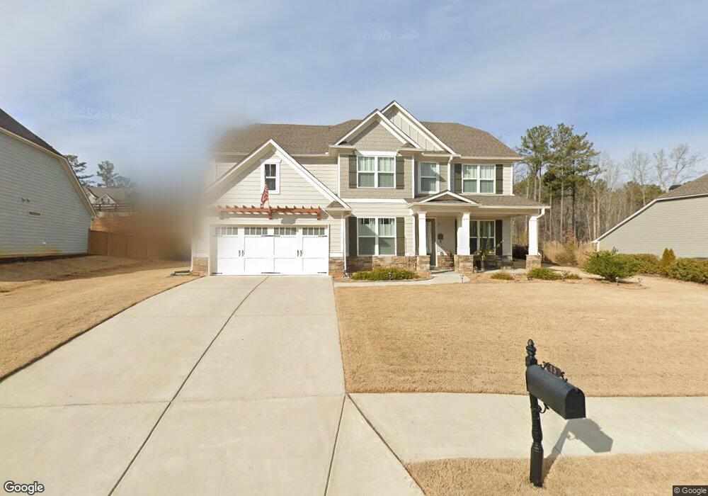
55 Dunston Way Villa Rica, GA 30180
Estimated Value: $446,863 - $528,000
5
Beds
3
Baths
3,088
Sq Ft
$160/Sq Ft
Est. Value
About This Home
This home is located at 55 Dunston Way, Villa Rica, GA 30180 and is currently estimated at $493,216, approximately $159 per square foot. 55 Dunston Way is a home with nearby schools including New Georgia Elementary School, Carl Scoggins Sr. Middle School, and South Paulding High School.
Ownership History
Date
Name
Owned For
Owner Type
Purchase Details
Closed on
Mar 9, 2018
Sold by
Artisan
Bought by
Starr Earl F and Starr Kellie A
Current Estimated Value
Home Financials for this Owner
Home Financials are based on the most recent Mortgage that was taken out on this home.
Original Mortgage
$246,813
Outstanding Balance
$211,198
Interest Rate
4.32%
Mortgage Type
New Conventional
Estimated Equity
$282,018
Create a Home Valuation Report for This Property
The Home Valuation Report is an in-depth analysis detailing your home's value as well as a comparison with similar homes in the area
Home Values in the Area
Average Home Value in this Area
Purchase History
| Date | Buyer | Sale Price | Title Company |
|---|---|---|---|
| Starr Earl F | $308,516 | -- |
Source: Public Records
Mortgage History
| Date | Status | Borrower | Loan Amount |
|---|---|---|---|
| Open | Starr Earl F | $246,813 |
Source: Public Records
Tax History Compared to Growth
Tax History
| Year | Tax Paid | Tax Assessment Tax Assessment Total Assessment is a certain percentage of the fair market value that is determined by local assessors to be the total taxable value of land and additions on the property. | Land | Improvement |
|---|---|---|---|---|
| 2024 | $1,245 | $181,472 | $18,000 | $163,472 |
| 2023 | $1,428 | $177,676 | $18,000 | $159,676 |
| 2022 | $1,228 | $151,612 | $18,000 | $133,612 |
| 2021 | $1,350 | $134,920 | $18,000 | $116,920 |
| 2020 | $1,391 | $131,040 | $16,000 | $115,040 |
| 2019 | $1,274 | $116,000 | $16,000 | $100,000 |
| 2018 | $422 | $14,000 | $14,000 | $0 |
| 2017 | $428 | $14,000 | $14,000 | $0 |
| 2016 | $127 | $4,200 | $4,200 | $0 |
| 2015 | $129 | $4,200 | $4,200 | $0 |
| 2014 | $71 | $2,240 | $2,240 | $0 |
| 2013 | -- | $2,240 | $2,240 | $0 |
Source: Public Records
Map
Nearby Homes
- 33 New Kent Ct
- 138 Torrey Pines Cir
- The Braselton Plan at Heritage Pointe at The Georgian
- The Chamblee Plan at Heritage Pointe at The Georgian
- The Monroe Plan at Heritage Pointe at The Georgian
- The Willingham Plan at Heritage Pointe at The Georgian
- The Rabun Plan at Heritage Pointe at The Georgian
- The Dalton Plan at Heritage Pointe at The Georgian
- The Augusta Plan at Heritage Pointe at The Georgian
- 98 Heritage Pointe Dr
- 36 Champions Crossing
- 81 Heritage Pointe Dr
- 49 Masters Dr
- 33 Champions Crossing
- 48 Masters Dr
- 87 Colonial Terrace
- 71 Colonial Terrace
- 61 Colonial Terrace
- 53 Colonial Terrace
- 54 Colonial Terrace
- 43 Dunston Way
- 79 Dunston Way
- 40 New Kent Ct
- 97 Dunston Way
- 48 Dunston Way Unit 26
- 48 Dunston Way
- 0 New Kent Ct Unit 12
- 24 Dunston Way Unit Lot 27
- 24 Dunston Way
- 160 Woodburn Dr
- 160 Woodburn Dr Unit 16
- 70 Dunston Way Unit 25
- 70 Dunston Way
- 37 New Kent Ct
- 202 Woodburn Dr
- 86 Dunston Way
- 94 Dunston Way
- 101 Dunston Way Unit 21
- 101 Dunston Way
- 33 New Kent Ct Unit 12