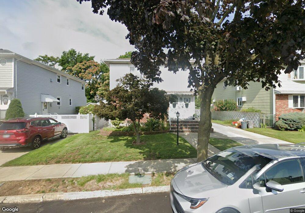
55 Farnum Blvd Franklin Square, NY 11010
Estimated Value: $1,021,000 - $1,072,725
3
Beds
1
Bath
2,328
Sq Ft
$450/Sq Ft
Est. Value
About This Home
This home is located at 55 Farnum Blvd, Franklin Square, NY 11010 and is currently estimated at $1,046,863, approximately $449 per square foot. 55 Farnum Blvd is a home located in Nassau County with nearby schools including St Anne's School.
Ownership History
Date
Name
Owned For
Owner Type
Purchase Details
Closed on
Jul 31, 2018
Sold by
Losasso Anthony
Bought by
Losasso Trust
Current Estimated Value
Purchase Details
Closed on
Dec 20, 2011
Sold by
Brighindi Vittorio B
Bought by
Losasso Anthony and Losasso Gabriella
Home Financials for this Owner
Home Financials are based on the most recent Mortgage that was taken out on this home.
Original Mortgage
$340,000
Interest Rate
3.98%
Mortgage Type
Purchase Money Mortgage
Purchase Details
Closed on
Apr 24, 2006
Sold by
Brighindi Angelo
Create a Home Valuation Report for This Property
The Home Valuation Report is an in-depth analysis detailing your home's value as well as a comparison with similar homes in the area
Home Values in the Area
Average Home Value in this Area
Purchase History
| Date | Buyer | Sale Price | Title Company |
|---|---|---|---|
| Losasso Trust | -- | None Available | |
| Losasso Anthony | $494,000 | -- | |
| -- | -- | -- |
Source: Public Records
Mortgage History
| Date | Status | Borrower | Loan Amount |
|---|---|---|---|
| Previous Owner | Losasso Anthony | $340,000 |
Source: Public Records
Tax History Compared to Growth
Tax History
| Year | Tax Paid | Tax Assessment Tax Assessment Total Assessment is a certain percentage of the fair market value that is determined by local assessors to be the total taxable value of land and additions on the property. | Land | Improvement |
|---|---|---|---|---|
| 2025 | $20,617 | $816 | $328 | $488 |
| 2024 | $7,159 | $816 | $328 | $488 |
| 2023 | $18,709 | $816 | $328 | $488 |
| 2022 | $18,709 | $816 | $328 | $488 |
| 2021 | $24,448 | $779 | $313 | $466 |
| 2020 | $17,944 | $1,095 | $716 | $379 |
| 2019 | $17,274 | $1,095 | $716 | $379 |
| 2018 | $16,354 | $1,095 | $0 | $0 |
| 2017 | $9,317 | $1,095 | $716 | $379 |
| 2016 | $14,907 | $1,095 | $716 | $379 |
| 2015 | $4,933 | $1,095 | $716 | $379 |
| 2014 | $4,933 | $1,095 | $716 | $379 |
| 2013 | $4,518 | $1,073 | $716 | $357 |
Source: Public Records
Map
Nearby Homes
- 120 Barrymore Blvd
- 178 Farnum Blvd
- 44 Catherine Ave
- 62 Herman Blvd
- 9 Court St
- 31 Evans Ave
- 163 Herman Blvd
- 1319 Journal Ave
- 0 Journal Ave Unit ONE3527047
- 162 Crown Ave
- 700 Tulip Ave
- 89 Hunnewell Ave
- 1098 Russell St
- 261 Fernwood Terrace
- 51 Pacific St
- 1134 Rosegold St
- 182 Lexington Ave
- 163 Crest Ave
- 103 Meacham Ave
- 1041 Russell St
- 59 Farnum Blvd
- 51 Farnum Blvd
- 63 Farnum Blvd
- 47 Farnum Blvd
- 47 Farnum Blvd Unit 1
- 43 Farnum Blvd
- 60 Farnum Blvd
- 67 Farnum Blvd
- 67 Farnum Blvd Unit 2
- 56 Farnum Blvd
- 64 Farnum Blvd
- 1223 Whiteside Ave
- 52 Farnum Blvd
- 39 Farnum Blvd
- 1221 Whiteside Ave
- 75 Farnum Blvd
- 70 Farnum Blvd
- 48 Farnum Blvd
- 35 Farnum Blvd
- 35 Farnum Blvd Unit 1st Fl