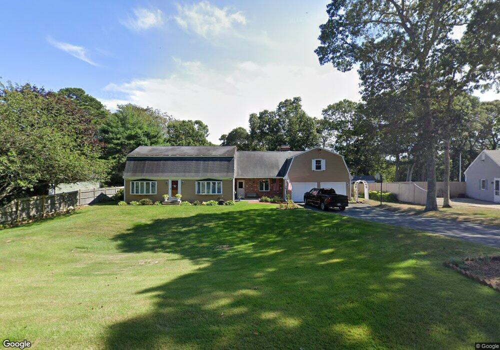
55 Freeboard Ln Yarmouth Port, MA 02675
Yarmouth Port NeighborhoodEstimated Value: $669,000 - $975,000
3
Beds
3
Baths
2,726
Sq Ft
$299/Sq Ft
Est. Value
About This Home
This home is located at 55 Freeboard Ln, Yarmouth Port, MA 02675 and is currently estimated at $815,755, approximately $299 per square foot. 55 Freeboard Ln is a home located in Barnstable County with nearby schools including Dennis-Yarmouth Regional High School, St. Pius X. School, and Trinity Christian Academy of Cape Cod.
Ownership History
Date
Name
Owned For
Owner Type
Purchase Details
Closed on
Sep 22, 2021
Sold by
Holmquist Doreen R
Bought by
Holmquist Ft
Current Estimated Value
Purchase Details
Closed on
Jun 14, 1991
Sold by
Ford Motor Credit Co
Bought by
Medeiros Doreen R and Franklin Dorothea B
Home Financials for this Owner
Home Financials are based on the most recent Mortgage that was taken out on this home.
Original Mortgage
$103,950
Interest Rate
9.39%
Mortgage Type
Purchase Money Mortgage
Create a Home Valuation Report for This Property
The Home Valuation Report is an in-depth analysis detailing your home's value as well as a comparison with similar homes in the area
Home Values in the Area
Average Home Value in this Area
Purchase History
| Date | Buyer | Sale Price | Title Company |
|---|---|---|---|
| Holmquist Ft | -- | None Available | |
| Medeiros Doreen R | $115,000 | -- |
Source: Public Records
Mortgage History
| Date | Status | Borrower | Loan Amount |
|---|---|---|---|
| Previous Owner | Medeiros Doreen R | $103,950 |
Source: Public Records
Tax History Compared to Growth
Tax History
| Year | Tax Paid | Tax Assessment Tax Assessment Total Assessment is a certain percentage of the fair market value that is determined by local assessors to be the total taxable value of land and additions on the property. | Land | Improvement |
|---|---|---|---|---|
| 2025 | $5,169 | $730,100 | $173,100 | $557,000 |
| 2024 | $4,793 | $649,400 | $150,600 | $498,800 |
| 2023 | $4,940 | $609,100 | $136,900 | $472,200 |
| 2022 | $5,073 | $552,600 | $130,600 | $422,000 |
| 2021 | $4,525 | $473,300 | $130,600 | $342,700 |
| 2020 | $4,575 | $457,500 | $138,300 | $319,200 |
| 2019 | $4,354 | $431,100 | $138,300 | $292,800 |
| 2018 | $4,198 | $408,000 | $115,200 | $292,800 |
| 2017 | $4,088 | $408,000 | $115,200 | $292,800 |
| 2016 | $3,980 | $398,800 | $106,000 | $292,800 |
| 2015 | $4,081 | $406,500 | $101,400 | $305,100 |
Source: Public Records
Map
Nearby Homes
- 1 Barnacle Rd
- 8 Rowley Ln
- 21 Boxwood Cir
- 68 Seminole Dr
- 800 Route 6a
- 800 Route 6a
- 43 Canterbury Rd
- 25 Oak Glen
- 25 Oak Glen Village Unit 25
- 28 Oak Glen
- 44 Stratford Ln
- 2 Pine Grove
- 24 Minnetuxet Way
- 17 Kates Path Unit A
- 209 Union St
- 16 Warren Rd Unit 16
- 16 Warren Rd
- 228 Kates Path
- 64 Kates Path
- 32 Deveau Ln
- 59 Freeboard Ln
- 1 Point of Rocks Rd
- 69 Freeboard Ln
- 60 Freeboard Ln
- 54 Freeboard Ln
- 7 Point of Rocks Rd
- 68 Freeboard Ln
- 2 Jared Ln
- 17 Point of Rocks Rd
- 178 Eileen St
- 168 Eileen St
- 8 Jared Ln
- 184 Eileen St
- 164 Eileen St
- 158 Eileen St
- 14 Jared Ln
- 84 Freeboard Ln
- 9 Jared Ln
- 154 Eileen St
- 30 Outward Reach