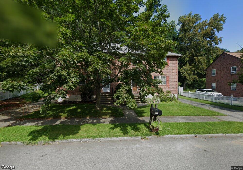
55 George Rd Winchester, MA 01890
Estimated Value: $710,000 - $803,000
3
Beds
2
Baths
1,350
Sq Ft
$568/Sq Ft
Est. Value
About This Home
This home is located at 55 George Rd, Winchester, MA 01890 and is currently estimated at $766,701, approximately $567 per square foot. 55 George Rd is a home located in Middlesex County with nearby schools including Lynch Elementary School, McCall Middle School, and Winchester High School.
Ownership History
Date
Name
Owned For
Owner Type
Purchase Details
Closed on
Feb 6, 2020
Sold by
55 George Road Rt
Bought by
Mojtabai Ft
Current Estimated Value
Purchase Details
Closed on
May 13, 1993
Sold by
Nygard Glenn P
Bought by
Mojtabai Fariba
Home Financials for this Owner
Home Financials are based on the most recent Mortgage that was taken out on this home.
Original Mortgage
$106,000
Interest Rate
7.47%
Mortgage Type
Purchase Money Mortgage
Create a Home Valuation Report for This Property
The Home Valuation Report is an in-depth analysis detailing your home's value as well as a comparison with similar homes in the area
Purchase History
| Date | Buyer | Sale Price | Title Company |
|---|---|---|---|
| Mojtabai Ft | -- | None Available | |
| Mojtabai Fariba | $147,500 | -- |
Source: Public Records
Mortgage History
| Date | Status | Borrower | Loan Amount |
|---|---|---|---|
| Previous Owner | Mojtabai Fariba | $106,000 | |
| Previous Owner | Mojtabai Fariba | $30,000 |
Source: Public Records
Tax History
| Year | Tax Paid | Tax Assessment Tax Assessment Total Assessment is a certain percentage of the fair market value that is determined by local assessors to be the total taxable value of land and additions on the property. | Land | Improvement |
|---|---|---|---|---|
| 2025 | $79 | $715,700 | $0 | $715,700 |
| 2024 | $7,778 | $686,500 | $0 | $686,500 |
| 2023 | $8,117 | $687,900 | $0 | $687,900 |
| 2022 | $8,319 | $665,000 | $0 | $665,000 |
| 2021 | $6,971 | $543,300 | $0 | $543,300 |
| 2020 | $6,731 | $543,300 | $0 | $543,300 |
| 2019 | $6,579 | $543,300 | $0 | $543,300 |
| 2018 | $5,774 | $473,700 | $0 | $473,700 |
| 2017 | $6,544 | $532,900 | $0 | $532,900 |
| 2016 | $5,776 | $494,500 | $0 | $494,500 |
| 2015 | $5,362 | $441,700 | $0 | $441,700 |
| 2014 | $4,915 | $388,200 | $0 | $388,200 |
Source: Public Records
Map
Nearby Homes
- 28 Arlington St
- 9 Charles Rd
- 8 Russell Rd Unit 10
- 20 Arthur St
- 7 Conant Rd Unit 33
- 171 Swanton St Unit 73
- 237 Swanton St
- 136 Sylvester Ave
- 95 Irving St
- 62 Richardson St
- 0 Mount Pleasant St
- 200 Swanton St Unit 228
- 200 Swanton St Unit 636
- 200 Swanton St Unit T28
- 149 Horn Pond Brook Rd
- 6 Porter St
- 36 Middlesex St Unit 38
- 49 Spruce St
- 230 Main St Unit 4
- 76 Woodside Rd
- 55 George Rd Unit 55
- 57 George Rd
- 51 George Rd Unit 53
- 53 George Rd Unit 53
- 51 George Rd Unit 51
- 53 George Rd
- 59 George Rd Unit 61
- 58 George Rd
- 56 George Rd
- 50 George Rd
- 50 George Rd Unit 50
- 52 George Rd
- 47 George Rd Unit 49
- 49 George Rd
- 48 George Rd
- 46 George Rd
- 46 George Rd Unit 2
- 65 George Rd
- 63 George Rd
- 65 George Rd Unit 65
Your Personal Tour Guide
Ask me questions while you tour the home.