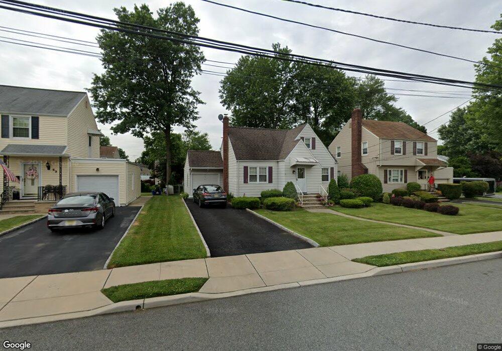
55 Greendale Rd Clifton, NJ 07013
Richfield NeighborhoodEstimated Value: $493,159 - $588,000
About This Home
This home is located at 55 Greendale Rd, Clifton, NJ 07013 and is currently estimated at $560,290, approximately $435 per square foot. 55 Greendale Rd is a home located in Passaic County with nearby schools including Clifton High School, St Andrew Elementary School, and New Hope School.
Ownership History
We collect this data history from publicly available records. To have your information removed, we recommend requesting removal directly through your county’s website.
Purchase Details
Purchase Details
Home Financials for this Owner
Home Financials are based on the most recent Mortgage that was taken out on this home.Purchase Details
Home Financials for this Owner
Home Financials are based on the most recent Mortgage that was taken out on this home.Home Values in the Area
Average Home Value in this Area
Purchase History
We collect this data history from publicly available records. To have your information removed, we recommend requesting removal directly through your county’s website.
| Date | Buyer | Sale Price | Title Company |
|---|---|---|---|
| $65,000 | None Listed On Document | ||
| $279,900 | -- | ||
| $152,000 | -- |
Mortgage History
We collect this data history from publicly available records. To have your information removed, we recommend requesting removal directly through your county’s website.
| Date | Status | Borrower | Loan Amount |
|---|---|---|---|
| Previous Owner | $265,905 | ||
| Previous Owner | $144,400 |
Tax History
We collect this data history from publicly available records. To have your information removed, we recommend requesting removal directly through your county’s website.
| Year | Tax Paid | Tax Assessment Tax Assessment Total Assessment is a certain percentage of the fair market value that is determined by local assessors to be the total taxable value of land and additions on the property. | Land | Improvement |
|---|---|---|---|---|
| 2025 | $9,242 | $155,700 | $96,700 | $59,000 |
| 2024 | $9,021 | $155,700 | $96,700 | $59,000 |
| 2022 | $8,890 | $155,700 | $96,700 | $59,000 |
| 2021 | $8,525 | $155,700 | $96,700 | $59,000 |
| 2020 | $8,553 | $155,700 | $96,700 | $59,000 |
| 2019 | $8,492 | $155,700 | $96,700 | $59,000 |
| 2018 | $8,444 | $155,700 | $96,700 | $59,000 |
| 2017 | $8,352 | $155,700 | $96,700 | $59,000 |
| 2016 | $8,190 | $155,700 | $96,700 | $59,000 |
| 2015 | $8,110 | $155,700 | $96,700 | $59,000 |
| 2014 | $7,944 | $155,700 | $96,700 | $59,000 |
Map
- 191 Pershing Rd
- 59 Pershing Rd
- 59 Hooyman Dr
- 71 Hackberry Place
- 9 Joan Place
- 11 Barbara Dr
- 22 Runyon Rd
- 72 Pilgrim Dr
- 24 Lennon Place
- 70 Lennon Place
- 479 Grove St
- 488 Grove St
- 375 Colfax Ave
- 565 Grove St Unit A-11
- 565 Grove St Unit 10
- 565 Grove St Unit B12
- 565 Grove St Unit 16
- 575 Grove St Unit 6
- 575 Grove St Unit 3
- 605 Grove St Unit 11
Ask me questions while you tour the home.