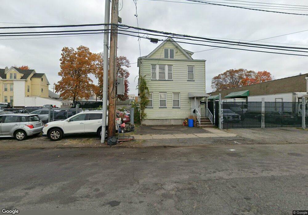
55 Illinois Ave Paterson, NJ 07503
South Paterson NeighborhoodEstimated Value: $799,000 - $1,017,000
--
Bed
--
Bath
3,003
Sq Ft
$297/Sq Ft
Est. Value
About This Home
This home is located at 55 Illinois Ave, Paterson, NJ 07503 and is currently estimated at $890,393, approximately $296 per square foot. 55 Illinois Ave is a home with nearby schools including Dale Avenue Elementary School, Edward W. Kilpatrick School of Discovery, and Paterson Public School No. 3.
Ownership History
Date
Name
Owned For
Owner Type
Purchase Details
Closed on
Jul 1, 2025
Sold by
55-59 Illinois Avenue Llc
Bought by
Fahed Ghena
Current Estimated Value
Purchase Details
Closed on
Jul 1, 2022
Sold by
55 Illinois Ave Assco Llc
Bought by
55-59 Illinois Avenue Llc
Purchase Details
Closed on
Oct 29, 2019
Sold by
Malatesta Benjamin and Malatesta Paul
Bought by
61 65 Illinois Ave Llc
Create a Home Valuation Report for This Property
The Home Valuation Report is an in-depth analysis detailing your home's value as well as a comparison with similar homes in the area
Home Values in the Area
Average Home Value in this Area
Purchase History
| Date | Buyer | Sale Price | Title Company |
|---|---|---|---|
| Fahed Ghena | $990,000 | Old Republic Title | |
| Ghena Fahed | $990,000 | Old Republic Title | |
| 55-59 Illinois Avenue Llc | $800,000 | Maricanda Alan J | |
| 55-59 Illinois Avenue Llc | $800,000 | None Listed On Document | |
| 61 65 Illinois Ave Llc | $1,000,000 | Old Republic Natl Ttl Ins Co |
Source: Public Records
Tax History Compared to Growth
Tax History
| Year | Tax Paid | Tax Assessment Tax Assessment Total Assessment is a certain percentage of the fair market value that is determined by local assessors to be the total taxable value of land and additions on the property. | Land | Improvement |
|---|---|---|---|---|
| 2025 | $19,055 | $374,000 | $197,600 | $176,400 |
| 2024 | $18,337 | $374,000 | $197,600 | $176,400 |
| 2022 | $17,361 | $374,000 | $197,600 | $176,400 |
| 2021 | $16,740 | $374,000 | $197,600 | $176,400 |
| 2020 | $15,615 | $374,000 | $197,600 | $176,400 |
| 2019 | $15,292 | $369,900 | $197,600 | $172,300 |
| 2018 | $15,863 | $366,700 | $197,600 | $169,100 |
| 2017 | $15,196 | $365,300 | $197,600 | $167,700 |
| 2016 | $16,267 | $374,900 | $197,600 | $177,300 |
| 2015 | $15,401 | $374,900 | $197,600 | $177,300 |
| 2014 | $16,762 | $578,000 | $420,000 | $158,000 |
Source: Public Records
Map
Nearby Homes
- 41 Columbia Ave
- 156 Kentucky Ave Unit 158
- 126 Gould Ave
- 366-2-382 Trenton Ave Unit 5D
- 366-2-382 Trenton Ave Unit 5B
- 366 Trenton Ave Unit 4F
- 238 Vernon Ave Unit 240
- 693 E 31st St Unit 695
- 693-695 E 31st St
- 432-434 Trenton Ave Unit 7
- 432 Trenton Ave
- 45 Dey St
- 102 22nd Ave Unit 104
- 652 E 32nd St Unit 654
- 652 654e32nd St
- 248 22nd Ave
- 291 Maryland Ave Unit 295
- 339 Paxton St
- 165 E 2nd St
- 1252 Madison Ave Unit 1254
- 231 Pennsylvania Ave Unit 233
- 227 Pennsylvania Ave Unit 229
- 223 Pennsylvania Ave Unit 225
- 60 Florida Ave Unit 64
- 219 Pennsylvania Ave Unit 221
- 9 Columbia Ave Unit 11
- 74 Florida Ave
- 72 Illinois Ave
- 70 Florida Ave Unit 72
- 76 Illinois Ave
- 78 Florida Ave
- 78 Illinois Ave
- 80 Florida Ave
- 261 Pennsylvania Ave
- 82 Florida Ave
- 10 Lehigh Ave
- 163-167 Michigan Ave Unit 2ndfl &3rdfr
- 163-167 Michigan Ave
- 12 Lehigh Ave Unit 14
- 179 Michigan Ave