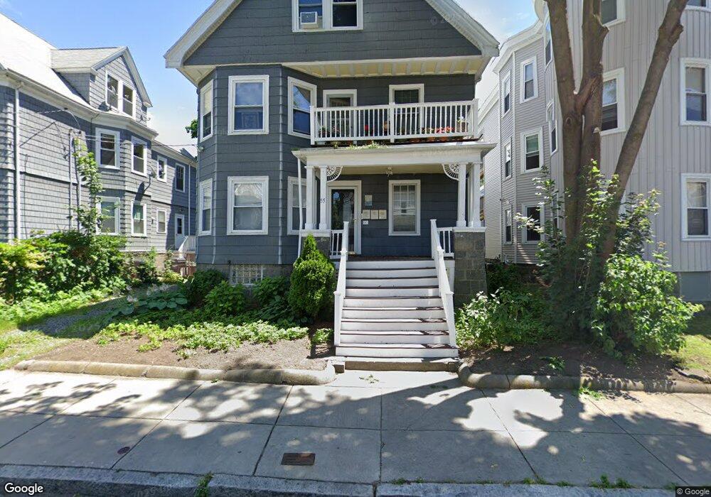
55 King St Unit 2 Dorchester, MA 02122
Saint Marks NeighborhoodEstimated Value: $522,000 - $557,000
2
Beds
1
Bath
1,018
Sq Ft
$525/Sq Ft
Est. Value
About This Home
This home is located at 55 King St Unit 2, Dorchester, MA 02122 and is currently estimated at $534,831, approximately $525 per square foot. 55 King St Unit 2 is a home located in Suffolk County with nearby schools including Codman Academy Charter Public School and Neighborhood House Charter School.
Ownership History
Date
Name
Owned For
Owner Type
Purchase Details
Closed on
Jun 27, 2023
Sold by
Kapler Janis
Bought by
Janis Kapler 2023 Ret and Kapler
Current Estimated Value
Purchase Details
Closed on
Jun 30, 2003
Sold by
Willis Michael P and Brems Dawn L
Bought by
Kaplan Janis K
Home Financials for this Owner
Home Financials are based on the most recent Mortgage that was taken out on this home.
Original Mortgage
$214,370
Interest Rate
5.53%
Mortgage Type
Purchase Money Mortgage
Create a Home Valuation Report for This Property
The Home Valuation Report is an in-depth analysis detailing your home's value as well as a comparison with similar homes in the area
Home Values in the Area
Average Home Value in this Area
Purchase History
| Date | Buyer | Sale Price | Title Company |
|---|---|---|---|
| Janis Kapler 2023 Ret | -- | None Available | |
| Kaplan Janis K | $221,000 | -- |
Source: Public Records
Mortgage History
| Date | Status | Borrower | Loan Amount |
|---|---|---|---|
| Previous Owner | Kaplan Janis K | $175,500 | |
| Previous Owner | Kaplan Janis K | $214,370 |
Source: Public Records
Tax History Compared to Growth
Tax History
| Year | Tax Paid | Tax Assessment Tax Assessment Total Assessment is a certain percentage of the fair market value that is determined by local assessors to be the total taxable value of land and additions on the property. | Land | Improvement |
|---|---|---|---|---|
| 2025 | $5,694 | $491,700 | $0 | $491,700 |
| 2024 | $4,799 | $440,300 | $0 | $440,300 |
| 2023 | $4,590 | $427,400 | $0 | $427,400 |
| 2022 | $4,386 | $403,100 | $0 | $403,100 |
| 2021 | $4,176 | $391,400 | $0 | $391,400 |
| 2020 | $3,737 | $353,900 | $0 | $353,900 |
| 2019 | $3,518 | $333,800 | $0 | $333,800 |
| 2018 | $3,239 | $309,100 | $0 | $309,100 |
| 2017 | $3,004 | $283,700 | $0 | $283,700 |
| 2016 | $2,916 | $265,100 | $0 | $265,100 |
| 2015 | $2,877 | $237,600 | $0 | $237,600 |
| 2014 | $2,741 | $217,900 | $0 | $217,900 |
Source: Public Records
Map
Nearby Homes
- 41 King St Unit 1
- 543 Adams St Unit 24
- 334 Centre St Unit 101
- 334 Centre St Unit 2
- 20 Leslie St
- 17 Lafield St Unit 2
- 96 King St Unit 1
- 80-84 Shepton St Unit 80-3
- 51 Florida St Unit 3
- 104 King St Unit 2
- 108 King St Unit 3
- 28 Dix St Unit 3
- 34 Dix St Unit 3
- 381 Adams St Unit 2
- 381 Adams St Unit 1
- 381 Adams St Unit 3
- 61 Shepton St
- 6 Agawam St
- 382 Adams St Unit 384-1
- 20 Parkman St Unit 2
- 55 King St Unit 3
- 55 King St Unit 1
- 55 King St Unit c
- 55 King St Unit 3-55
- 51 King St
- 51 King St Unit 3
- 51 King St Unit 2
- 51 King St Unit 1
- 57 King St Unit 2
- 57 King St Unit 1
- 57 King St
- 86 Saint Marks Rd Unit 88
- 49 King St
- 86-88 Saint Marks Rd Unit 86
- 59 King St
- 59 King St Unit 2
- 90 Saint Marks Rd Unit 92
- 82 Saint Marks Rd Unit 84
- 90 Saint Marks Rd Unit 2
- 94 Saint Marks Rd Unit 96