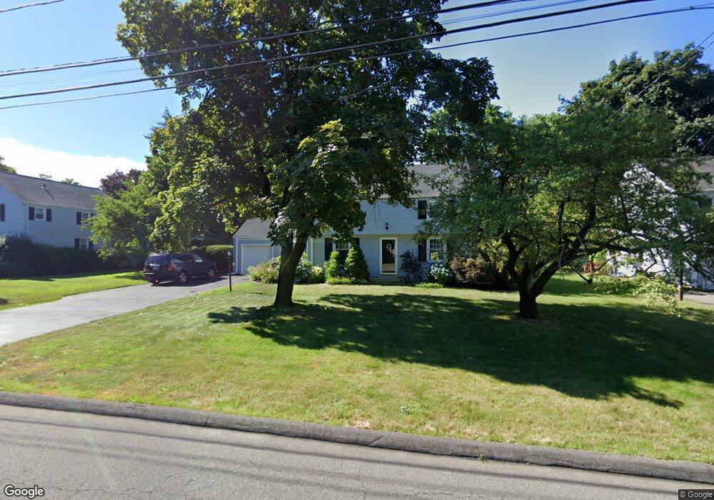
55 Longlane Rd West Hartford, CT 06117
Estimated Value: $600,000 - $693,000
3
Beds
4
Baths
2,430
Sq Ft
$266/Sq Ft
Est. Value
About This Home
This home is located at 55 Longlane Rd, West Hartford, CT 06117 and is currently estimated at $646,616, approximately $266 per square foot. 55 Longlane Rd is a home located in Hartford County with nearby schools including Norfeldt School, King Philip Middle School, and Hall High School.
Ownership History
Date
Name
Owned For
Owner Type
Purchase Details
Closed on
Jun 3, 2005
Sold by
Obrien Rober F
Bought by
Obrien-Green Kimberly J
Current Estimated Value
Purchase Details
Closed on
May 3, 1993
Sold by
Cronin Ronalene and Clouet James
Bought by
Wright Christopher and Pelkey Cassandra
Create a Home Valuation Report for This Property
The Home Valuation Report is an in-depth analysis detailing your home's value as well as a comparison with similar homes in the area
Home Values in the Area
Average Home Value in this Area
Purchase History
| Date | Buyer | Sale Price | Title Company |
|---|---|---|---|
| Obrien-Green Kimberly J | $75,000 | -- | |
| Wright Christopher | $70,000 | -- |
Source: Public Records
Mortgage History
| Date | Status | Borrower | Loan Amount |
|---|---|---|---|
| Open | Wright Christopher | $100,000 | |
| Closed | Wright Christopher | $185,000 |
Source: Public Records
Tax History Compared to Growth
Tax History
| Year | Tax Paid | Tax Assessment Tax Assessment Total Assessment is a certain percentage of the fair market value that is determined by local assessors to be the total taxable value of land and additions on the property. | Land | Improvement |
|---|---|---|---|---|
| 2025 | $12,676 | $283,080 | $94,290 | $188,790 |
| 2024 | $11,988 | $283,080 | $94,290 | $188,790 |
| 2023 | $11,584 | $283,080 | $94,290 | $188,790 |
| 2022 | $11,516 | $283,080 | $94,290 | $188,790 |
| 2021 | $11,100 | $261,660 | $90,650 | $171,010 |
| 2020 | $10,554 | $252,490 | $82,740 | $169,750 |
| 2019 | $10,554 | $252,490 | $82,740 | $169,750 |
| 2018 | $10,352 | $252,490 | $82,740 | $169,750 |
| 2017 | $10,362 | $252,490 | $82,740 | $169,750 |
| 2016 | $9,732 | $246,330 | $78,190 | $168,140 |
| 2015 | $9,437 | $246,330 | $78,190 | $168,140 |
| 2014 | $9,205 | $246,330 | $78,190 | $168,140 |
Source: Public Records
Map
Nearby Homes
- 14 Gledhill Ln
- 2645 Albany Ave
- 100 Richmond Ln
- 53 Whitehill Dr
- 6 Old Oak Rd
- 592 Mountain Rd Unit A
- 35 W Ridge Dr
- 2581 Albany Ave
- 30 Farmstead Ln
- 64 Avondale Rd
- 64 Harvest Ln
- 2 Ferncliff Dr
- 62 Blue Ridge Ln
- 124 Ferncliff Dr
- 8 Tanglewood Rd
- 7 Mountainside Rd
- 51 Sky View Dr Unit 4
- 105 Hilldale Rd
- 1 King Philip Dr Unit 207
- 124 High Ridge Rd
- 53 Longlane Rd
- 59 Longlane Rd
- 49 Longlane Rd
- 73 Huntington Dr
- 69 Huntington Dr
- 54 Longlane Rd
- 67 Huntington Dr
- 65 Longlane Rd
- 62 Longlane Rd
- 6 Barksdale Rd
- 66 Hamlin Dr
- 67 Longlane Rd
- 64 Hamlin Dr
- 45 Longlane Rd
- 3 Barksdale Rd
- 66 Longlane Rd
- 65 Huntington Dr
- 10 Barksdale Rd
- 60 Hamlin Dr
- 68 Longlane Rd